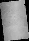
This mosaic represents the Thermal Emission Imaging System (THEMIS) -daytime infrared (IR) 100 meter/pixel mosaic (version 12) released in the summer of 2014 by Arizona State University. Values…
Product Information: This digital elevation model (DEM) is based on data from the Mars Orbiter Laser Altimeter (MOLA; Smith et al., 2001), an instrument on NASA’s Mars Global Surveyor (MGS)…
This product is a cartographically controlled mosaic of Mars Charts (MC) 08 through 23, covering 50.0 percent of Mars' surface, from -30 deg N to +30 deg N latitude and 0–360 deg E longitude. The…
This PDS4 archive includes 1,354 HiRISE DEMs, 1,354 CTX DEMs that overlap the HiRISE DEMs, orthoimages associated with each, and pixel masks to show the quality of each stereo correlation. DEMs…
Product Information: This PDS4-compliant archive contains version 2.0 Mars Reconnaissance Orbiter (MRO) Mars Color Imager (MARCI) Mars Daily Global Maps (MDGMs). Each MDGM is a daily global mosaic…
This orthorectified image was created by projecting an image from the Mars Reconnaissance Orbiter Context Camera (CTX) onto a Digital Terrain Model (DTM). The DTM is available under the “Derived…
This Digital Terrain Model (DTM) was produced as part of a project to understand Martian lava flows. It was constructed from a pair of Mars Reconnaissance Orbiter Context Camera (CTX) images using…
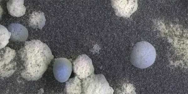
The Microscopic Imagers (MI) on the Mars Exploration Rovers, Spirit and Opportunity, have returned images of Mars with higher resolution than any previous camera system, allowing detailed…
Sub-glacially erupted volcanoes form free-standing flat-topped mesas, known as tuyas. Although there are some silicic edifices (e.g. Tuffen et al., 2002), most terrestrial sub-ice volcanoes are mafic…
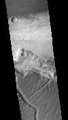
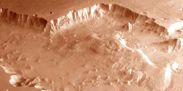
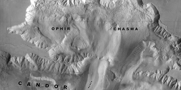
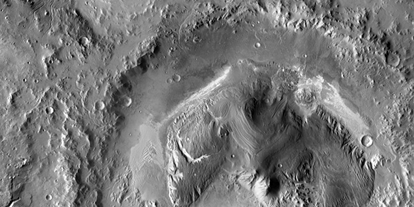
The Valles Marineris is a system of canyons located just south of the Martian equator. The system is about 4000 km long, and, if on earth, would extend all the way across the United States. The…
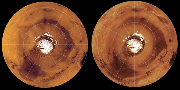
The surface of Mars has changed dramatically during the three decades spanned by spacecraft exploration. Comparisons of Mars Global Surveyor images with Viking and Mariner 9 pictures suggest that…
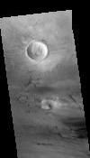
Sand dunes are among the most widespread aeolian features present on Mars, serving as unique indicators of the interaction between the atmosphere and surface. On a planetary body, dunes accumulate…
North Pole Consortium Meetings Instruments and Data Tharsis Region South Pole South Pole Cryptic Region South Pole Recession
Former USGS scientist, Jeff Johnson, performed key research on the detection of dust on the Martian surface. This work explored the laboratory thermal infrared and visible/near-infrared spectroscopy…
Table of Contents Mercury R O Venus R Moon1 R Mars R G Phobos O Deimos O Asteroids 243 Ida R 433 Eros O 951 Gaspra R Jupiter Io R G O Europa R G Ganymede R…
Image Information and Instructions The ISIS cube file can be loaded into JMars as a custom map. You can download JMars at the following site: http://jmars.asu.eduFor instructions on how to load a…
The Astrogeology Science Center's mission includes producing planetary maps and cartographic products which reveal topography, geology, topology, image mosaics and more, all made available to the…
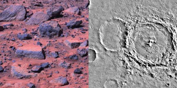
Following the successful landing of the Mars Pathfinder, DLR has carried out a comprehensive study of the Pathfinder landing site in terms of geology, mineralogy, and surface photometric properties.…
We recomputed the Viking Mars Control Point Network and derived Mars-fixed 3-dimensional coordinates of 3739 selected, globally distributed landmarks. The Mars Pathfinder coordinates and data from…
The Imager for Mars Pathfinder (IMP) obtained 5 full panoramic sets of images, varying in color and stereo coverage and degree of data compression, from the highly compressed First Look to the…
Imagery is the major source for our current understanding of the geologic and climatologic evolution of Mars. It has the potential to drastically enhance our knowledge in the future and is an…
Viking Orbiter images were reprocessed using new techniques to produce a precision controlled, photomosaic map of the Mars Pathfinder landing site prior to landing. The difference between the…
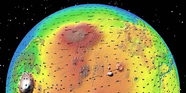
The Mars Orbiter Laser Altimeter (MOLA) on the Mars Global Surveyor (MGS) mission will produce a precision global geodetic control network for Mars of 30,000 - 50,000 points which will be accurate to…
The RAND control network of Mars was begun during the Mariner 9 mission, and it has been expanded and improved since then. The network is based on measurements of points made on images taken by the…
The map sheet "MARS 1:2,000,000 Mouth of Ares and Tiu Valles" presents the mapped area on the planet's northern hemisphere in two different cartographic categories. The Image Map, portraying the…
The SPICE ancillary information system developed at NASA's Jet Propulsion Laboratory offers a flexible, multimission suite of data containers and related software--a subroutine library--for…
Described the exciting results which have been obtained from the initial set of mainly Northern hemispheric laser altimetry tracks from the MOLA instrument known as the SPO-1 phase. More recently has…