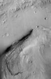
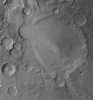
Product Information: This basemap was initially created as an assessment tool for the entry, descent, and landing (EDL) analysis conducted by the Mars Science Laboratory (MSL) engineering team to…
Product Information: This digital elevation model (DEM) was initially created as an assessment tool for the entry, descent, and landing (EDL) analysis conducted by the Mars Science Laborarory (MSL)…
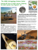
We have created 39 regional semi-controlled CTX mosaics at 5m/pixel for the 2015 proposed Mars Human Exploration zones. They are individually available for download in GeoTiff format from the "Online…
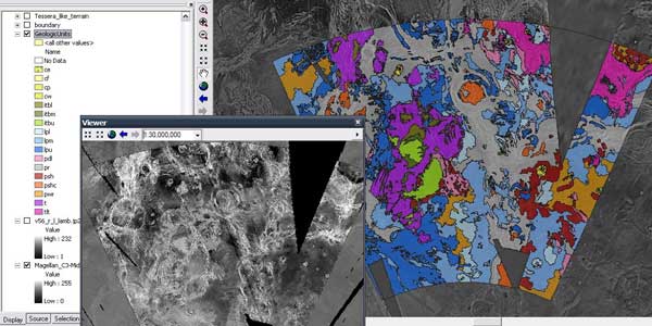
These polygons are beased on the original created 1:5M geologic maps for Mercury as published in the late 80's and early 90's as created by several authors. The original GIS conversion was completed…
This product is a daytime infrared image mosaic generated using Thermal Emission Imaging System (THEMIS) images from the 2001 Mars Odyssey orbiter mission. The mosaic is generated at the full…
Product Information: This mosaic of Phobos was created by compiling updated versions of Viking high-resolution mosaics and selecting the best high-resolution images from other spacecraft to…
Product Information: This global map base of Europa utilizes the best image quality and moderate resolution coverage supplied by the Galileo SSI (Solid-State Imaging) instrument and Voyager 1 and 2.…
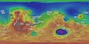
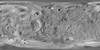
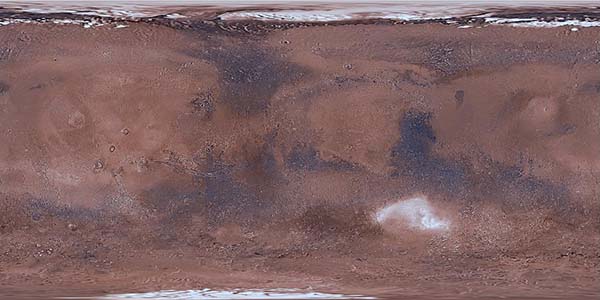
Product Information: This global image map of Mars has a resolution of 256 pixels/degree (scale approximately 232 meters per pixel (m) at the equator). The colorized mosaic was completed by NASA…
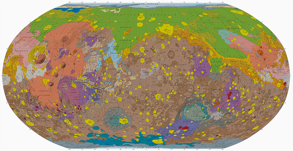
A digital adaptation of the hard-copy Viking Orbiter-based geologic maps of Mars. The western equatorial region was originally mapped by David H. Scott and K. L. Tanaka (USGS I-1802-A, 1986, 1:15M…
In 2003-2005, the USGS worked under the guidance of NASA's Mars Critical Data Products Initiative to conduct research on how controlled large area or global 2001 Mars Odyssey THEMIS IR image mosaics…
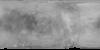
This global image map of Mars has a resolution of 256 pixels/degree (scale approximately 231 m/pixel at the equator). The black-and-white mosaic is processed to emphasize local topographic…
Layers available for download from:USGS AstrogeologyData Portal: Astropediahistorical FTP downloads
GIS Video TutorialsIntroduction to GIS Data for ArcMap 10.1 and HigherOverview of the Geologic Map GIS TemplateTour of the Planetary Geologic Mapping Python ToolboxSOPs for Common Mapping Workflows…
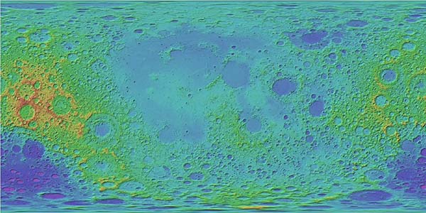
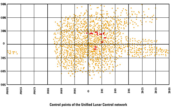
Lunar Orbiter Lunar Control Network 2004 The USGS worked to digitize and restore a global set of Lunar Orbiter images and to assemble this into a global digital Lunar Orbiter mosaic of the Moon. A…
The U.S. Geological Survey has recently completed a final revised version of its 231 m/pixel global Viking image mosaic of Mars that has substantially improved geodetic accuracy compared to versions…
The Astrogeology Team at USGS provides coordination of NASA's planetary geologic mapping program. Geologic mapping investigations of any imaged planetary body (except Earth) are proposed to NASA's…
ISPRS is an international NGO devoted to the development of international cooperations for the advancement of knowlege, research, development and education in the Protogrammetry, Remote Sensing and…
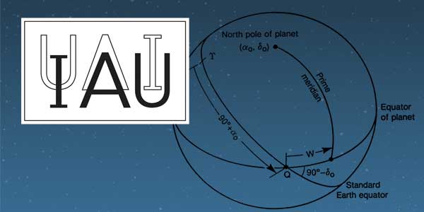
History: The IAU Working Group on Cartographic Coordinates and Rotational Elements of the Planets and Satellites was established as a consequence of a resolution adopted by Commissions 4 and 16 at…
The overall problem we’re solving is that we want to be able to set up the relationships between the coordinates of arbitrary physical points in space (e.g. ground points) and their coordinates on…
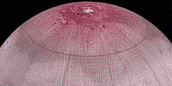
Cassini observations show that Saturn’s moon Titan is slightly oblate. A fourth-order spherical harmonic expansion yields north polar, south polar, and mean equatorial radii of 2574.32 T 0.05…
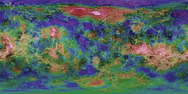
Cassini RADAR SARtopo and altimetry data are used to construct a global gridded 1 x 1° elevation map, for use in Global Circulation Models, hydrological models and correlative studies. The data are…
The USGS Astrogeology Science Center Honoring 50 Years of Public Service: Exploring the Solar System from Flagstaff, AZ
Since arrival at Mars in Sept. 1997 the Mars Orbiter Laser Altimeter (MOLA) on the Mars Global Surveyor (MGS) spacecraft has obtained a number of topographic profiles across the northern hemisphere…
The Pathfinder mission made use of a unique capability to rapidly generate and interactively display three-dimensional photo-realistic virtual reality (VR) models of the Martian surface. The Stereo…
The Imager for Mars Pathfinder (IMP) returned 16,000 pictures of the Ares Vallis landing site. These images have been photometrically corrected, mosaicked, and geometrically corrected into maps of…
A comparison of the MOLA topographic profile data with existing digital topography indicates the presence of both systematic and significant local and regional differences. These differences are in…
The Viking Orbiters acquired quality stereo coverage of a significant fraction of Mars in 1976-1980. Several groups have been using this stereo coverage to produce global and regional scale…