Mars CTX Controlled Equatorial Mosaics
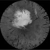
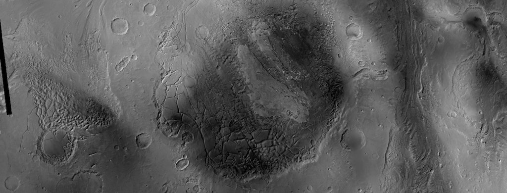
This product is a cartographically controlled mosaic of Mars Charts (MC) 08 through 23, covering 50.0 percent of Mars' surface, from -30 deg N to +30 deg N latitude and 0–360 deg E longitude. The images come from NASA's Mars Reconnaissance Orbiter's Context Camera (CTX), which has been returning 5–6 meters per pixel images of Mars since 2008. This product was produced using automated cartographic control network code that was then manually edited. It includes data through the Mars Reconnaissance Orbiter CTX PDS release 56, with some regions containing data through release 57 or 58. The control network code incorporated all usable images in that release, and there were roughly 70,000 images that met our quality requirements. Those images cover 98.9 percent of the surface area of the region. The mosaic was produced by priority-ordering images in an automated method that emphasized Spring/Autumn images, images with an emission or slew angle closest to 0 deg, and images with the best pixel scale. The mosaic order was manually edited where severe discontinuities were observed due seasonal issues or when low signal-to-noise images were emphasized. The mosaic was further cosmetically corrected to produce the appearance of an approximately similarly illuminated product throughout. The final network has 2.4 million tie points, and 99.92 percent of them have residuals ≤1 pixel. RMS ground point uncertainty is 4.7 m in latitude, 9.3 m in longitude, and 180.1 m in radius.
The full equatorial mosaic was split into 16 quads to help with downloads and follow the traditional 30 1:5M Mars Charts. See files for download from this link. The use of a free application like "wget" is recommended for downloading.
Citation:
Robbins, S. J., Kirchoff, M. R., and Hoover, R. H. (2023). Fully controlled 6 meters per pixel equatorial mosaic of Mars from Mars Reconnaissance Orbiter Context Camera images, version 1. Earth and Space Science, 10, e2022EA002443, URL: https://doi.org/10.1029/2022EA002443.
References:
Robbins, S.J., et al. (2020), Empirical Brightness Control and Equalization of Mars Context Camera Images, Earth and Space Science, Volume 7, DOI: 10.1029/2019EA001053, URL: https://doi.org/10.1029/2019EA001053.
Robbins, S.J. et al. (2020), Fully Controlled 6 meters per pixel Mosaic of Mars’ South Polar Region, Earth and Space Science, Volume 7, Issue 10, DOI: 10.1029/2019EA001054, URL:https://doi.org/10.1029/2019EA001054.
- Publisher
- Southwest Research Institute (SwRI)
- Publication Date
- 20 December 2023
- Originator
- Stuart Robbins, Michelle R. Kirchoff, Rachael H. Hoover
- Group
- PDS
- Added to Astropedia
- 11 February 2023
- Modified
- 24 March 2023
General
- Purpose
We have improved our previous almost completely automated methods, and we have applied it to 50 percent of Mars' surface in a band around the equator. There are over 50, 000 images included in the mosaic, and the mosaic itself is 2.11 trillion pixels, rendered at 6 m per pixel. The average uncertainty of pixel location is now about 5 m, about 100 times better than when based on Earth tracking.
- Geospatial Data Presentation Form
- Raster Data, Regional Mosaic, Remote-sensing Data, Control Network
- Edition
- 1
- Online Linkage
- https://asc-pds-services.s3.us-west-2.amazonaws.com/mosaic/Mars/Mars_MRO_CTX_Equi_Mosaics_Robbins/index.html
- Native Data Set Environment
- ISIS v3
- Color
- Black and White
Keywords
- System
- Mars
- Target
- Mars
- Theme
- Image Processing, Geographic Information System (GIS), Remote Sensing, Geomorphology
- Mission
- Mars Reconnaissance Orbiter
- Instrument
- CTX
- Search Terms
- Mars, CTX, controlled, mosaic, equatorial, MRO
Contact and Distribution
- Access Constraints
- please cite authors
- Access Instructions
- This mosaic is available as tiled into 16 large quads using a positive 16bit bit range. We recommend a GIS application or Image Reader capable of reading very large images needed for viewing images and a SPICE reader for reading SPICE kernel data. Using a free download application like "wget" is recommended. Internally the quads were produced as cloud-optimized GeoTiffs (COGs) which means they are compressed with internal pyramids. Thus these files can be streamed to some GIS applications without download.
- Use Constraints
- public domain
Data Status and Quality
- Currentness Reference
- Publication date
- Progress
- In Work
- Update Frequency
- As needed
- Logical Consistency Report
- The final network has 2.4 million tie points, and 99.92 percent of them have residuals < 1 pixel. RMS ground point uncertainty is 4.7 m in latitude, 9.3 m in longitude, and 180.1 m in radius.
- Process Description
We developed an efficient, accurate workflow within ISIS3 (USGS's Integrated Software for Imagers and Spectrometers v3), driven by Python scripts, to automate much of the control process to create a fully controlled CTX dataset. We have now applied this to half of Mars' surface area, spanning the full 360° of longitude and between -30 to 30 deg latitude.
- Horizontal Positional Accuracy Value
- 2
- Horizontal Positional Accuracy Report
- Accurate to Control Net
Lineage
- PDS Status
- Locally Archived
- Source PDS Archive
- Mars Reconnaissance Orbiter
- Source Originator
- Context Camera Investigation on board the Mars Reconnaissance Orbiter
- Source Online Linkage
- https://pds-imaging.jpl.nasa.gov/portal/mro_mission.html
- Type of Source Media
- Online
Geospatial Information
- Minimum Latitude
- -30
- Maximum Latitude
- 30
- Minimum Longitude
- -180
- Maximum Longitude
- 180
- Direct Spatial Reference Method
- Raster
- Object Type
- Pixel
- Lines (pixels)
- 281309
- Samples (pixels)
- 444560
- Bit Type
- 16
- Quad System
- Mars 1:5M
- Quad Name
- MC-8, MC-9, MC-10, MC-11, MC-12, MC-13, MC-14, MC-15, MC-16, MC-17, MC-18, MC-19, MC-20, MC-21, MC-22, MC-23
- Radius A
- 3396190
- Radius C
- 3396190
- Control Net
- MOLA
- Bands
- 1
- Pixel Resolution (meters/pixel)
- 6
- Scale (pixels/degree)
- 9879.1
- Horizontal Coordinate System Units
- Meters
- Map Projection Name
- Simple Cylindrical
- Latitude Type
- Planetocentric
- Longitude Direction
- Positive East
- Longitude Domain
- -180 to 180