Products

156 Results Collapse
Venus Magellan SAR FMAP Stereo Look Global Mosaic 75m v1 thumbnail

Venus Magellan SAR FMAP Stereo Look Global Mosaic 75m v1

application/isis 239 kBAug 30 2025

Product Information: This mosaic was created from the Magellan Full resolution Basic Image Data Records (F-BIDRs), the highest resolution radar images of the Venus surface (~75 meters per pixel…

Venus Magellan SAR FMAP Right Look Global Mosaic 75m v1 thumbnail

Venus Magellan SAR FMAP Right Look Global Mosaic 75m v1

application/isis 29 kBAug 01 2025

Product Information: This mosaic was created from the Magellan Full resolution Basic Image Data Records (F-BIDRs), the highest resolution radar images of the Venus surface (~75 meters per pixel…

Venus Magellan SAR FMAP Left Look Global Mosaic 75m v1 thumbnail

Venus Magellan SAR FMAP Left Look Global Mosaic 75m v1

application/isis 74 kBAug 01 2025

Product Information: This mosaic was created from the Magellan F-BIDRs, (Full resolution Basic Image Data Records), the highest resolution radar images of the Venus surface (~75 m/pixel). For a…

NEAR MSI Albedo Mosaics thumbnail

NEAR MSI Albedo Mosaics

application/pds-img 277 kBJun 16 2023

This download consists of 14 Eros global albedo mosaics across 7 filters and 2 map projections (Simple Cylindrical and Sinusoidal). The data is hosted as GeoTiffs with PDS4 and ISIS3 detached labels.…

Mars MRO CTX South Polar Digital Terrain Model Mosaic 50m v1 thumbnail

Mars MRO CTX South Polar Digital Terrain Model Mosaic 50m v1

application/isis 1 kBSep 30 2020

This digital terrain model (DTM) mosaic over the south polar region of Mars was generated by extracting three-dimensional point clouds from approximately 400 distinct CTX stereo image pairs and…

Mars 2020 Terrain Relative Navigation HiRISE Orthorectified Image Mosaic thumbnail

Mars 2020 Terrain Relative Navigation HiRISE Orthorectified Image Mosaic

image/tiff 4 bytesJul 24 2020

The Mars 2020 rover will explore Jezero crater, Mars to investigate an ancient delta for evidence of past microbial life and to better understand the geologic history of the region. The landing…

Mars 2020 Terrain Relative Navigation HiRISE DTM Mosaic thumbnail

Mars 2020 Terrain Relative Navigation HiRISE DTM Mosaic

image/tiff 1 kBJul 24 2020

The Mars 2020 rover will explore Jezero crater, Mars to investigate an ancient delta for evidence of past microbial life and to better understand the geologic history of the region. The landing…

Mars 2020 Terrain Relative Navigation CTX DTM Mosaic thumbnail

Mars 2020 Terrain Relative Navigation CTX DTM Mosaic

image/tiff 1 kBJul 24 2020

The Mars 2020 rover will explore Jezero crater, Mars to investigate an ancient delta for evidence of past microbial life and to better understand the geologic history of the region. The landing…

Mars 2020 Terrain Relative Navigation Context Camera Orthorectified Image Mosaic thumbnail

Mars 2020 Terrain Relative Navigation Context Camera Orthorectified Image Mosaic

image/tiff 4 bytesJul 24 2020

This is a visible image mosaic generated from the Context Camera (CTX) images from the Mars Reconnaissance Orbiter mission. This product is the Lander Visions System (LVS) map that will be onboard…

Moon Apollo 17 LROC NAC Landing Site Orthomosaic 50cm v1 thumbnail

Moon Apollo 17 LROC NAC Landing Site Orthomosaic 50cm v1

application/zip 6 MBMay 01 2018

Product Information: This is an (ortho-) mosaic map of the Apollo 17 landing site (L15K 20.2/30.7East COMT). The map includes nomenclature, elevation contours, the astronauts' major geology stops,…

Project Pages

1 Result Collapse
Moon Pyroclastic Volcanism Project thumbnail

Moon Pyroclastic Volcanism Project

http://astrogeology.usgs.gov/geology/moon-pyroclastic-volcanism-project

Project Overview 
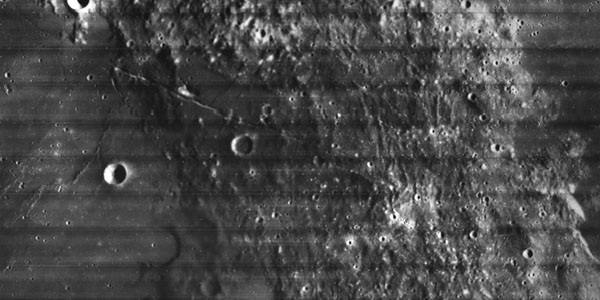
The goal of this research project is to advance our understanding of pyroclastic volcanism on the Moon using remote sensing data, primarily the high-spatial-resolution (~100 m/pixel)…