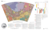
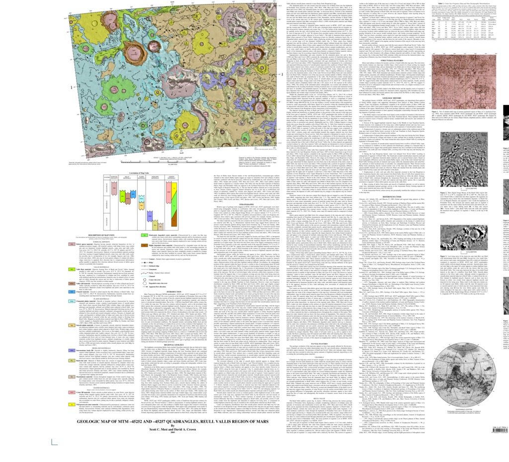
Mars Geologic Map of MTM -45252 and -45257 Quadrangles, Reull Vallis Region
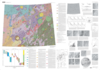
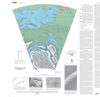
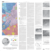
Mars Transverse Mercator (MTM) quadrangles -45252 and -45257 (latitude 42.5° S. to 47.5°S., longitude 250° W. to 260° W.) cover a portion of the highlands of Promethei Terra east of Hellas basin. The map area consists of heavily cratered ancient highland materials having moderate to high relief, isolated knobs and massifs of rugged mountainous material, and extensive tracts of smooth and channeled plains. Part of the ~1,500-km-long Reull Vallis outflow system is within the map area. The area also contains surficial deposits, such as the prominent large debris aprons that commonly surround highland massifs. Regional slopes are to the west, toward the Hellas basin, as indicated by topographic maps of Mars. Approximately 60 percent of the surface of Mars is covered by rugged, heavily cratered terrains believed to represent the effects of heavy bombardment in the inner solar system about 4.0 billion years ago. Much of this terrain, including that within the map area, records a long history of modification by tectonism, fluvial processes, mass wasting, and eolian activity. The presence of fluvial features to the east of Hellas basin, including Reull Vallis and other smaller channels, has significant implications for past environmental conditions. The degraded terrains surrounding Hellas basin provide constraints on the role and timing of volatile-driven activity in the evolution of the highlands. Current photogeologic mapping at 1:500,000 scale (see also Mest and Crown, 2002) from analysis of Viking Orbiter images complements previous geomorphic studies of Reull Vallis and other highland outflow systems, drainage networks, and highland debris aprons, as well as regional geologic mapping studies and geologic mapping of Hellas basin as a whole at 1:5,000,000 scale. Viking Orbiter image coverage of the map area generally ranges from 160 to 220 m/pixel; the central part of the map area is covered by higher resolution images of about 47 m/pixel. Crater size-frequency distributions have been compiled to constrain the relative ages of geologic units and determine the timing and duration of inferred geologic processes.
- Mimetype
- application/pdf
- Filename
- Mars-Geologic-Map-of-MTM--45252-and--45257-Quadrangles-Reull-Vallis-Region.pdf
- Publisher
- USGS Astrogeology Science Center
- Publication Date
- 3 January 2003
- Originator
- S. Mest, D. Crown
- Group
- RPIF
- Added to Astropedia
- 3 May 2016
- Modified
- 6 November 2017
General
- Geospatial Data Presentation Form
- Geologic Map, Raster Data, Vector Data
- Series Id
- 2763
Keywords
- Target
- Mars
- Theme
- Cartography, Geology, Geomorphology, Photogeology, Stratigraphy, Planetary evolution
- Mission
Contact and Distribution
- Access Instructions
- 1 Map: 110 x 99 cm
Geospatial Information
- Minimum Latitude
- -47
- Maximum Latitude
- 0
- Minimum Longitude
- 0
- Maximum Longitude
- 110
- Quad Name
- MC-12, MC-14, MC-20, MC-22, MC-27, MC-28
- Map Projection Name
- Transverse Mercator