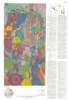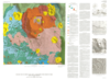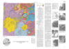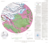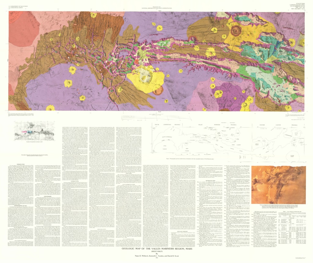
Mars Geologic Map of the Valles Marineris Region
- Mimetype
- application/pdf
- Filename
- Mars-Geologic-Map-of-the-Valles-Marineris-Region.pdf
- Publisher
- USGS Astrogeology Science Center
- Publication Date
- 30 December 1991
- Originator
- N. Witbeck, K. Tanaka, D. Scott
- Group
- RPIF
- Added to Astropedia
- 3 May 2016
- Modified
- 12 December 2017
General
- Geospatial Data Presentation Form
- Geologic Map, Raster Data, Vector Data
- Series Id
- 2010
Keywords
- Target
- Mars
- Theme
- Cartography, Geology, Geomorphology, Photogeology, Stratigraphy, Planetary evolution
- Mission
Contact and Distribution
- Access Instructions
- 2 remote-sensing images :col. ;39 x 118 cm. and 53 x 118 cm., on sheets 101 x 127 cm. and 103 x 127 cm., folded in envelope 30 x 24 cm.
Geospatial Information
- Minimum Latitude
- -15
- Maximum Latitude
- 0
- Minimum Longitude
- 247
- Maximum Longitude
- 337
- Quad Name
- MC-9, MC-11, MC-17, MC-19
- Map Projection Name
- Mercator