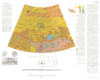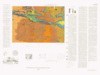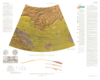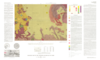
Mars Geologic Map of the Tharsis Quadrangle
- Mimetype
- application/pdf
- Filename
- Mars-Geologic-Map-of-the-Tharsis-Quadrangle.pdf
- Publisher
- USGS Astrogeology Science Center
- Publication Date
- 14 October 2019
- Originator
- M. Carr
- Group
- RPIF
- Added to Astropedia
- 3 May 2016
- Modified
- 6 December 2017
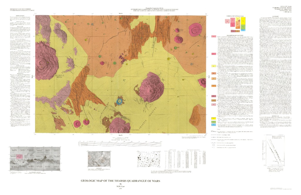
General
- Geospatial Data Presentation Form
- Geologic Map, Raster Data, Vector Data
- Series Id
- 893
Keywords
- Target
- Mars
- Theme
- Cartography, Geology, Geomorphology, Photogeology, Stratigraphy, Planetary evolution
- Mission
Contact and Distribution
- Access Instructions
- 1 map :col. ;37 x 54 cm. fold. in envelope 30 x 24 cm.
Geospatial Information
- Minimum Latitude
- 0
- Maximum Latitude
- 30
- Minimum Longitude
- 225
- Maximum Longitude
- 270
- Quad Name
- MC-9
- Map Projection Name
- Mercator