Products

260 Results Collapse
Venus Geologic Map of the Themis Regio Quadrangle (V-53) thumbnail

Venus Geologic Map of the Themis Regio Quadrangle (V-53)

application/pdf 13 MBFeb 12 2012

The Themis Regio quadrangle (V-53), Venus, has been geologically mapped at 1:5,000,000 scale as part of the NASA Planetary Geologic Mapping Program. The quadrangle extends from lat 25° to 50° S.…

Venus Geologic Map of the Ganiki Planitia Quadrangle (V-14) thumbnail

Venus Geologic Map of the Ganiki Planitia Quadrangle (V-14)

application/zip 266 MBFeb 11 2011

The Ganiki Planitia (V-14) quadrangle on Venus, which extends from 25° N. to 50° N. and from 180° E. to 210° E., derives its name from the extensive suite of plains that dominates the geology of…

Venus Geologic Map of the Metis Mons Quadrangle (V-6) thumbnail

Venus Geologic Map of the Metis Mons Quadrangle (V-6)

application/zip 113 MBFeb 11 2011

The Metis Mons quadrangle (V6) in the northern hemisphere of Venus (lat 50° to 75° N., long 240° to 300° E.) includes a variety of coronae, large volcanoes, ridge and fracture (structure) belts,…

Venus Geologic Map of the Artemis Chasma Quadrangle (V-48) thumbnail

Venus Geologic Map of the Artemis Chasma Quadrangle (V-48)

application/pdf 39 MBFeb 10 2010

Artemis, named for the Greek goddess of the hunt, represents an approximately 2,600 km diameter circular feature on Venus, and it may represent the largest circular structure in our solar system.…

Venus Geologic Map of the Greenaway Quadrangle (V-24) thumbnail

Venus Geologic Map of the Greenaway Quadrangle (V-24)

application/pdf 27 MBFeb 10 2010

The Greenaway quadrangle (V-24; lat 0 degrees -25 degrees N., long 120 degrees -150 degrees E.), Venus, derives its name from the impact crater Greenaway, centered at lat 22.9 degrees N., long 145.1…

Venus Geologic Map of the Lakshmi Planum Quadrangle (V-7) thumbnail

Venus Geologic Map of the Lakshmi Planum Quadrangle (V-7)

application/pdf 30 MBFeb 10 2010

The Lakshmi Planum quadrangle is in the northern hemisphere of Venus and extends from lat 50 degrees to 75 degrees N., and from long 300 degrees to 360 degrees E. The elevated volcanic plateau of…

Mercury Geologic Map of the Bach Region thumbnail

Mercury Geologic Map of the Bach Region

application/pdf 7 MBDec 29 1990

Mercury Geologic Map of the Beethoven Quadrangle thumbnail
Mercury Geologic Map of the Discovery Quadrangle thumbnail

Mercury Geologic Map of the Discovery Quadrangle

application/pdf 10 MBNov 23 1984

Mercury Geologic Map of the Borealis Region thumbnail

Mercury Geologic Map of the Borealis Region

application/pdf 9 MBNov 23 1984

Project Pages

23 Results Collapse
Sub-ice Volcanism on Earth and Mars thumbnail

Sub-ice Volcanism on Earth and Mars

http://astrogeology.usgs.gov/geology/mars-volcano-ice-interactions

Sub-glacially erupted volcanoes form free-standing flat-topped mesas, known as tuyas. Although there are some silicic edifices (e.g. Tuffen et al., 2002), most terrestrial sub-ice volcanoes are mafic…

Valles Marineris - The Grand Canyon of Mars thumbnail

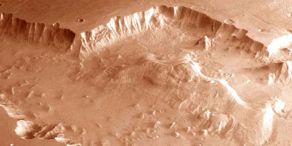
Valles Marineris - The Grand Canyon of Mars

http://astrogeology.usgs.gov/geology/mars-valles-marineris

The Valles Marineris is a system of canyons located just south of the Martian equator. The system is about 4000 km long, and, if on earth, would extend all the way across the United States. The…

Three Decades of Martian Surface Changes thumbnail

Three Decades of Martian Surface Changes

http://astrogeology.usgs.gov/geology/mars-surface-changes

The surface of Mars has changed dramatically during the three decades spanned by spacecraft exploration. Comparisons of Mars Global Surveyor images with Viking and Mariner 9 pictures suggest that…

Mars Dunes

http://astrogeology.usgs.gov/geology/mars-dunes

Sand dunes are among the most widespread aeolian features present on Mars, serving as unique indicators of the interaction between the atmosphere and surface. On a planetary body, dunes accumulate…

Mars Ice

http://astrogeology.usgs.gov/geology/mars-ice

North Pole Consortium Meetings Instruments and Data Tharsis Region South Pole South Pole Cryptic Region South Pole Recession

Laboratory Infrared Spectroscopy of Mars Analog Materials thumbnail

Laboratory Infrared Spectroscopy of Mars Analog Materials

http://astrogeology.usgs.gov/geology/mars-pathfinder-infrared-spectroscopy

Former USGS scientist, Jeff Johnson, performed key research on the detection of dust on the Martian surface. This work explored the laboratory thermal infrared and visible/near-infrared spectroscopy…

Cassini Observations of Io's Visible Aurorae thumbnail

Cassini Observations of Io's Visible Aurorae

http://astrogeology.usgs.gov/geology/io-cassini-visible-aurorae

Detailed comparisons of laboratory SO2 spectra with the Cassini observations indicate that a mixture of gases contribute to the equatorial emissions: Potassium (K) is suggested by new detections of…

Evidence of Cryovolcanism on Titan thumbnail

Evidence of Cryovolcanism on Titan

http://astrogeology.usgs.gov/geology/titan-cryovolcanism

From NASA Press Release…New data from NASA's Cassini spacecraft reveal topography on Saturn's moon Titan that makes the best case yet for an ice volcano on Titan and reveals the most…

Mars Science Laboratory - Landing Site Selection thumbnail

Mars Science Laboratory - Landing Site Selection

http://astrogeology.usgs.gov/maps/mars-science-laboratory-landing-site-selection

Image Information and Instructions The ISIS cube file can be loaded into JMars as a custom map. You can download JMars at the following site: http://jmars.asu.eduFor instructions on how to load a…

Moon Apollo Anaglyph 3D Images thumbnail

Moon Apollo Anaglyph 3D Images

http://astrogeology.usgs.gov/maps/moon-apollo-anaglyph-3d-images

This gallery features several digitized photographs from Apollo Mission explorations of the lunar surface. Anaglyph or 3D images require red-blue or red-green 3D glasses. The imagery and maps…

Documents

3 Results Collapse