Mercury MESSENGER Global Products

The following products bring together observations and scientific findings from NASA’s MErcury Surface, Space ENvironment, GEochemistry, and Ranging (MESSENGER) spacecraft, which was the first spacecraft to orbit Mercury. Scientists used data from the MESSENGER spacecraft to produce a highly detailed image mosaics and topographic map, similar to the type of map used by hikers to illustrate elevation changes and landforms. The spacecraft's cameras and sophisticated instruments collected unprecedented images during MESSENGER’s mission, which began in 2011 and included 4,104 orbits around Mercury.
Mercury MESSENGER Global DEM 665m
Digital Elevation Model | Raster Data | Topographic Map 2016-10-21Product Information: Using the Integrated Software for Imagers and Spectrometers (ISIS3) and observations from Mercury Dual Imaging System (MDIS) narrow-angle camera (NAC) and multispectral wide-angle camera (WAC), we derived a global digital
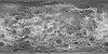
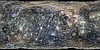
Mercury Messenger Global Mosaic 2010 Observation Guide
Global MosaicObservation Guide labeling the individual images used to make up the 2010 Mercury Messenger Global Mosaic.
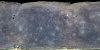
Mercury MESSENGER MDIS Basemap Enhanced Color Global Mosaic 665m
Global Mosaic | Raster Data | Remote-sensing Data 2016-05-13This mosaic shows Mercury's surface in "enhanced color," a term used to describe a color scheme created to emphasize color differences on Mercury's surface. This is not what Mercury would look like
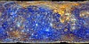
Mercury MESSENGER MDIS Basemap MD3 Color Global Mosaic 665m
Global Mosaic | Raster Data | Remote-sensing Data 2016-05-13This mosaic shows Mercury's colors as viewed by placing images from MESSENGER's 1000 nm, 750 nm, and 430 nm narrow-band filters in the red, green, and blue channel respectively. This is not
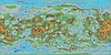
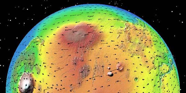
Mercury MESSENGER MDIS DEM Global Color Shaded Relief 2km
Raster Data | Shaded-Relief Map | Topographic Map 2016-05-06Product Information: This is a colorized shaded-relief of the original digital elevation model (DEM). Using the Integrated Software for Imagers and Spectrometers (ISIS3) and observations from Mercury Dual Imaging System (MDIS) narrow-angle
Mercury MESSENGER MDIS DTMs Fassett 2016
Digital Elevation Model | Image | Raster Data | Remote-sensing Data | Topographic Map 2016-12-01In this study, 96 digital terrain models (DTM/DEMs) and derived orthorecitifed images of Mercury were created using the NASA Ames Stereo Pipeline, using 1456 pairs of stereo images from the Mercury Dual
Mercury MESSENGER MDIS Global Basemap BDR 166m
Global Mosaic | Raster Data | Remote-sensing Data 2016-05-06The Map Projected Basemap RDR (BDR) data set consists of a global monochrome map of reflectance at a resolution of 256 pixels per degree (~166 m/p). This edition, version 1, was released
Mercury MESSENGER MDIS Global Color Mosaic 665m
Global Mosaic | Remote-sensing DataProduct Information: This color mosaic is comprised of photometrically corrected I/F (radiance factor) for 3 narrow-band color filters of the Mercury Dual Imaging System (MDIS) Wide Angle Camera (WAC), placing the 1000-nm,
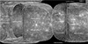
Mercury MESSENGER MDIS Global Mosaic 250m
Global Mosaic | Raster Data | Remote-sensing DataProduct Information: This May 2013 basemap is a combination of the following mosaics; (1) The 2013-05-10 version of the monochrome global mosaic, made from Applied Coherent Technology (ACT) Corporation tiles, (2) An
Mercury MESSENGER MDIS NAC Global Mosaic 1km
Global Mosaic | Remote-sensing DataProduct Information: This mosaic represents the best geodetic map of Mercury's surface as of 2010. In 2008 the MESSENGER spacecraft made two close flybys (M1 and M2) of Mercury and imaged about