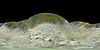
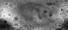
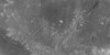
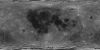
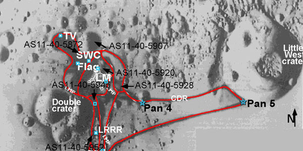
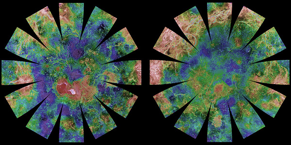
Products

739 Results Collapse
Moon Apollo 17 LROC NAC DEM 1.5m v1 thumbnail

Moon Apollo 17 LROC NAC DEM 1.5m v1

image/tiff 1 kBMay 01 2018

Product Information: This is a digital elevation model (DEM/DTM) of the Apollo 17 landing site generated from stereo images provided by the Lunar Reconnaissance Orbiter Camera (LROC) Narrow Angle…

Triton Voyager 2 Global Color Mosaic 600m v1 thumbnail

Triton Voyager 2 Global Color Mosaic 600m v1

application/isis 291 MBAug 21 2014

Product Information: Voyager 2 data was used to construct the best-ever global color map of Triton. This map has a resolution of 1,970 feet (600 meters per pixel [m]). Color was synthesized by…

Moon LROC WAC DTM GLD100 118m v1 thumbnail

Moon LROC WAC DTM GLD100 118m v1

application/isis 7 GBAug 01 2013

Product Information: This product represents a near-global lunar topography from stereo image data acquired by the Wide-angle Camera (WAC) of the Lunar Reconnaissance Orbiter Camera (LROC) system…

Moon Apollo Metric Albedo Mosaic v1 thumbnail

Moon Apollo Metric Albedo Mosaic v1

application/pds-img 84 kBJan 15 2010

The Apollo Metric Cameras were carried on the Apollo 15, 16, and 17 missions to map Earth’s Moon with a high degree of geometric fidelity. This PDS volume contains the "Apollo 15, 16, and 17…

Moon Clementine UVVIS Global Mosaic 118m v2 thumbnail

Moon Clementine UVVIS Global Mosaic 118m v2

application/octet-stream 2 kBApr 09 2009

Product Information: The Clementine Ultraviolet/Visible (UVVIS) Version 2 mosaic is a grayscale data set representing the albedo (brightness of the lunar surface) as measured at the 750 nanometer…

Moon Clementine UVVIS Warped Color Ratio Mosaic 200m v1 thumbnail

Moon Clementine UVVIS Warped Color Ratio Mosaic 200m v1

application/isis 4 GBAug 15 2008

Product Information: This base represents the Clementine Ultraviolet/Visible (UVVIS) warped color-ratio mineral map. This was generated from the UVVIS mosaics using three spectral filters (415,…

Moon Clementine UVVIS 5 Band Warped Image Mosaic 200m v1 thumbnail

Moon Clementine UVVIS 5 Band Warped Image Mosaic 200m v1

application/isis 14 GBMar 01 2008

Product Information: The Clementine Ultraviolet/Visible (UVVIS) mosaic of Earth's Moon is a radiometrically and geometrically controlled, photometrically modeled global Mosaicked Digital Image Model…

Moon Apollo Lunar Sample Photographs thumbnail

Moon Apollo Lunar Sample Photographs

text/xml 7 kB

Product Information: This set of archive volumes contains digital scanned versions of original film photographs of rock, soil, and core samples collected from the lunar surface during the Apollo 11,…

Moon LRO South Pole DEM Shaded Relief thumbnail

Moon LRO South Pole DEM Shaded Relief

image/tiff 97 MB

The Lunar Reconnaissance Orbiter Camera (LROC) consists of one Wide Angle Camera (WAC) for synoptic multispectral imaging and two Narrow Angle Cameras (NAC) that provide high-resolution images (0.5…

Moon SELENE Kaguya TC Global Orthomosaic 474m v2 thumbnail

Moon SELENE Kaguya TC Global Orthomosaic 474m v2

application/isis 506 MB

Product Information: This near-global mosaic was generated using data from the SELenological and Engineering Explorer (SELENE) “Kaguya” Terrain Camera (TC) instrument. TC source data originated…

Project Pages

28 Results Collapse
Control Networks thumbnail

Control Networks

http://astrogeology.usgs.gov/maps/control-networks

Table of Contents Mercury R O Venus R Moon1 R Mars R G Phobos O Deimos O Asteroids   243 Ida R 433 Eros O 951 Gaspra R Jupiter   Io R G O Europa R G Ganymede R…

Zond8 Lunar Consortium Historical Data Archive thumbnail

Zond8 Lunar Consortium Historical Data Archive

http://astrogeology.usgs.gov/maps/moon-zond8-historical-data-archive

Photographic hardcopy scans of 1970 photographs captured by a Soyuz 7K-L1 unmanned spacecraft on the soviet Zond8 mission. This data along with data from Apollo, Lunar Orbiter and Galileo missions is…

Moon Apollo Anaglyph 3D Images thumbnail

Moon Apollo Anaglyph 3D Images

http://astrogeology.usgs.gov/maps/moon-apollo-anaglyph-3d-images

This gallery features several digitized photographs from Apollo Mission explorations of the lunar surface. Anaglyph or 3D images require red-blue or red-green 3D glasses. The imagery and maps…

Moon Apollo Traverse Maps thumbnail

Moon Apollo Traverse Maps

http://astrogeology.usgs.gov/maps/moon-apollo-traverse-maps

This page features several maps showing routes the astronauts took during extravehicular activities (EVAs). The imagery and maps were prepared as part of a project by a USGS team under funding from…

Moon Apollo Landing Panoramas thumbnail

Moon Apollo Landing Panoramas

http://astrogeology.usgs.gov/maps/moon-apollo-landing-panoramas

The following 360° panoramas were created using digitized photographs collected by the astronauts during the Apollo 11 - 17 lunar exploration missions. The imagery and maps were prepared as part…

Io Voyager and Galileo Global Mosaics thumbnail

Io Voyager and Galileo Global Mosaics

http://astrogeology.usgs.gov/maps/io-voyager-galileo-global-mosaics

This basemap of Jupiter’s moon Io was produced by combining the best images from both the Voyager 1 and Galileo Missions. Although the subjovian hemisphere of Io was poorly seen by Galileo,…

Moon Clementine NIR Global Map thumbnail

Moon Clementine NIR Global Map

http://astrogeology.usgs.gov/maps/moon-clementine-near-ir-global-map

Background In May and June of 1994, the NASA/DoD Clementine Mission acquired global, 11-band, multispectral data of the lunar surface using the ultraviolet-visible (UVVIS) and near-infrared (NIR)…

Maps and Globes thumbnail

Maps and Globes

http://astrogeology.usgs.gov/maps/planetary-maps-and-globes

Download, print, and make your own planetary globes! The number, size, and placement of text annotations were chosen to provide a general orientation of prominent features on a 12-inch globe. …

Documents

53 Results Collapse
ISPRS 2003 Photoclinometry Made Simple...? thumbnail

ISPRS 2003 Photoclinometry Made Simple...?

application/pdf 964 kB

We describe a series of programs and scripts under development for the USGS digital cartography and image processing software system ISIS that will make it possible for users to create digital…

ISPRS 2003 GIS 101 for Planetary Research thumbnail

ISPRS 2003 GIS 101 for Planetary Research

application/pdf 156 kB

GIS-like tools have existed in the computer age since scientists have been displaying images or comparing digital datasets. Whether it was a program on a mainframe to draw a satellite image to…

ISPRS 2003 Low Resolution Planetary Experiments: Gridding and Mapping Routines using IDL thumbnail

ISPRS 2003 Low Resolution Planetary Experiments: Gridding and Mapping Routines using IDL

application/pdf 211 kB

We present a toolkit of routines for IDL. This toolkit converts a set of coordinates and data sorted by acquisition time into a map. It was developed at first for low-resolution data that require…

ISPRS 2003 A Systematic Approach for Optimizing Spectral and Spatial Matching Between Independent Datasets thumbnail

ISPRS 2003 A Systematic Approach for Optimizing Spectral and Spatial Matching Between Independent Datasets

application/pdf 567 kB

In the field of Earth observation and planetary exploration, a number of spacecrafts have been equipped in the last years with various multispectral and/or hyperspectral optical instruments spanning…

ISPRS 2003 Cartographic Support to Venglobgek International Project on the General Geologic Mapping of Venus: The Main Outlines thumbnail

ISPRS 2003 Cartographic Support to Venglobgek International Project on the General Geologic Mapping of Venus: The Main Outlines

application/pdf 158 kB

The planet Venus is the second largest (after the Earth) body among the terrestrial-type planets. The surface of Venus is 460x106 km2, which is three times larger than the area of the dry land…

ISPRS 2003 Utilizing GIS in Martian Impact Crater Studies thumbnail

ISPRS 2003 Utilizing GIS in Martian Impact Crater Studies

application/pdf 545 kB

The Mars Crater Morphology Consortium was formed in 1997 to facilitate exchange of martian impact crater data among researchers through standardizing nomenclature, integrating crater databases into…

ISPRS 2004 Multi-Image Shape from Shading, Derivation of Planetary Digital Terrain Models Using Clementine Images thumbnail

ISPRS 2004 Multi-Image Shape from Shading, Derivation of Planetary Digital Terrain Models Using Clementine Images

application/pdf 627 kB

In many cases, the derivation of high-resolution digital terrain models (DTMs) from planetary surfaces using only conventional digital image matching is a problem. The matching methods need at least…

ISPRS 2004 Combining Mars Data in GRASS GIS for Geologic Mapping thumbnail

ISPRS 2004 Combining Mars Data in GRASS GIS for Geologic Mapping

application/pdf 662 kB

Geo Information Systems (GIS) are standard tools in the Earth sciences whenever different geographic data sets must be combined. GIS became increasingly popular in the field of planetary research as…

ISPRS 2004 Topographic Mapping of Mars from Hectometer to Micrometer Scales thumbnail

ISPRS 2004 Topographic Mapping of Mars from Hectometer to Micrometer Scales

application/pdf 2 MB

We describe USGS topomapping of Mars at resolutions from 100 m to 30 µm with data from the latest spacecraft missions. Analysis of NASA 2001 Mars Odyssey Thermal Emission Imaging System (THEMIS)…

ISPRS 2004 Some Aspects of Multilingual Planetary Map Producing for Non-Professional Audience: Visualization and Nomenclature thumbnail

ISPRS 2004 Some Aspects of Multilingual Planetary Map Producing for Non-Professional Audience: Visualization and Nomenclature

application/pdf 565 kB

In general, maps should answer a very simple question of its reader: "what's there" and „where is something”? For planetary maps, the answer is more difficult, because (1) in some cases even map…