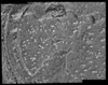
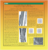
Post-RAT brush ortho mosaic of rock based on the digital elevation model
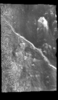
Post-RAT image mosaic of rock
Planetary nomenclature, like terrestrial nomenclature, is used to uniquely identify a feature on the surface of a planet or satellite so that the feature can be easily located, described, and…
In 2003-2005, the USGS worked under the guidance of NASA's Mars Critical Data Products Initiative to conduct research on how controlled large area or global 2001 Mars Odyssey THEMIS IR image mosaics…
The overall problem we’re solving is that we want to be able to set up the relationships between the coordinates of arbitrary physical points in space (e.g. ground points) and their coordinates on…
Stuart has suggested that I draft some suggestions for the format and names to be used for parameters in the randlsq.F program. I previously implemented the limited naming of parameters in this…