Project sheet with instructions for creating the Viking and Global Surveyor Mars globes using tennis balls.
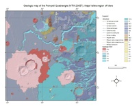
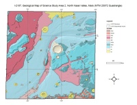
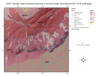
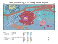
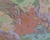
This map is one in a series of 1:500,000-scale geologic maps initiated by the National Aeronautics and Space Administration to investigate areas of particular scientific interest on…
The north Kasei Valles area merits detailed geologic study because it contains part of a large channel system whose age can be determined relative to geologic units that range in…
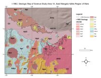
The east Mangala Valles area merits detailed geologic study because it contains several small channels whose ages can be determined relative to geologic units that range in age from early (Noachian)…
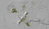
Product Information: This data set represents ongoing identification, characterization, and mapping of small vents across the Tharsis province utilizes Mars Orbiter Laser Altimeter (MOLA), Thermal…
The map area is in the Mangala-Memnonia region which contains remarkably diverse geologic features and terrain types. Studies of the Mariner 9 images revealed the wide range of ages of the major rock…
The original map document was created in 1992 as a Mercator projection and is based on older Viking images. It was scanned and georeferenced into ArcGIS in two parts that are located in…
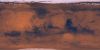
Product Information: About 1000 Viking Orbiter red- and violet-filter images have been processed to provide global color coverage of Mars at a scale of 925 meters per pixel (m). Individual image…