Lunar and Planetary Cartographic Catalog
Download
Browse
(jpg) 512 x 512
Original
(pdf) 2 MB
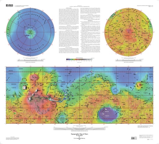
Mars Topographic and Color-Coded Contour Maps
Mimetype
application/pdf
Filename
Mars-Topographic-and-Color-Coded-Contour-Maps.pdf
Publisher
USGS Astrogeology Science Center
Publication Date
3 January 2003
Originator
Group
RPIF
Added to Astropedia
3 May 2016
Modified
22 June 2021
General
Geospatial Data Presentation Form
Topographic Map
Series Id
2782
Keywords
Target
Mars
Theme
Cartography
,
Remote Sensing
,
Topography
Mission
Contact and Distribution
Access Instructions
2 maps : col. ; 33 x 86 cm. with 2 spheres each 28 cm. in diam., on sheets 82 x 92 cm., folded in envelope 30 x 24 cm.
Geospatial Information
Quad Name
FGDC:
xml metadata
Ancillary Data
Metadata
(xml) 1003 bytes
i2782_sh2.eps
(pdf) 8 MB
ISIS
Planetary Nomenclature
Map a Planet 2
PDS Cartography and Imaging Science Node
RPIF
Photogrammetry Guest Facility
PILOT
MRCTR GIS Lab