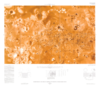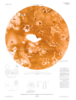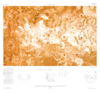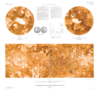

Io Shaded Relief and Surface Markings Map, Shaded Relief Map, and Controlled Photomosaic
- Mimetype
- application/pdf
- Filename
- Io-Shaded-Relief-and-Surface-Markings-Map-Shaded-Relief-Map-and-Controlled-Photomosaic.pdf
- Publisher
- USGS Astrogeology Science Center
- Originator
- Group
- RPIF
- Added to Astropedia
- 31 March 2016
- Modified
- 9 November 2017
General
- Geospatial Data Presentation Form
- Global Mosaic, Shaded-Relief Map
- Series Id
- 1713
Keywords
- System
- Jupiter
- Target
- Io
- Theme
- Cartography, Image Processing, Remote Sensing, Remote Sensing, Topography
- Mission
Contact and Distribution
- Access Instructions
- 8 maps on 3 sheets :some col. ;sheets 81 x 84 cm. and smaller, folded in envelope 30 x 24 cm.
Geospatial Information
- Quad Name