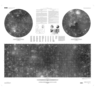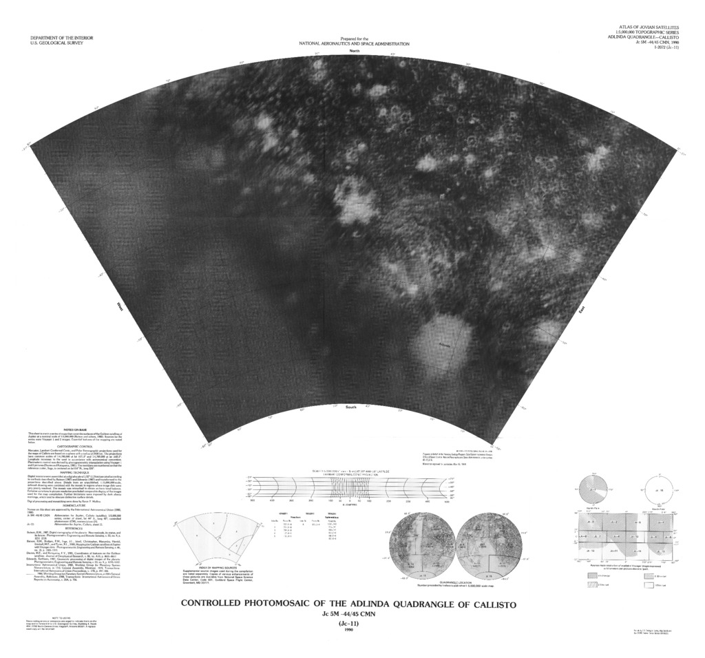
Callisto Controlled Photomosaic of the Adlinda Quadrangle
This sheet is one in a series of maps that covers the surface of Galilean satellites of Jupiter at nominal scale of 1:5,000,000(Batson and others, 1980). Sources for the series were Voyager 1 and 2 images. Essential features of the mapping are noted below.
Cartographic Control
Mercator, Lambert Conformal Conic, and Polar Stereographic projections used for the maps of Callisto are based on a sphere with a radius of 2400km. The projections have common scales of 1:4,780,000 at lat ±21.3˚ and 1:4,769,000 at lat ±65.2˚. Longitude increases to the west in accordance with the astronomical convention. Planimetric control was derived by photogrammetric triangulation using Voyager 1 and 2 pictures (Davies and Katayama, 1981). The meridians are numbered so that the reference crater, Saga is centered on lat 0.6˚N., long 326˚.
Mapping Technique
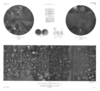
Digital mosaics were assembled at a digital scale of 1/32˚ (1.3km) per pixel according to methods described by Batson (1987) and Edwards (1987) and transformed to the projections described above. Details from an unpublished, 1:15,000,000-scale, airbrush drawing were combined with the mosaic in regions where the image data were very poorly resolved. The mosaic was retouched to obtain uniform tonal balance. Extreme variations in picture resolution precluded comparable display of the images used for the map compilation. Further limitations were imposed by dark albedo markings, which tend to obscure distinctive surface details. Digital processing and mosaicking were done by Kevin F. Mullins.
References:
Batson, R.M., Bridges, P.M., Inge, J.L. Isabell, Christopher, Masursky, Harold, Strobell, M.E., and Tyner, R.L., 1980, Mapping the Galilean satellites of Jupiter with Voyager data: Photogrammetric Engineering and Remote Sensing, v. 46, n0. 10, p.1303-1312.
Batson, R.M., 1987, Digital cartography of the planets: New methods, its status, and its future: Photogrammetric Engineering and Remote Sensing, v.46, no. 10, p. 1303-1312
Davies, M.E., and Katayama, F.Y., 1981, Coordinates of features on the Galilean Satellites: Journal of Geophysical Research, v.86, no. A10, p.8635-8657.
Edwards, Kathleen, 1987, Geometric processing of digital images of the planets: Photogrammetric Engineering and Remote Sensing, v.53, no.9, p. 1219-1222
- Mimetype
- application/pdf
- Filename
- Callisto-Controlled-Photomosaic-of-the-Adlinda-Quadrangle.pdf
- Publisher
- USGS Astrogeology Science Center
- Originator
- Group
- Added to Astropedia
- 21 March 2016
- Modified
- 3 May 2019
General
- Geospatial Data Presentation Form
- Regional Mosaic
- Series Id
- 2072
Keywords
- System
- Jupiter
- Target
- Callisto
- Theme
- Cartography, Image Processing, Remote Sensing
- Mission
- Voyager
- Mission Specific
- Voyager 1, Voyager 2
Contact and Distribution
- Access Instructions
- 1 remote-sensing image ;on sheet 71 x 76 cm., folded in envelope 30 x 24 cm.
Geospatial Information
- Feature Name
- Adlinda Quadrangle
- Quad Name
- Map Projection Name
- Lambert Conformal