Create High Quality DTMs
8 May 2018A digital terrain model (DTM) is a digital representation of the elevation of a planetary surface. Members of the Astrogeology Team produce DTMs of different bodies in the solar system to address questions about how landscapes formed or changed over time, and to identify safe landing sites for robotic missions. One method of producing DTMs involves using a pair of images collected by a satellite of the same area on the ground from two different angles to create a stereo view. Specialized software is then used to match identical features in each image and extract a three-dimensional location based on the geometric relationship between the images. Astrogeology Team member, David Mayer, recently presented a poster at the Lunar and Planetary Science Conference in The Woodlands, Texas on how to produce DTMs of Mars using the free Ames Stereo Pipeline software. The poster and accompanying abstract focus on creating high-quality DTMs for geologic research from images collected by the CTX camera on the Mars Reconnaissance Orbiter. The poster and abstract are available here: https://www.lpi.usra.edu/publications/absearch/?meeting=574&abstract_no=1604 : “An Improved Workflow for Producing Digital Terrain Models of Mars from CTX Stereo Data Using the NASA Ames Stereo Pipeline,” D. P. Mayer, 49th Lunar and Planetary Science Conference (2018), Abstract #1604.
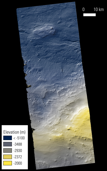
Photo of CTX DTM made using the method outlines in David's abstract/poster. Photo Credit: David Mayer (Astrogeology Team).


