Products

108 Results Collapse
Geologic Map of Io, SIM 3168 thumbnail

Geologic Map of Io, SIM 3168

application/zip 268 MBMar 13 2012

Io, discovered by Galileo Galilei on January 7-13, 1610, is the innermost of the four Galilean satellites of the planet Jupiter. It is the most volcanically active object in the Solar System, as…

Europa Voyager - Galileo SSI Global Mosaic 500m v2 thumbnail

Europa Voyager - Galileo SSI Global Mosaic 500m v2

application/isis 2 kBJan 01 2010

Product Information: This global map base of Europa utilizes the best image quality and moderate resolution coverage supplied by the Galileo SSI (Solid-State Imaging) instrument and Voyager 1 and 2.…

Io Galileo SSI / Voyager Color Merged Global Mosaic 1km thumbnail

Io Galileo SSI / Voyager Color Merged Global Mosaic 1km

application/isis 189 MB

To present more information-rich views of Io, the global color derived from the Galileo color images was superimposed on the more detailed, higher resolution monochrome mosaics. The procedure adopted…

Ganymede Voyager - Galileo SSI Color Global Mosaic 1.4km v1 thumbnail

Ganymede Voyager - Galileo SSI Color Global Mosaic 1.4km v1

application/isis 190 MB

Product Information: This global mosaic of Ganymede utilizes the best image quality and moderate resolution coverage supplied by Galileo Solid-State Imaging (SSI) and Voyager 1 and 2. The image data…

Ganymede Voyager - Galileo SSI Global Mosaic 1km v1 thumbnail

Ganymede Voyager - Galileo SSI Global Mosaic 1km v1

application/isis 131 MB

Product Information: This global mosaic of Ganymede utilizes the best image quality and moderate resolution coverage supplied by Galileo Solid-State Imaging (SSI) and Voyager 1 and 2. The image data…

Venus Geologic Map of the Lakshmi Planum Quadrangle (V-7) thumbnail

Venus Geologic Map of the Lakshmi Planum Quadrangle (V-7)

application/pdf 30 MBFeb 10 2010

The Lakshmi Planum quadrangle is in the northern hemisphere of Venus and extends from lat 50 degrees to 75 degrees N., and from long 300 degrees to 360 degrees E. The elevated volcanic plateau of…

Io Voyager Image Control Network (RAND) thumbnail

Io Voyager Image Control Network (RAND)

application/zip 141 MB

This page has been created as part of a project to put planetary control networks on the web. This control network for Jupiter’s moon, Io, originated from Merton Davies and Tim Colvin at the RAND…

Io Galileo SSI Global Color Merge Mosaic 1km v1 thumbnail

Io Galileo SSI Global Color Merge Mosaic 1km v1

application/isis 189 MB

Product Information: This global false color mosaic was constructed from low phase angle violet, green, and near-infrared (756 nanometer) images from orbits G2, E6, C9, and C21 of the Galileo…

Io Geologic Map of the Lerna Region (Ji-4) thumbnail

Io Geologic Map of the Lerna Region (Ji-4)

application/pdf 9 MBDec 30 2021

Io Geologic Map of the Maasaw Patera Area thumbnail

Io Geologic Map of the Maasaw Patera Area

application/pdf 10 MBNov 13 2021

Io, the innermost Galilean satellite of Jupiter, is about the same size as Earth’s Moon, but its surface properties and geologic processes are significantly different. Impact craters and basins,…

Project Pages

9 Results Collapse
GIS Tools thumbnail

GIS Tools

http://astrogeology.usgs.gov/facilities/mrctr/gis-tools

Tools for ArcMap 10.x …

Map a Planet

http://astrogeology.usgs.gov/tools/map-a-planet

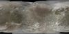
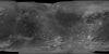
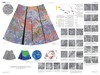
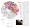
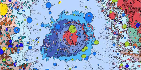
Welcome to Map-A-Planet MAP (v2) allows users to select global image mosaics for download, or with an account, one can also request the mosaic be map projected, clipped to extents, run pre-defined…

Mars Global Digital Image Mosaic MDIM 2.1 thumbnail

Mars Global Digital Image Mosaic MDIM 2.1

http://astrogeology.usgs.gov/maps/mdim-2-1

This global image map of Mars has a resolution of 256 pixels/degree (scale approximately 231 m/pixel at the equator). The black-and-white mosaic is processed to emphasize local topographic…

Moon Control Networks thumbnail

Moon Control Networks

http://astrogeology.usgs.gov/maps/control-networks/moon

Lunar Orbiter Lunar Control Network 2004 The USGS worked to digitize and restore a global set of Lunar Orbiter images and to assemble this into a global digital Lunar Orbiter mosaic of the Moon. A…

IAU - WGCCRE thumbnail

IAU - WGCCRE

http://astrogeology.usgs.gov/groups/iau-wgccre

History: The IAU Working Group on Cartographic Coordinates and Rotational Elements of the Planets and Satellites was established as a consequence of a resolution adopted by Commissions 4 and 16 at…

Cassini Observations of Io's Visible Aurorae thumbnail

Cassini Observations of Io's Visible Aurorae

http://astrogeology.usgs.gov/geology/io-cassini-visible-aurorae

Detailed comparisons of laboratory SO2 spectra with the Cassini observations indicate that a mixture of gases contribute to the equatorial emissions: Potassium (K) is suggested by new detections of…

Control Networks thumbnail

Control Networks

http://astrogeology.usgs.gov/maps/control-networks

Table of Contents Mercury R O Venus R Moon1 R Mars R G Phobos O Deimos O Asteroids   243 Ida R 433 Eros O 951 Gaspra R Jupiter   Io R G O Europa R G Ganymede R…

Io Voyager and Galileo Global Mosaics thumbnail

Io Voyager and Galileo Global Mosaics

http://astrogeology.usgs.gov/maps/io-voyager-galileo-global-mosaics

This basemap of Jupiter’s moon Io was produced by combining the best images from both the Voyager 1 and Galileo Missions. Although the subjovian hemisphere of Io was poorly seen by Galileo,…

Maps / Products thumbnail

Maps / Products

http://astrogeology.usgs.gov/maps

The Astrogeology Science Center's mission includes producing planetary maps and cartographic products which reveal topography, geology, topology, image mosaics and more, all made available to the…

Documents

15 Results Collapse
PDS 2018 Tool Working Group Report thumbnail

PDS 2018 Tool Working Group Report

application/vnd.openxmlformats-officedocument.presentationml.presentation 1 MB

Modeling and Adjustment of THEMIS IR Line Scanner Camera Image Measurements thumbnail

Modeling and Adjustment of THEMIS IR Line Scanner Camera Image Measurements

application/pdf 269 kB

The overall problem we’re solving is that we want to be able to set up the relationships between the coordinates of arbitrary physical points in space (e.g. ground points) and their coordinates on…

USGS Astrogeology 50th Anniversary Flyer thumbnail

USGS Astrogeology 50th Anniversary Flyer

application/pdf 667 kB

The USGS Astrogeology Science Center Honoring 50 Years of Public Service: Exploring the Solar System from Flagstaff, AZ

ISPRS 1998 Stereogrammetric Mapping of Mars thumbnail

ISPRS 1998 Stereogrammetric Mapping of Mars

application/pdf 65 kB

The Viking Orbiters acquired quality stereo coverage of a significant fraction of Mars in 1976-1980. Several groups have been using this stereo coverage to produce global and regional scale…

ISPRS 2001 Topographic Mapping of the Galilean and Other Icy Satellites: Prospects and Problems for Stereo and Photoclinometry thumbnail

ISPRS 2001 Topographic Mapping of the Galilean and Other Icy Satellites: Prospects and Problems for Stereo and Photoclinometry

application/pdf 107 kB

The utility (read: need) of topographic data in formulating and testing hypotheses for the formation of geologic features is undisputed. In the absence of laser altimeters, however, image-based…

ISPRS 2001 Improving the Rand-USGS Control Network for IO thumbnail

ISPRS 2001 Improving the Rand-USGS Control Network for IO

application/pdf 2 MB

We present here our current results from photogrammetric triangulation solutions for a control network and reference surface for Jupiter’s moon Io. It is compared to previous such solutions by us…

ISPRS 2003 Topography of Io: Methods to Mapping Local and Regional Geology thumbnail

ISPRS 2003 Topography of Io: Methods to Mapping Local and Regional Geology

application/pdf 125 kB

On such a volcanically active world as Io, topography is especially important for understanding lava emplacement, mountain formation, internal dynamics, and volcanic history. Previously we have…

ISPRS 2003 Topographic Mapping of Icy Satellites: New Methods and New Maps thumbnail

ISPRS 2003 Topographic Mapping of Icy Satellites: New Methods and New Maps

application/pdf 111 kB

Topographic mapping of icy satellites is a critical tool for evaluation of geologic problems ranging from the origin of ionian mountains to the thickness of floating ice shells. With the lack of…

ISPRS 2003 Photoclinometry Made Simple...? thumbnail

ISPRS 2003 Photoclinometry Made Simple...?

application/pdf 964 kB

We describe a series of programs and scripts under development for the USGS digital cartography and image processing software system ISIS that will make it possible for users to create digital…

ISPRS 2003 Evolving Automated Feature Extraction Algorithms for Planetary Science thumbnail

ISPRS 2003 Evolving Automated Feature Extraction Algorithms for Planetary Science

application/pdf 544 kB

Planetary exploration missions have returned a wealth of imagery data over the last 40 years. The problem is how to make best use of it all. Thoroughly analyzing such large datasets manually is…