Products

104 Results Collapse
Venus Magellan SAR FMAP Stereo Look Global Mosaic 75m v1 thumbnail

Venus Magellan SAR FMAP Stereo Look Global Mosaic 75m v1

application/isis 239 kBAug 30 2025

Product Information: This mosaic was created from the Magellan Full resolution Basic Image Data Records (F-BIDRs), the highest resolution radar images of the Venus surface (~75 meters per pixel…

Venus Magellan SAR FMAP Right Look Global Mosaic 75m v1 thumbnail

Venus Magellan SAR FMAP Right Look Global Mosaic 75m v1

application/isis 29 kBAug 01 2025

Product Information: This mosaic was created from the Magellan Full resolution Basic Image Data Records (F-BIDRs), the highest resolution radar images of the Venus surface (~75 meters per pixel…

Venus Magellan SAR FMAP Left Look Global Mosaic 75m v1 thumbnail

Venus Magellan SAR FMAP Left Look Global Mosaic 75m v1

application/isis 74 kBAug 01 2025

Product Information: This mosaic was created from the Magellan F-BIDRs, (Full resolution Basic Image Data Records), the highest resolution radar images of the Venus surface (~75 m/pixel). For a…

Mars MGS MOLA - MEX HRSC Blended DEM Global 200m v2 thumbnail

Mars MGS MOLA - MEX HRSC Blended DEM Global 200m v2

application/octet-stream 1 kBJan 31 2018

Product Information: This data product, now at version 2, is a blend of digital elevation model (DEM) data derived from the Mars Orbiter Laser Altimeter (MOLA), an instrument aboard NASA’s Mars…

Europa Voyager - Galileo SSI Global Mosaic 500m v2 thumbnail

Europa Voyager - Galileo SSI Global Mosaic 500m v2

application/isis 2 kBJan 01 2010

Product Information: This global map base of Europa utilizes the best image quality and moderate resolution coverage supplied by the Galileo SSI (Solid-State Imaging) instrument and Voyager 1 and 2.…

Mars Viking Colorized Global Mosaic 232m v2 thumbnail

Mars Viking Colorized Global Mosaic 232m v2

application/isis 12 GBFeb 02 2009

Product Information: This global image map of Mars has a resolution of 256 pixels/degree (scale approximately 232 meters per pixel (m) at the equator). The colorized mosaic was completed by NASA…

Titan Cassini ISS Near Global Mosaic 450m v1 thumbnail

Titan Cassini ISS Near Global Mosaic 450m v1

application/isis 1 GB

Product Information: The Cassini mission has returned an abundance of data about the surface of Titan. To maximize the science return from these data and to assist with planning for Cassini and…

Tethys Cassini Global Mosaic 293m v2 thumbnail

Tethys Cassini Global Mosaic 293m v2

application/isis 63 MB

Product Information: This global map of Saturn's moon Tethys was created using images taken during Cassini spacecraft flybys which mostly occurred during the Solstice mission extension. The map is…

Rhea Cassini - Voyager Global Mosaic 417m v2 thumbnail

Rhea Cassini - Voyager Global Mosaic 417m v2

application/isis 63 MB

Product Information: This global digital map was created using data taken during Cassini and Voyager spacecraft flybys of Rhea. It is the first mosaic of Rhea to be created using mostly only Cassini…

Dione Cassini - Voyager Global Mosaic 154m v1 thumbnail

Dione Cassini - Voyager Global Mosaic 154m v1

application/isis 253 MB

Product Information: This global map of Saturn's moon Dione was created using images taken during flybys by NASA's Cassini spacecraft. Images from NASA's Voyager mission fill the gaps in Cassini's…

Project Pages

8 Results Collapse
Mars Global Digital Image Mosaic MDIM 2.1 thumbnail

Mars Global Digital Image Mosaic MDIM 2.1

http://astrogeology.usgs.gov/maps/mdim-2-1

This global image map of Mars has a resolution of 256 pixels/degree (scale approximately 231 m/pixel at the equator). The black-and-white mosaic is processed to emphasize local topographic…

Moon Pyroclastic Volcanism Project thumbnail

Moon Pyroclastic Volcanism Project

http://astrogeology.usgs.gov/geology/moon-pyroclastic-volcanism-project

Project Overview The goal of this research project is to advance our understanding of pyroclastic volcanism on the Moon using remote sensing data, primarily the high-spatial-resolution (~100 m/pixel)…

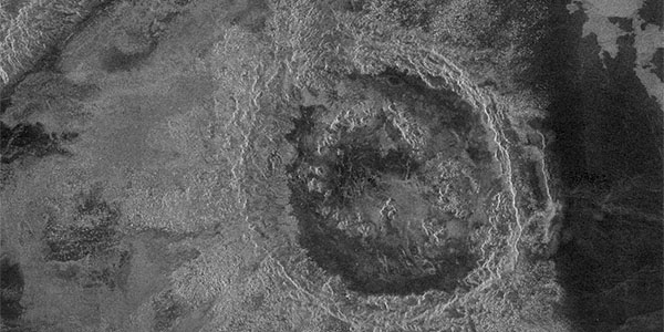
Venus Magellan Impact Crater Database thumbnail

Venus Magellan Impact Crater Database

http://astrogeology.usgs.gov/geology/venus-magellan-crater-database

The Crater Database The database tables include the name (where applied), coordinates, diameter, modification state, crater morphologic type, and mean elevation of 967 craters interpreted to be of…

Mars Dunes

http://astrogeology.usgs.gov/geology/mars-dunes

Sand dunes are among the most widespread aeolian features present on Mars, serving as unique indicators of the interaction between the atmosphere and surface. On a planetary body, dunes accumulate…

Mars Ice

http://astrogeology.usgs.gov/geology/mars-ice

North Pole Consortium Meetings Instruments and Data Tharsis Region South Pole South Pole Cryptic Region South Pole Recession

Cassini Observations of Io's Visible Aurorae thumbnail

Cassini Observations of Io's Visible Aurorae

http://astrogeology.usgs.gov/geology/io-cassini-visible-aurorae

Detailed comparisons of laboratory SO2 spectra with the Cassini observations indicate that a mixture of gases contribute to the equatorial emissions: Potassium (K) is suggested by new detections of…

Evidence of Cryovolcanism on Titan thumbnail

Evidence of Cryovolcanism on Titan

http://astrogeology.usgs.gov/geology/titan-cryovolcanism

From NASA Press Release…New data from NASA's Cassini spacecraft reveal topography on Saturn's moon Titan that makes the best case yet for an ice volcano on Titan and reveals the most…

Mars Science Laboratory - Landing Site Selection thumbnail

Mars Science Laboratory - Landing Site Selection

http://astrogeology.usgs.gov/maps/mars-science-laboratory-landing-site-selection

Image Information and Instructions The ISIS cube file can be loaded into JMars as a custom map. You can download JMars at the following site: http://jmars.asu.eduFor instructions on how to load a…

Documents

22 Results Collapse
State of the IPDA 2018 thumbnail

State of the IPDA 2018

application/vnd.openxmlformats-officedocument.presentationml.presentation 11 MB

ISPRS 1999 A Database of Viking Orbiter Image Coverage of Mars for Cartographic and Scientific Use thumbnail

ISPRS 1999 A Database of Viking Orbiter Image Coverage of Mars for Cartographic and Scientific Use

application/pdf 2 MB

Viking Orbiters 1 and 2 collectively returned more than 46,000 images of Mars between 1976 and 1980. Numerous observation sequences with different objectives resulted in an extremely complex and…

ISPRS 1999 Constraints, Approach, and Status of Mars Surveyor '01 Landing Site Selection thumbnail

ISPRS 1999 Constraints, Approach, and Status of Mars Surveyor '01 Landing Site Selection

application/pdf 13 kB

There are many similarities between the Mars Surveyor '01 (MS '01) landing site selection process and that of Mars Pathfinder. The selection process includes two parallel activities in which…

ISPRS 2001 The Accuracy, Stability and

ISPRS 2001 The Accuracy, Stability and "Value" of Geodetic Reference Parameters for Mars

application/pdf 51 kB

Recent geodetic observations of Mars by the Mars Global Surveyor spacecraft, particularly the altimetry and gravity experiments, have provided a new framework in which Mars may be geodetically…

ISPRS 2001 High Resolution Digital Elevation Models of Mars from MOC Narrow Angle Stereoimages thumbnail

ISPRS 2001 High Resolution Digital Elevation Models of Mars from MOC Narrow Angle Stereoimages

application/pdf 296 kB

In this abstract we report on our initial experiences performing stereotopographic mapping of Mars with high-resolution images from the Mars Global Surveyor Mars Orbiter Camera Narrow-Angle subsystem…

ISPRS 2002 High-Resolution Topomapping of Mars Orbiter Camera Narrow-Angle Images thumbnail

ISPRS 2002 High-Resolution Topomapping of Mars Orbiter Camera Narrow-Angle Images

application/pdf 800 kB

We describe our initial experiences producing controlled digital elevation models (DEMs) of Mars with horizontal resolutions of ≤10 m and vertical precisions of ≤2 m. Such models are of intense…

ISPRS 2003 The Messenger Mercury Dual Imaging System (MDIS): Imaging Strategy at Mercury thumbnail

ISPRS 2003 The Messenger Mercury Dual Imaging System (MDIS): Imaging Strategy at Mercury

application/pdf 140 kB

The MESSENGER (MErcury Surface, Space ENvironment, GEochemistry, and Ranging) spacecraft will launch in March of 2004, beginning a 5-year journey to Mercury. Mercury has been visited by only one…

ISPRS 2003 A Virtual Observatory of Planetary Surfaces thumbnail

ISPRS 2003 A Virtual Observatory of Planetary Surfaces

application/pdf 676 kB

Study of the origin, composition and alteration of planetary regoliths and soils is a key to set constraints on the formation and evolution of telluric planets. Surfaces are indeed complex interfaces…

ISPRS 2003 Photoclinometry Made Simple...? thumbnail

ISPRS 2003 Photoclinometry Made Simple...?

application/pdf 964 kB

We describe a series of programs and scripts under development for the USGS digital cartography and image processing software system ISIS that will make it possible for users to create digital…

ISPRS 2003 Visual Calculus of Perceptual Fribble? World Maps with Constant Scale Edges: A Novel Projection Method, Well-Suited to our Era thumbnail

ISPRS 2003 Visual Calculus of Perceptual Fribble? World Maps with Constant Scale Edges: A Novel Projection Method, Well-Suited to our Era

application/pdf 3 MB

I introduce world maps with constant scale edges [cse], and show how cse encompasses both conventional projections and a new class of maps—world maps with constant scale natural boundaries [csnb].…