ISPRS 1999 An Image Map of the Mars Pathfinder Landing Site
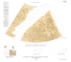
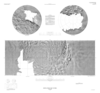
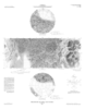
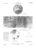
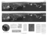
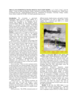
application/pdf 13 kBOn 4 July 1997, the Pathfinder spacecraft landed on Mars near the mouth of the outflow channel Ares Vallis, located in the southern part of Chryse Planitia. Between July 4 and September 27, 1997, the…