Mars Geologic, Paleotectonic, and Paleoerosional Maps of the Thaumasia Region
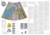
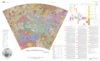
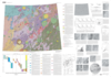
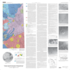
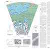
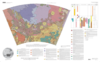
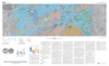
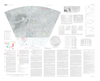
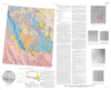
application/pdf 11 MBJan 01 2001The geology of the Thaumasia region (fig. 1, sheet 3) includes a wide array of rock materials, depositional and erosional landforms, and tectonic structures. The region is dominated by the Thaumasia…