Venus Geologic Map of the Diana Chasma Quadrangle (V-37)
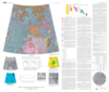
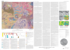
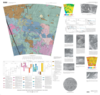
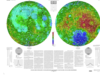
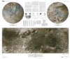
application/pdf 19 MBJan 02 2002Introduction The Diana Chasma quadrangle (V-37), an equatorial region between 0° to 25° S. and 150° to 180° E. that encompasses ~8,400,000 km2, is broadly divided into southern Rusalka…