Products

74 Results Collapse
Apollo 11 Traverse Map thumbnail

Apollo 11 Traverse Map

image/jpeg 111 kB

Apollo 11 Photo and Television Map thumbnail

Apollo 11 Photo and Television Map

image/jpeg 198 kB

Photograph and television pictures map (Baston and Larson 1969)

Apollo 12 Traverse Map thumbnail

Apollo 12 Traverse Map

image/jpeg 152 kB

Apollo 14 Traverse Map thumbnail

Apollo 14 Traverse Map

image/jpeg 127 kB

Apollo 15 Traverse Map thumbnail

Apollo 15 Traverse Map

image/jpeg 148 kB

Apollo 14 Panorama - Station H thumbnail

Apollo 14 Panorama - Station H

image/jpeg 298 kB

The panorama was collected by Edgar Dean at station H. Alan Shepard is to the left of the lander aiming the TV camera at the MESA. The panorama is made from the frame set AS14-68-9477 to 9491.

Apollo 16 Anaglyph/3D - Charles Moss Duke Collecting Core Samples thumbnail

Apollo 16 Anaglyph/3D - Charles Moss Duke Collecting Core Samples

image/jpeg 116 kB

Collection of the double core sample at Station 10 Prime. Charles Moss Duke has driven both sections of the core into the ground and is holding the hammer.

Apollo 16 Anaglyph/3D - John Watts Young at the back of the rover thumbnail

Apollo 16 Anaglyph/3D - John Watts Young at the back of the rover

image/jpeg 154 kB

John Watts Young working at the back of the rover.

Apollo 17 Anaglyph/3D - Harrison

Apollo 17 Anaglyph/3D - Harrison "Jack" Schmitt at the Rover

image/jpeg 87 kB

One of a panoramic series of photographs taken at Station 4 by Eugene Andrew Cernan. This image shows Harrison H. "Jack" Schmitt at the rover. The trench site in orange soil is at the cross mark to…

Apollo 17 Anaglyph/3D - Station 9 Looking North thumbnail

Apollo 17 Anaglyph/3D - Station 9 Looking North

image/jpeg 121 kB

Part of a panoramic series of photographs taken as station 9 looking north.

Project Pages

10 Results Collapse

Astrogeology 1963-2013: Fifty Years of Exploration

http://astrogeology.usgs.gov/rpif/videos/astrogeology-1963-2013-fifty-years-of-exploration

Collection Highlights thumbnail

Collection Highlights

http://astrogeology.usgs.gov/rpif/collection-highlights

The USGS/NASA Astrogeology RPIF contains many unique research materials and artifacts. Including: Images and films of Apollo astronaut training Forty years of draft map materials including…

IAU - WGCCRE thumbnail

IAU - WGCCRE

http://astrogeology.usgs.gov/groups/iau-wgccre

History: The IAU Working Group on Cartographic Coordinates and Rotational Elements of the Planets and Satellites was established as a consequence of a resolution adopted by Commissions 4 and 16 at…

Moon Pyroclastic Volcanism Project thumbnail

Moon Pyroclastic Volcanism Project

http://astrogeology.usgs.gov/geology/moon-pyroclastic-volcanism-project

Project Overview The goal of this research project is to advance our understanding of pyroclastic volcanism on the Moon using remote sensing data, primarily the high-spatial-resolution (~100 m/pixel)…

Venus Magellan Impact Crater Database thumbnail

Venus Magellan Impact Crater Database

http://astrogeology.usgs.gov/geology/venus-magellan-crater-database

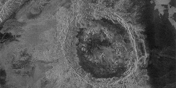
The Crater Database The database tables include the name (where applied), coordinates, diameter, modification state, crater morphologic type, and mean elevation of 967 craters interpreted to be of…

Sub-ice Volcanism on Earth and Mars thumbnail

Sub-ice Volcanism on Earth and Mars

http://astrogeology.usgs.gov/geology/mars-volcano-ice-interactions

Sub-glacially erupted volcanoes form free-standing flat-topped mesas, known as tuyas. Although there are some silicic edifices (e.g. Tuffen et al., 2002), most terrestrial sub-ice volcanoes are mafic…

Valles Marineris - The Grand Canyon of Mars thumbnail

Valles Marineris - The Grand Canyon of Mars

http://astrogeology.usgs.gov/geology/mars-valles-marineris

The Valles Marineris is a system of canyons located just south of the Martian equator. The system is about 4000 km long, and, if on earth, would extend all the way across the United States. The…

Mars Dunes

http://astrogeology.usgs.gov/geology/mars-dunes

Sand dunes are among the most widespread aeolian features present on Mars, serving as unique indicators of the interaction between the atmosphere and surface. On a planetary body, dunes accumulate…

Mars Ice

http://astrogeology.usgs.gov/geology/mars-ice

North Pole Consortium Meetings Instruments and Data Tharsis Region South Pole South Pole Cryptic Region South Pole Recession

Mars Science Laboratory - Landing Site Selection thumbnail

Mars Science Laboratory - Landing Site Selection

http://astrogeology.usgs.gov/maps/mars-science-laboratory-landing-site-selection

Image Information and Instructions The ISIS cube file can be loaded into JMars as a custom map. You can download JMars at the following site: http://jmars.asu.eduFor instructions on how to load a…