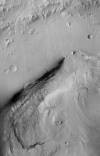
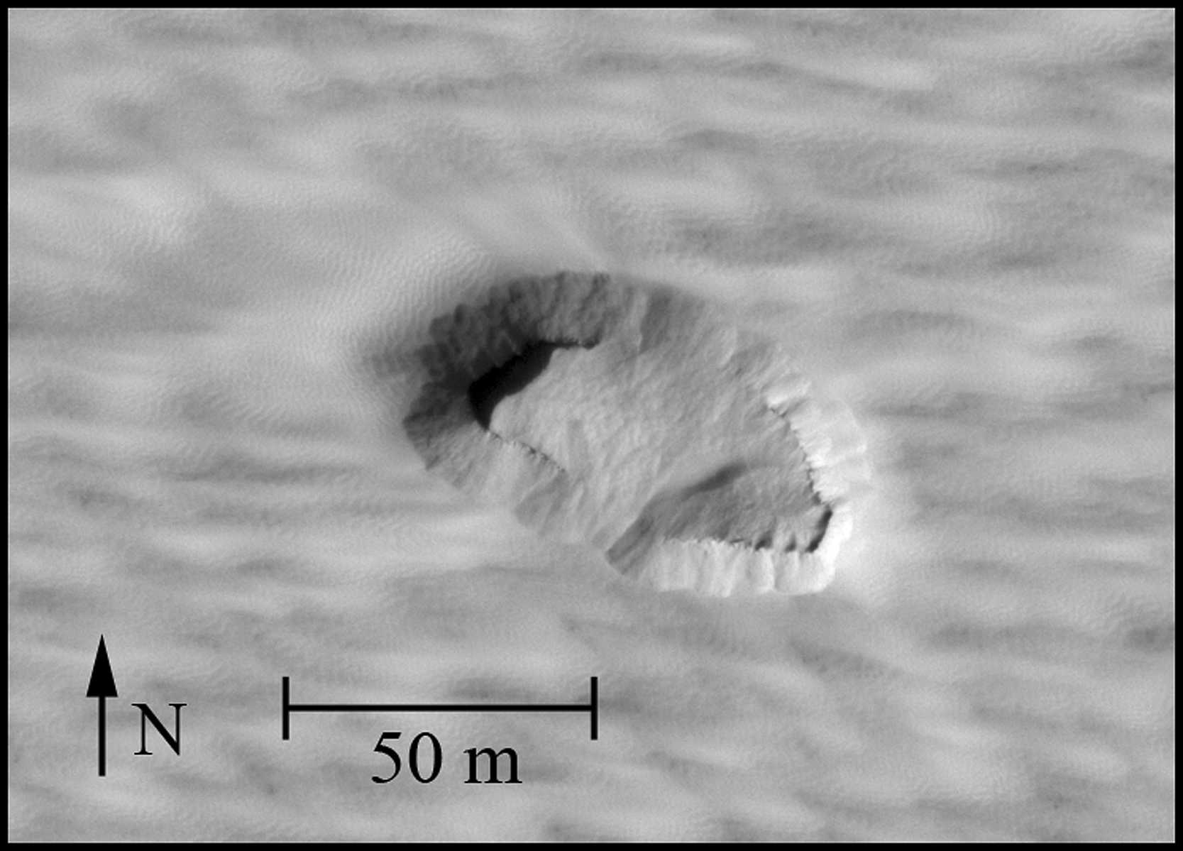
Products

64 Results Collapse
Mars 2020 Terrain Relative Navigation HiRISE Orthorectified Image Mosaic thumbnail

Mars 2020 Terrain Relative Navigation HiRISE Orthorectified Image Mosaic

image/tiff 4 bytesJul 24 2020

The Mars 2020 rover will explore Jezero crater, Mars to investigate an ancient delta for evidence of past microbial life and to better understand the geologic history of the region. The landing…

Mars 2020 Terrain Relative Navigation HiRISE DTM Mosaic thumbnail

Mars 2020 Terrain Relative Navigation HiRISE DTM Mosaic

image/tiff 1 kBJul 24 2020

The Mars 2020 rover will explore Jezero crater, Mars to investigate an ancient delta for evidence of past microbial life and to better understand the geologic history of the region. The landing…

Mars 2020 Terrain Relative Navigation CTX DTM Mosaic thumbnail

Mars 2020 Terrain Relative Navigation CTX DTM Mosaic

image/tiff 1 kBJul 24 2020

The Mars 2020 rover will explore Jezero crater, Mars to investigate an ancient delta for evidence of past microbial life and to better understand the geologic history of the region. The landing…

Mars 2020 Terrain Relative Navigation Context Camera Orthorectified Image Mosaic thumbnail

Mars 2020 Terrain Relative Navigation Context Camera Orthorectified Image Mosaic

image/tiff 4 bytesJul 24 2020

This is a visible image mosaic generated from the Context Camera (CTX) images from the Mars Reconnaissance Orbiter mission. This product is the Lander Visions System (LVS) map that will be onboard…

Moon Apollo 17 LROC NAC Landing Site Orthomosaic 50cm v1 thumbnail

Moon Apollo 17 LROC NAC Landing Site Orthomosaic 50cm v1

application/zip 6 MBMay 01 2018

Product Information: This is an (ortho-) mosaic map of the Apollo 17 landing site (L15K 20.2/30.7East COMT). The map includes nomenclature, elevation contours, the astronauts' major geology stops,…

Mars MSL Gale Merged Orthophoto Mosaic 25cm v3 thumbnail

Mars MSL Gale Merged Orthophoto Mosaic 25cm v3

image/tiff 4 MBOct 20 2016

Product Information: This basemap was initially created as an assessment tool for the entry, descent, and landing (EDL) analysis conducted by the Mars Science Laboratory (MSL) engineering team to…

Context Camera (CTX) Image Mosaics for Mars Human Exploration Zones 5m thumbnail

Context Camera (CTX) Image Mosaics for Mars Human Exploration Zones 5m

image/tiff 2 MBJul 01 2016

We have created 39 regional semi-controlled CTX mosaics at 5m/pixel for the 2015 proposed Mars Human Exploration zones. They are individually available for download in GeoTiff format from the "Online…

Moon LRO LOLA Color Shaded Relief 388m v4  thumbnail

Moon LRO LOLA Color Shaded Relief 388m v4

application/isis 3 GBAug 01 2011

Product Information: This is a colorized shaded-relief of a original polar digital elevation model (DEM) from the Lunar Orbiter Laser Altimeter (LOLA; Smith et al., 2010), an instrument on the…

Mars Human Exploration Zone DEM Archive 2023 thumbnail

Mars Human Exploration Zone DEM Archive 2023

image/tiff 114 kBMay 01 2023

This PDS4 archive includes 1,354 HiRISE DEMs, 1,354 CTX DEMs that overlap the HiRISE DEMs, orthoimages associated with each, and pixel masks to show the quality of each stereo correlation. DEMs…

Moon Apollo 17 LROC NAC Orthomosaic 50cm v1 thumbnail

Moon Apollo 17 LROC NAC Orthomosaic 50cm v1

image/tiff 1 kBMay 01 2018

Product Information: This is an orthomosaic of the Apollo 17 landing site created from images provided by the Lunar Reconnaissance Orbiter (LRO) Camera (LROC) Narrow Angle Camera (NAC). The images…

Project Pages

19 Results Collapse
Planetary Caves thumbnail

Planetary Caves

http://astrogeology.usgs.gov/geology/planetary-caves

As USGS scientist and planetary cave enthusiast, Glen Cushing, points out, "Caves are important to the future of planetary exploration because they are believed to provide shelter from a range of…

Astrogeology 1963-2013: Fifty Years of Exploration

http://astrogeology.usgs.gov/rpif/videos/astrogeology-1963-2013-fifty-years-of-exploration

Spirit MI Pancam Merges

http://astrogeology.usgs.gov/maps/mars-mer-mi-merged-products/spirit-mi-pancam-merges

Opportunity MI Pancam Merges

http://astrogeology.usgs.gov/maps/mars-mer-mi-merged-products/opportunity-mi-pancam-merges

Grover Photo Collection

http://astrogeology.usgs.gov/rpif/photos/grover-photo-collection

The Apollo Lunar Roving Vehicle was an engineering miracle, but It would have collapsed on Earth under the weight of a suited astronaut. That's because it was designed to operate in lunar gravity,…

Mars MER Microscopic Imager Merged Products thumbnail

Mars MER Microscopic Imager Merged Products

http://astrogeology.usgs.gov/maps/mars-mer-mi-merged-products

A single MI image or an Microscopic Imager mosaic can be merged with Pancam color images. The two products must be coregistered first, and then added together to produce colorized images in which the…

Grover - Geologic Rover

http://astrogeology.usgs.gov/rpif/videos/grover

The Apollo Lunar Roving Vehicle was an engineering miracle, but It would have collapsed on Earth under the weight of a suited astronaut. That's because it was designed to operate in lunar gravity,…

Rocket Flight

http://astrogeology.usgs.gov/rpif/videos/rocket-flight

The 1960s Apollo Lunar Module could support two men for three days, and the Apollo space suits carried only enough oxygen and cooling water for eight hours of work on the moon. Because of these…

Photos thumbnail

Photos

http://astrogeology.usgs.gov/rpif/photos

The Regional Planetary Information Facility (RPIF) at the USGS Astrogeology Science Center in Flagstaff, Arizona is an archival repository for photographic evidence of space exploration and planetary…

Moon Control Networks thumbnail

Moon Control Networks

http://astrogeology.usgs.gov/maps/control-networks/moon

Lunar Orbiter Lunar Control Network 2004 The USGS worked to digitize and restore a global set of Lunar Orbiter images and to assemble this into a global digital Lunar Orbiter mosaic of the Moon. A…