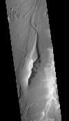
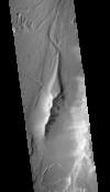
This orthorectified image was created by projecting an image from the Mars Reconnaissance Orbiter Context Camera (CTX) onto a Digital Terrain Model (DTM). The DTM is available under the “Derived…
This Digital Terrain Model (DTM) was produced as part of a project to understand Martian lava flows. It was constructed from a pair of Mars Reconnaissance Orbiter Context Camera (CTX) images using…
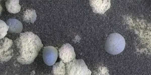
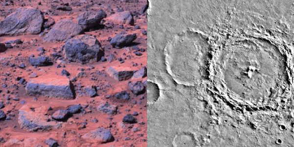
The Microscopic Imagers (MI) on the Mars Exploration Rovers, Spirit and Opportunity, have returned images of Mars with higher resolution than any previous camera system, allowing detailed…
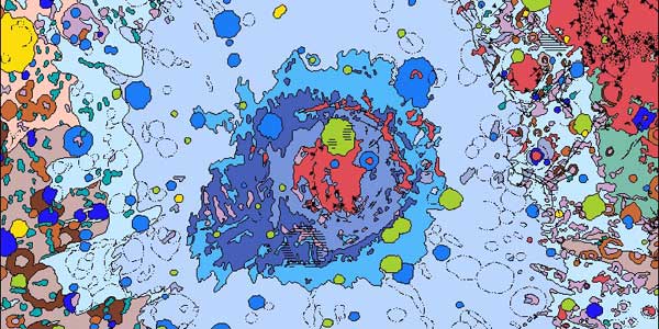
Sub-glacially erupted volcanoes form free-standing flat-topped mesas, known as tuyas. Although there are some silicic edifices (e.g. Tuffen et al., 2002), most terrestrial sub-ice volcanoes are mafic…
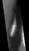
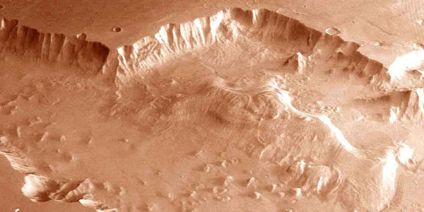
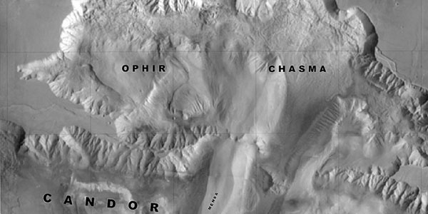
The Valles Marineris is a system of canyons located just south of the Martian equator. The system is about 4000 km long, and, if on earth, would extend all the way across the United States. The…
The surface of Mars has changed dramatically during the three decades spanned by spacecraft exploration. Comparisons of Mars Global Surveyor images with Viking and Mariner 9 pictures suggest that…
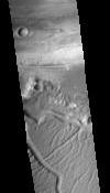
Sand dunes are among the most widespread aeolian features present on Mars, serving as unique indicators of the interaction between the atmosphere and surface. On a planetary body, dunes accumulate…
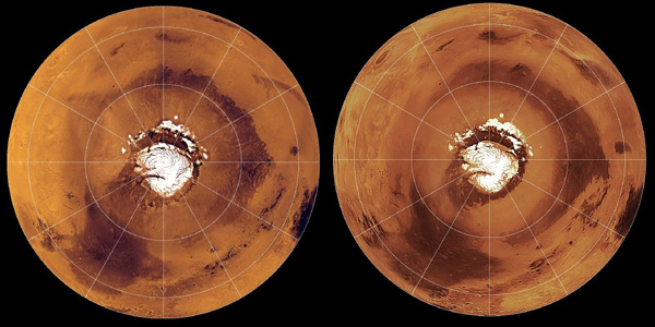
North Pole Consortium Meetings Instruments and Data Tharsis Region South Pole South Pole Cryptic Region South Pole Recession
Former USGS scientist, Jeff Johnson, performed key research on the detection of dust on the Martian surface. This work explored the laboratory thermal infrared and visible/near-infrared spectroscopy…
Table of Contents Mercury R O Venus R Moon1 R Mars R G Phobos O Deimos O Asteroids 243 Ida R 433 Eros O 951 Gaspra R Jupiter Io R G O Europa R G Ganymede R…
Image Information and Instructions The ISIS cube file can be loaded into JMars as a custom map. You can download JMars at the following site: http://jmars.asu.eduFor instructions on how to load a…
The Astrogeology Science Center's mission includes producing planetary maps and cartographic products which reveal topography, geology, topology, image mosaics and more, all made available to the…
At the development of a mathematical basis of cartographic products the problems of selection of a reference-surface system, system of coordinates, and also selection and elaboration of cartographic…
In the late 1980s, the USGS, Flagstaff, produced the first in what would become a series of very large, global digital image mosaics of solar system bodies. This Mars mosaicked digital image model…
Viking Orbiters 1 and 2 collectively returned more than 46,000 images of Mars between 1976 and 1980. Numerous observation sequences with different objectives resulted in an extremely complex and…
This abstract describes progress in cartographic processing of data from the Imager for Mars Pathfinder (IMP) by the U. S. Geological Survey in the past year, and plans for advanced cartographic…
To assist in landing site selection, we are compiling a suite of stereo images of potential landing sites for the 1998 and 2001 Mars landers. From these, we are using automated stereogrammetry…
The Mars Volatiles and Climate Surveyor (MVACS) instrument payload on the Mars Polar Lander includes two imagers designed and constructed at the Lunar and Planetary Laboratory at the University of…
Super resolution of the horizon at both Viking landing sites has revealed “new” features we use for triangulation, similar to the approach used during the Mars Pathfinder Mission. We propose…
On 4 July 1997, the Pathfinder spacecraft landed on Mars near the mouth of the outflow channel Ares Vallis, located in the southern part of Chryse Planitia. Between July 4 and September 27, 1997, the…
We present a new global map of Mars based on images taken by the Viking Orbiters. Precise image position information and camera pointing data, needed to produce this map, were derived from a recent…
We re-analyzed the Viking Mars control point network, an effort, which resulted in accurate pointing data for a list of 1138 Viking Orbiter images. From these images, which have resolutions between…