Product Information: The Lunar Crater Database contains approximately 1.3 million lunar impact craters and is approximately complete for all craters larger than about 1–2 km in diameter…
Product Information: This is an orthomosaic of the Apollo 17 landing site created from images provided by the Lunar Reconnaissance Orbiter (LRO) Camera (LROC) Narrow Angle Camera (NAC). The images…
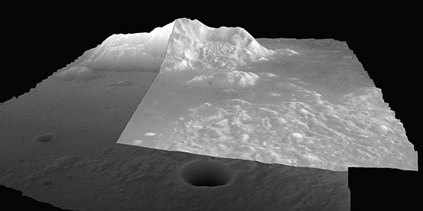
Product Information: This is a digital elevation model (DEM/DTM) of the Apollo 17 landing site generated from stereo images provided by the Lunar Reconnaissance Orbiter Camera (LROC) Narrow Angle…
Product Information: This product represents a near-global lunar topography from stereo image data acquired by the Wide-angle Camera (WAC) of the Lunar Reconnaissance Orbiter Camera (LROC) system…
The Apollo Metric Cameras were carried on the Apollo 15, 16, and 17 missions to map Earth’s Moon with a high degree of geometric fidelity. This PDS volume contains the "Apollo 15, 16, and 17…
Product Information: The Clementine Ultraviolet/Visible (UVVIS) Version 2 mosaic is a grayscale data set representing the albedo (brightness of the lunar surface) as measured at the 750 nanometer…
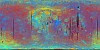
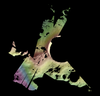
Product Information: This base represents the Clementine Ultraviolet/Visible (UVVIS) warped color-ratio mineral map. This was generated from the UVVIS mosaics using three spectral filters (415,…
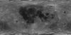
Product Information: The Clementine Ultraviolet/Visible (UVVIS) mosaic of Earth's Moon is a radiometrically and geometrically controlled, photometrically modeled global Mosaicked Digital Image Model…
The Lunar Reconnaissance Orbiter Camera (LROC) consists of one Wide Angle Camera (WAC) for synoptic multispectral imaging and two Narrow Angle Cameras (NAC) that provide high-resolution images (0.5…
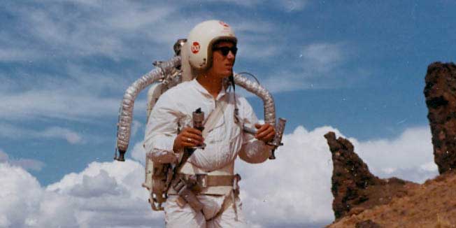
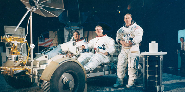
The 1960s Apollo Lunar Module could support two men for three days, and the Apollo space suits carried only enough oxygen and cooling water for eight hours of work on the moon. Because of these…
The Regional Planetary Information Facility (RPIF) at the USGS Astrogeology Science Center in Flagstaff, Arizona is an archival repository for photographic evidence of space exploration and planetary…
The RPIF's 16-mm film collection contains historic films related to astronaut training, equipment field tests, geological expeditions and more.
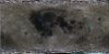
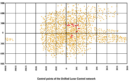
Lunar Orbiter Lunar Control Network 2004 The USGS worked to digitize and restore a global set of Lunar Orbiter images and to assemble this into a global digital Lunar Orbiter mosaic of the Moon. A…
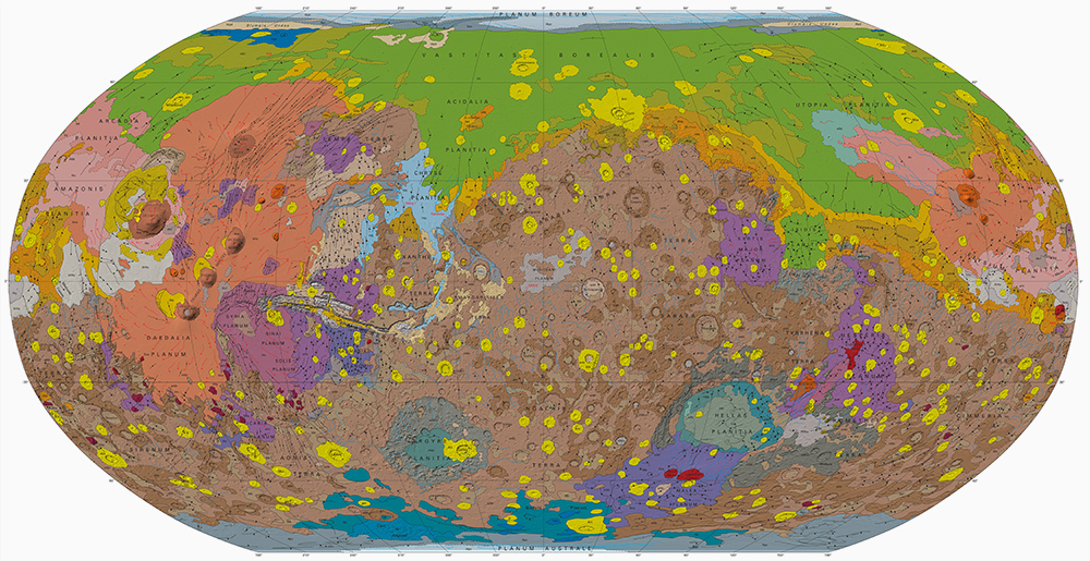
The Astrogeology Team at USGS provides coordination of NASA's planetary geologic mapping program. Geologic mapping investigations of any imaged planetary body (except Earth) are proposed to NASA's…
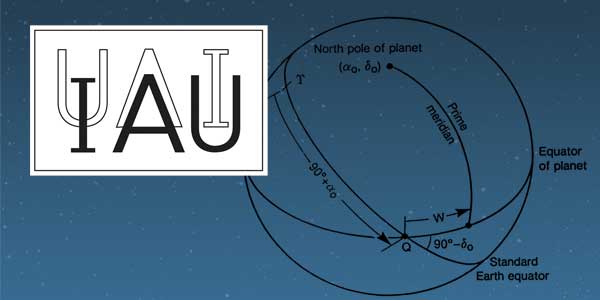
History: The IAU Working Group on Cartographic Coordinates and Rotational Elements of the Planets and Satellites was established as a consequence of a resolution adopted by Commissions 4 and 16 at…
Project Overview The goal of this research project is to advance our understanding of pyroclastic volcanism on the Moon using remote sensing data, primarily the high-spatial-resolution (~100 m/pixel)…
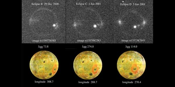
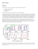
Detailed comparisons of laboratory SO2 spectra with the Cassini observations indicate that a mixture of gases contribute to the equatorial emissions: Potassium (K) is suggested by new detections of…
From NASA Press Release…New data from NASA's Cassini spacecraft reveal topography on Saturn's moon Titan that makes the best case yet for an ice volcano on Titan and reveals the most…
USGS LMMP products will soon be available at the LMMP Portal. These include very large high resolution DTMs and orthomosaics of close to 50 key sites on the lunar surface, and high resolution…