Products

180 Results Collapse
ISPRS 1998 Reanalysis of the Viking Control Point Network: Implications for global Shape and Coordinate Systems of Mars thumbnail

ISPRS 1998 Reanalysis of the Viking Control Point Network: Implications for global Shape and Coordinate Systems of Mars

application/pdf 64 kB

We recomputed the Viking Mars Control Point Network and derived Mars-fixed 3-dimensional coordinates of 3739 selected, globally distributed landmarks. The Mars Pathfinder coordinates and data from…

ISPRS 1998 Mars Pathfinder: Photogrammetric Processing of Lander Images and Cartographic Analysis of the Landing Site from Orbit thumbnail

ISPRS 1998 Mars Pathfinder: Photogrammetric Processing of Lander Images and Cartographic Analysis of the Landing Site from Orbit

application/pdf 66 kB

Following the successful landing of the Mars Pathfinder, DLR has carried out a comprehensive study of the Pathfinder landing site in terms of geology, mineralogy, and surface photometric properties.…

ISPRS 1998 Stereogrammetric Mapping of Mars thumbnail

ISPRS 1998 Stereogrammetric Mapping of Mars

application/pdf 65 kB

The Viking Orbiters acquired quality stereo coverage of a significant fraction of Mars in 1976-1980. Several groups have been using this stereo coverage to produce global and regional scale…

ISPRS 1998 Relationship of the New MOLA Topography of Mars to Existing Maps and Models thumbnail

ISPRS 1998 Relationship of the New MOLA Topography of Mars to Existing Maps and Models

application/pdf 60 kB

A comparison of the MOLA topographic profile data with existing digital topography indicates the presence of both systematic and significant local and regional differences. These differences are in…

ISPRS 1998 Mars Lander Cameras for Pathfinder, Polar Lander, and Beyond thumbnail

ISPRS 1998 Mars Lander Cameras for Pathfinder, Polar Lander, and Beyond

application/pdf 64 kB

The Imager for Mars Pathfinder (IMP) returned 16,000 pictures of the Ares Vallis landing site. These images have been photometrically corrected, mosaicked, and geometrically corrected into maps of…

ISPRS 1998 Use of GIS in Determining Valley Origin on Mars thumbnail

ISPRS 1998 Use of GIS in Determining Valley Origin on Mars

application/pdf 79 kB

The Pathfinder mission made use of a unique capability to rapidly generate and interactively display three-dimensional photo-realistic virtual reality (VR) models of the Martian surface. The Stereo…

ISPRS 1998 Mapping Mars using Virtual Reality: the Pathfinder Experience thumbnail

ISPRS 1998 Mapping Mars using Virtual Reality: the Pathfinder Experience

application/pdf 79 kB

The Pathfinder mission made use of a unique capability to rapidly generate and interactively display three-dimensional photo-realistic virtual reality (VR) models of the Martian surface. The Stereo…

ISPRS 1998 Preliminary Mapping from the Mars Orbiter Laser Altimeter thumbnail

ISPRS 1998 Preliminary Mapping from the Mars Orbiter Laser Altimeter

application/pdf 59 kB

Since arrival at Mars in Sept. 1997 the Mars Orbiter Laser Altimeter (MOLA) on the Mars Global Surveyor (MGS) spacecraft has obtained a number of topographic profiles across the northern hemisphere…

ISPRS 2003 The Messenger Mercury Dual Imaging System (MDIS): Imaging Strategy at Mercury thumbnail

ISPRS 2003 The Messenger Mercury Dual Imaging System (MDIS): Imaging Strategy at Mercury

application/pdf 140 kB

The MESSENGER (MErcury Surface, Space ENvironment, GEochemistry, and Ranging) spacecraft will launch in March of 2004, beginning a 5-year journey to Mercury. Mercury has been visited by only one…

Project Pages

2 Results Collapse

Documents

180 Results Collapse
Meteor Crater Abstract  LPSC 41 thumbnail

Meteor Crater Abstract LPSC 41

application/pdf 68 kB

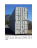
A NEW REPOSITORY FOR DRILL HOLE SAMPLES AND REMOTE SENSING DATA FROM METEOR CRATER, AZ J. J. Hagerty, S. E. Clark, T. M. Hare, R. K. Hayward, H. E. Newsom, S. P. Wright, and J. McHone, U.S.G.S.…