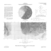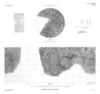

Enceladus Pictorial Map and Controlled Photomosaic
- Mimetype
- application/pdf
- Filename
- Enceladus-Pictorial-Map-and-Controlled-Photomosaic.pdf
- Publisher
- USGS Astrogeology Science Center
- Publication Date
- 31 December 1992
- Originator
- Group
- RPIF
- Added to Astropedia
- 21 March 2016
- Modified
- 5 January 2018
General
- Geospatial Data Presentation Form
- Global Mosaic
- Series Id
- 2156
Keywords
- System
- Saturn
- Target
- Enceladus
- Theme
- Cartography, Image Processing, Remote Sensing
- Mission
- Voyager
- Mission Specific
- Voyager 1, Voyager 2
Contact and Distribution
- Access Instructions
- 4 remote-sensing images on 2 sheets ;27 cm. diam. and 31 x 79 cm., sheets 79 x 87 cm. and 82 x 87 cm., folded in envelope 30 x 24 cm.
Geospatial Information
- Quad Name
- Map Projection Name
- Mercator