Mars 2020 Jezero Crater Landing Site Products
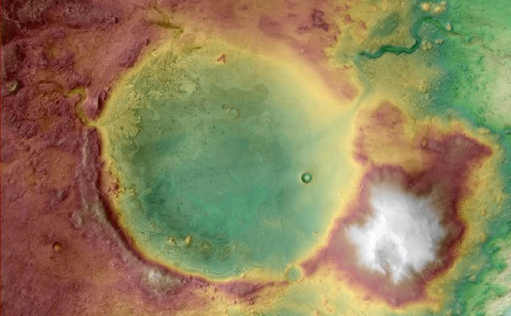
The US Geological Survey (USGS) Astrogeology Science Center has generated Context Camera (CTX) and High-Resolution Imaging Science Experiment (HiRISE) Digital Terrain Models (DTM) and orthoimage mosaics in support of Mars 2020 Terrain Relative Navigation (TRN). The Mars 2020 rover will explore Jezero crater, Mars, and will investigate an ancient delta for evidence of past microbial life and to better understand the geologic history of the region. The TRN landing system onboard Mars 2020 is a new technology developed at the Jet Propulsion Laboratory (JPL) that will enable the spacecraft to autonomously avoid small hazards (e.g., rock fields, crater rims) that exceed the safety tolerance of the landing system. This capability allows small-scale hazards to be present in the landing ellipse, providing greater flexibility in spacecraft landing location.
In support of TRN, the USGS has generated the Lander Vision System (LVS) elevation (DTM) and appearance (orthoimage) maps derived from three CTX stereo image pairs. The LVS appearance map will be onboard the spacecraft and will be the "truth" dataset that TRN will use to orient itself relative to the surface during Entry, Decent, and Landing (EDL). See the "Mars 2020 Terrain Relative Navigation Context Camera Orthorectified Image Mosaic" and "Mars 2020 Terrain Relative Navigation Context Camera DTM Mosaic" links below for these products.
In addition, the USGS has also generated HiRISE DTMs and derived orthoimages comprised of six HiRISE stereo models (although procedurally there were seven models, as one HiRISE stereo pair was split into two models). This HiRISE mosaic is the basemap onto which landing hazards identified by JPL (e.g., rock fields and regions of high slope) were mapped. This hazard map will be onboard the spacecraft and used to determine the safest landing location. These maps will also be the base map used by the Mars 2020 planning and science team for planning purposes and to support scientific investigations. See the "Mars 2020 Terrain Relative Navigation HiRISE Orthorectified Image Mosaic" and "Mars 2020 Terrain Relative Navigation HiRISE DTM Mosaic" links below for these products.
Mars Sample Return Terrain Relative Navigation HiRISE DTM and Orthoimage Mosaics
Digital Elevation Model | Data | Grey Scale | Merge | Raster Data | Regional Mosaic | Remote-sensing Data | Topographic Map 2025-02-28The main download (above) contains the created DTM, Orthoimage, and Confidence mosaics as a zip file. Background: In order to support the landing and operations of NASA Mars 2020 Perseverance rover, the
Mars 2020 Science Investigation CTX DEM Mosaic
Digital Elevation Model | Grey Scale | Landing Site Map | Raster Data | Regional Mosaic | Remote-sensing Data | Topographic Map 2021-10-14This product represents a CTX digital elevation model (DEM/DTM) mosaic at 20 m/pixel from stereo pairs covering Jezero crater. This mosaic includes the original Mars 2020 Jezero CTX TRN DEM but
Mars 2020 Terrain Relative Navigation Context Camera Orthorectified Image Mosaic
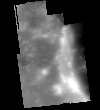
Grey Scale | Image | Landing Site Map | Remote-sensing Data 2020-07-24This is a visible image mosaic generated from the Context Camera (CTX) images from the Mars Reconnaissance Orbiter mission. This product is the Lander Visions System (LVS) map that will be onboard

Mars 2020 Terrain Relative Navigation CTX DTM Mosaic
Digital Elevation Model | Landing Site Map | Remote-sensing Data | Topographic Map 2020-07-24The Mars 2020 rover will explore Jezero crater, Mars to investigate an ancient delta for evidence of past microbial life and to better understand the geologic history of the region. The landing

Mars 2020 Terrain Relative Navigation HiRISE Orthorectified Image Mosaic
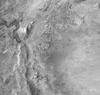
Grey Scale | Landing Site Map | Raster Data | Remote-sensing Data 2020-07-24The Mars 2020 rover will explore Jezero crater, Mars to investigate an ancient delta for evidence of past microbial life and to better understand the geologic history of the region. The landing

Topographic Slopes of Mars 2020 Landing Site Jezero West
Digital Elevation Model | Landing Site Map | Raster Data 2017-03-20This product represents adirectional topographic slopes over 20 meter horizontal baselines within part of a candidate landing site for the Mars2020 mission. The slope map was derived from a CTX-based digital terrain