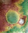
Mars 2020 Science Investigation CTX DEM Mosaic
- Primary Authors
- Fred Calef
- Originators
- Planetary Data System
- Publisher
- USGS Astrogeology Science Center
- Publication Date
- 2021-10-14
- Abstract
-
This product represents a CTX digital elevation model (DEM/DTM) mosaic at 20 m/pixel from stereo pairs covering Jezero crater. This mosaic includes the original Mars 2020 Jezero CTX TRN DEM but extends to include the entire crater with DEMs produced using Ames Stereo Pipeline (Beyer 2020). The added DEMs were localize to the Mars MOLA dataset vertically and some horizontal georeferencing was done in ArcGIS Pro.
Science Investigation orthomosaic (5m/pixel, GeoTiff), matched to the DEM.
Reference: Mangold et al., 2021, Perseverance rover reveals an ancient delta-lake system and flood deposits at Jezero crater, Mars, Science. https://doi.org/10.1126/science.abl4051 Beyer, R. A, O. Alexandrov, S. McMichael, et al. 2020, NeoGeographyToolkit/StereoPipeline 2.7.0, Zenodo, https://doi.org/10.5281/zenodo.3963341. Fergason, R. L., Hare, T. M., Mayer, D. P., Galuszka, D. M., Redding, B. L., Smith, E. D., Shinaman, J. R., Cheng, Y., Otero, R. E., 2020, Mars 2020 Terrain Relative Navigation Flight Product Generation: Digital Terrain Model and Orthorectified Image Mosaics, 51st Lunar and Planetary Science Conference, URL: https://doi.org/10.5066/P906QQT8, or abstract. Malin, M.C. et al., 2007, Context Camera Investigation on board the Mars Reconnaissance Orbiter, J. Geophys. Res. 112, E05S04, doi:10.1029/2006JE002808, URL: https://doi.org/10.1029/2006JE002808 - Purpose
- This dataset was created to generate a contextual reference for science investigations in Jezero crater.
Contact and Distribution
- Format
- Digital Elevation Model, Grey Scale, Landing Site Map, Raster Data, Regional Mosaic, Remote-sensing Data, Topographic Map
- Access Constraints
- please cite authors
- Access Scope
- PDS
- Use Constraints
- public domain
- Supplemental Information
- https://doi.org/10.1126/science.abl4051
- Native Data Set Environment
- ESRI Arcinfo, GDAL
- Astrogeology Theme
- Geographic Information System (GIS), Image Processing, Impact Crater, Photogrammetry, Remote Sensing, Topography
- Mission Names
- Mars 2020, Mars Reconnaissance Orbiter
- Instrument Names
- CTX
- Online Package Link
- https://astrogeology.usgs.gov/search/map/mars_2020_science_investigation_ctx_dem_mosaic
- External File Size
- 87 MB
- Online File Link
- https://planetarymaps.usgs.gov/mosaic/mars2020_trn/CTX/ScienceInvestigationMaps_JPL/M20_JezeroCrater_CTXDEM_20m.tif
- Contact Address
- 2255 N. Gemini Drive
- Contact City
- Flagstaff
- Contact State
- AZ
- Contact Postal Code
- 86001
- Contact Email
- astroweb@usgs.gov
Data Status and Quality
- Time Period of Content (start)
- 2021-10-14
- Currentness Reference
- Publication date
- Progress
- Complete
- Update Frequency
- As needed
- Completeness Report
- This mosaic includes the original CTX TRN DEM but extends to include the entire crater with DEMs produced by Ames Stereo Pipeline.
- Source Title
- Context Camera (CTX)
- Source Online Linkage
- https://pds-imaging.jpl.nasa.gov/portal/mro_mission.html
- Source PDS Archive
- Mars Reconnaissance Orbiter
- PDS Status
- PDS 4 Like
- Horizontal Positional Accuracy Report
- Accurate to Control Net
Geospatial Information
- Target
- Mars
- System
- Mars
- Feature Name
- Jezero crater
- Minimum Latitude
- 19.29
- Maximum Latitude
- 17.58
- Minimum Longitude
- 76.99
- Maximum Longitude
- 78.58
- Direct Spatial Reference Method
- Raster
- Object Type
- Grid Cell
- Raster Row Count (lines)
- 5067
- Raster Column Count (samples)
- 4456
- Bit Type (8, 16, 32)
- 32
- Quad System
- Mars 1:5M
- Quad Name
- MC-13
- Radius A
- 3396160
- Radius C
- 3396160
- Control Net
- MOLA
- Bands
- 1
- Pixel Resolution (meters/pixel)
- 20
- Scale (pixels/degree)
- 2963.7
- Vertical Coordinate System Units
- Meters
- Map Projection Name
- Equirectangular
- Latitude Type
- Planetocentric
- Longitude Direction
- Positive East
- Longitude Domain
- -180 to 180


