Lunar Consortium Data Historical Archive
- Primary Authors
- Philip Davis
- Originators
- USGS Astrogeology Science Center
- Publisher
- USGS Astrogeology Science Center
- Abstract
-
Assorted Lunar Images and Data from 1965 to 1992
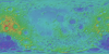
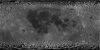
Presented here are safed versions of variety of data selected from a collection of data commonly referred to as the Lunar Consortium Data. This pre-Clementine data set consists of products derived from Apollo, Lunar Orbiter, Galileo, and Zond 8 missions. Select data collected from Earth-based observations are also included as part of this collection.
Introduction
This zip file contains a variety of data selected from a collection of
data commonly referred to as the Lunar Consortium. Compilation of this Lunar Consortium Data was initially directed by Dr. Philip Davis (now retired).
An included Hypertext Markup Language (HTML) file is intended as a user
interface to information and data provided in the archive. Using a web
browser,, open the
'index.htm' file located in the 'root' directory. This
HTML document will direct you to browse
versions of each image data product in the zip file.
Data Formats
All document files, detached label files, and tables are stored as
ASCII stream-record files. In a stream-record file, records (lines
of text) are separated by a carriage-return (CR) and line-feed (LF) character sequence. The CR/LF sequence marks the end-of-record
and the start of a new record. This organization works well for the
Microsoft-based systems because the CR/LF sequence is identically
used on these systems. On UNIX-based systems, the expected end-of-record mark is simply a LF
character. However, UNIX text editors can read and access the text files, but a special-character (usually a ^M sequence)
indicator will mark the "extraneous" CR character at the end of
each line. File names with extension "TAB", "LBL", "LAB", "TXT", and
"CAT" are formatted as ASCII stream-record files. In addition to the
standard ASCII text file format used for documentation files, some
documentation files may additionally exist in other forms to
facilitate easy access to these files. File names with extension
"DOC" are formatted as Microsoft Word Version 6.0 documents. File
names with extension "PDF" are formatted as Adobe Portable Document
Format (PDF) files.
Tabular files are formatted so that they may be read directly into
many database management systems of various computers. All fields
are separated by commas, and character fields are enclosed in
double quotation marks ("). Character fields are left justified,
and numeric fields are right justified. The "start byte" and
"bytes" values listed in the labels that describe the tabular files
do not include the commas between fields or the quotation marks
surrounding character fields. The records are of fixed length, and
the last two bytes of each record contain the ASCII CR/LF
characters. This scheme allows a table to be treated as a fixed-
length record file on computers that support this file type and as
a normal text file on other computers.
PDS (v3) labels are object-oriented. The object to which the label
refers (IMAGE, TABLE, etc.) is denoted by a statement of the form:
^object = location
in which the carat character (^) indicates that the object starts
at the given location. In an embedded label, the Clementine Base Map
image archive uses the form:
^object = n
where "n" points to the starting byte location of the object. (The first byte in a file is designated as byte location 1.) For detached labels (labels existing in their own file) the object location is signified as: ^object = "file.nam" In this form, the object of the label description exists in the file named "file.nam". For a description of the PDS object label specifications, consult JPL document D-7669. Credits & Notes: Lunar Sourcebook tables reprinted with permission from Cambridge University Press.
Contact and Distribution
- Format
- Digital Elevation Model, Raster Data, Remote-sensing Data
- Access Constraints
- please cite authors
- Access Scope
- Astrogeology, PDS
- Use Constraints
- public domain
- Supplemental Information
- https://astrogeology.usgs.gov/maps/moon-lunar-orbiter-digitization
- Native Data Set Environment
- ISIS v2
- Astrogeology Theme
- Geology, History, Image Processing, Remote Sensing, Selenology, Topography
- Mission Names
- Apollo, Galileo, Lunar Orbiter
- Online Package Link
- https://astrogeology.usgs.gov/search/map/lunar_consortium_data_historical_archive
- External File Size
- (275 MB)
- Online File Link
- https://planetarymaps.usgs.gov/mosaic/Lunar_safed/LunarConsortiumData_historical_archive.zip
- Access Instructions
- Download and unzip file for data access. A PDS3 reader will be needed for the images.
- Contact Address
- 2255 N. Gemini Drive
- Contact City
- Flagstaff
- Contact State
- AZ
- Contact Postal Code
- 86001
- Contact Email
- [email protected]
- Currentness Reference
- Publication date
- Progress
- Complete
- Update Frequency
- None planned
- Completeness Report
- This data is safed and there are no plans to updated the release.
- Source Title
- Lunar Consortium Data
- Source PDS Archive
- Apollo
- PDS Status
- PDS 3 Compatible
- Attribute Accuracy Report
- Best Effort
Geospatial Information
- Target
- Moon
- System
- Earth
- Direct Spatial Reference Method
- Raster
- Object Type
- Grid Cell
- Quad Name
- Radius A
- 1737400
- Radius C
- 1737400
- Control Net
- Pre-Clementine
- Horizontal Coordinate System Units
- Degrees
- Vertical Coordinate System Units
- Meters
- Latitude Type
- Planetocentric
- Longitude Direction
- Positive East
- Longitude Domain
- -180 to 180