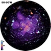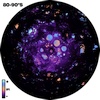
Moon Ice Favorability Index South Pole 591mp
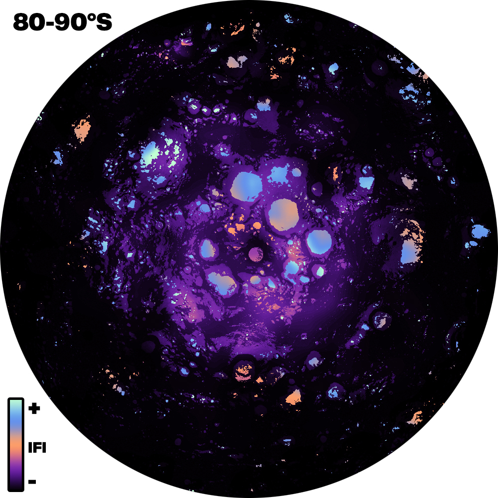
The Ice Favorability Index (IFI) maps below are based on a geologic system model for ice deposition and evolution (Cannon and Britt 2020). The index maps are predictive, not based on surface ice detections, and highlight regions likely to host the most favorable ice deposits for mining. Desired characteristics include older ages, ice stability closer to the surface, and higher areal fraction of cold traps. These maps are agnostic in terms of mining architecture, and some areas may only be accessible with nuclear power for example.
References:
Cannon, K. M., and D. T. Britt (2020), A geologic model for lunar ice deposits at mining scales. Icarus 347, 10.1016/j.icarus.2020.113778.
Siegler et al. (2016), Lunar true polar wander inferred from polar hydrogen Nature, 531 (2016), pp. 480-484.
Rubanenko and Aharonson (2017), Stability of ice on the Moon with rough topography Icarus, 296 (2017), pp. 99-109.
Neukum (1983), Meteoritenbombardement and Datierung Planetarer Oberflächen Habilitation Dissertation for Faculty Membership, Univ. of Munich.
Neukum et al. (2001), Cratering records in the Inner Solar System in relation to the Lunar Reference System R. Kallenbach, J. Geiss, W.K. Hartmann (Eds.), Chronology and Evolution of Mars, Bern, Switzerland.
Robbins (2019), A New Global Database of Lunar Impact Craters >1–2 km: 1. Crater Locations and Sizes, Comparisons With Published Databases, and Global Analysis J. Geophys. Res. Planets, 124 (2019), pp. 871-892.
- Publisher
- Colorado School of Mines
- Publication Date
- 1 September 2020
- Author
- Kevin Cannon
- Originator
- Group
- PDS
- Added to Astropedia
- 12 April 2022
- Modified
- 19 April 2022
General
- Purpose
The Ice Favorability Index (IFI) is a unitless measure meant to predict which locations at the lunar poles may be more or less favorable for hosting deep, substantial deposits of water ice. It is not meant to be a quantitative measure of ice resources or reserves, and should not be used in isolation to select landing sites or mining locations. The intent of the IFI is to guide further site analysis and ground prospecting efforts.
- Geospatial Data Presentation Form
- Raster Data, Model
- Edition
- 1
- Online Linkage
- https://planetarymaps.usgs.gov/mosaic/Lunar_Research/IceFavorabilityIndex/Moon_IceFavorabilityIndex_90S000E_591mp.tif
- Native Data Set Environment
- GDAL, ESRI Arcinfo, ISIS v3
- Supplemental Information
- https://doi.org/10.1016/j.icarus.2020.113778
Keywords
- System
- Earth
- Target
- Moon
- Theme
- Ice, Image Processing
Contact and Distribution
- Access Constraints
- none
- Use Constraints
- please cite Cannon and Britt 2020
Data Status and Quality
- Time Period of Content Begin
- 1 September 2018
- Time Period of Content End
- 1 September 2020
- Currentness Reference
- Publication date
- Progress
- Complete
- Update Frequency
- As needed
- Logical Consistency Report
- The main inputs into the model are the ice stability depth maps from Siegler et al. (2016), the latitude-dependent micro cold trap areal fractions from Rubanenko and Aharonson (2017), the impact flux over time from Neukum (1983) and Neukum et al. (2001), and an estimate for the crater retention age of a location using the Robbins (2019) crater database.
- Process Description
IFI maps were created on a stereographic grid from 80° to the pole, 1000 × 1000 cells in size
- Entity and Attribute Overview
- unitless measure
- Entity and Attribute Linkage
- https://doi.org/10.1016/j.icarus.2020.113778
Lineage
- PDS Status
- PDS 3 Compatible
- Source Originator
- Elsevier
- Source Publication Date
- 1 September 2020
- Source Title
- A geologic model for lunar ice deposits at mining scales
- Source Online Linkage
- https://doi.org/10.1016/j.icarus.2020.113778, https://kevincannon.rocks/lunarmining/#favorability,
- Type of Source Media
- Online
Geospatial Information
- Minimum Latitude
- -90
- Maximum Latitude
- -75.863
- Minimum Longitude
- -180
- Maximum Longitude
- 180
- Direct Spatial Reference Method
- Raster
- Object Type
- Pixel
- Lines (pixels)
- 1000
- Samples (pixels)
- 1000
- Bit Type
- 32
- Quad System
- Moon 1:1M
- Quad Name
- LQ-30
- Radius A
- 1737400
- Radius C
- 1737400
- Bands
- 1
- Pixel Resolution (meters/pixel)
- 590.961
- Scale (pixels/degree)
- 51.312
- Horizontal Coordinate System Units
- Meters
- Map Projection Name
- Polar Stereographic
- Latitude Type
- Planetocentric
- Longitude Direction
- Positive East
- Longitude Domain
- -180 to 180