Moon Apollo Traverse Maps
This page features several maps showing routes the astronauts took during extravehicular activities (EVAs). The imagery and maps were prepared as part of a project by a USGS team under funding from the USGS Technology Transfer Program and NASA's Planetary Geology and Geophysics Program. Dr. Christopher D. Condit (U. Massachusetts) and Mr. Richard Kozak provided scientific and technical assistance.
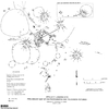
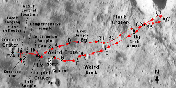
Apollo 11 Photo and Television Map
Traverse MapPhotograph and television pictures map (Baston and Larson 1969)
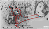
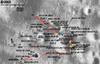
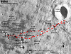

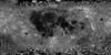
Moon Apollo 17 LROC NAC Landing Site Orthomosaic 50cm
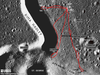
Landing Site Map | Raster Data | Remote-sensing Data | Topographic Map | Traverse Map | Vector Data 2018-05-01Product Information: This is an (ortho-) mosaic map of the Apollo 17 landing site (L15K 20.2/30.7East COMT). The map includes nomenclature, elevation contours, the astronauts' major geology stops, and rover traverses. It