Download
- Original (pdf) 90 kB
ISPRS 1998 Status of the RAND Control Network of Mars
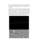
The RAND control network of Mars was begun during the Mariner 9 mission, and it has been expanded and improved since then. The network is based on measurements of points made on images taken by the Mariner 9 and Viking spacecraft. These points, often the centers of craters, are identified on pictures, and their geographic coordinates computed. Many of the early maps published by the U.S.G.S. used our control networks.
- Mimetype
- application/pdf
- Filename
- davies.pdf
- Publisher
- ISPRS
- Originator
- Merton Davies, Tim Colvin
- Group
- Astrogeology
- Added to Astropedia
- 16 May 2012
- Modified
- 9 July 2013
General
- Geospatial Data Presentation Form
- Document
Keywords
Geospatial Information
- Quad Name