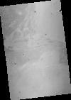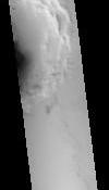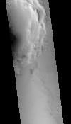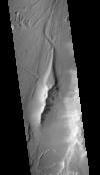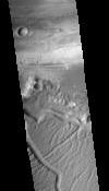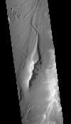
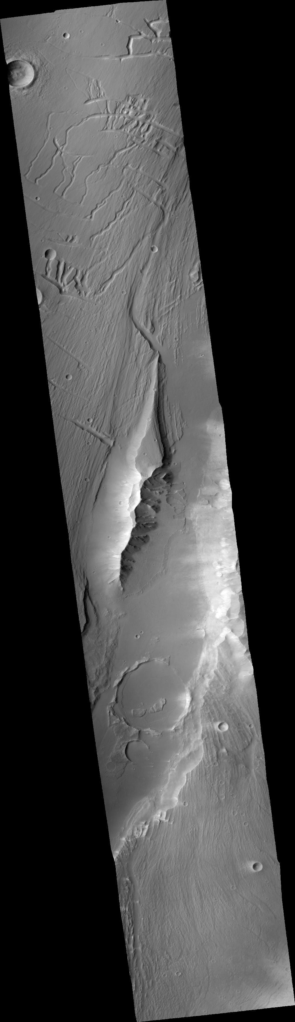
CTX Orthoimage Northwest Kasei Valles Constriction
This orthorectified image was created by projecting an image from the Mars Reconnaissance Orbiter Context Camera (CTX) onto a Digital Terrain Model (DTM). The DTM is available under the “Derived From” section on the right of this page.
- Publication Date
- 9 April 2018
- Author
- Colin M. Dundas
- Originator
- Colin M. Dundas, Glen C. Cushing
- Group
- Added to Astropedia
- 9 April 2018
- Modified
- 22 June 2021
General
- Purpose
This orthoimage was produced to understand the properties of large lava flows on Mars.
- Geospatial Data Presentation Form
- Digital Elevation Model, Raster Data
- Edition
- 1
- Online Linkage
- https://planetarymaps.usgs.gov/mosaic/dundas_flood_lavas_topo/G19_025758_2047_XI_24N072W_6m_o.tif
- Native Data Set Environment
- GDAL, ISIS v3
- Supplemental Information
Keywords
- System
- Target
- Mars
- Theme
- Topography, Photogrammetry, Volcanism
- Mission
- Mars Reconnaissance Orbiter
- Instrument
- CTX
- Search Terms
- DTM, DEM, topography, elevation, lava, volcanism
Contact and Distribution
- Access Constraints
- Public Domain
Data Status and Quality
- Currentness Reference
- Publication date
- Progress
- Complete
- Update Frequency
- None planned
- Process Description
The DTM processing work-flow consists of the following steps: (1) Automatically generate and place tiepoints in the stereoimages and perform a relative adjustment to bring the images into alignment (2) Create a low resolution (typically 100 m/post) DTM from the relatively adjusted stereopair (3) Absolutely control the low resolution DTM to the available reference data (MOLA, or HRSC) using the Ames Stereo Pipeline program pc align (4) Apply the transformation to the ground coordinates previously calculated for the tiepoints, placing them in alignment with the reference (5) Perform a final adjustment with the tiepoints converted to XYZ points at their transformed locations (6) Perform interactive quality control and editing to remove artifacts introduced in the matching step (7) Export the final DTM and orthorectified images
NOTE: Some artifacts may remain even after editing.
- Horizontal Positional Accuracy Value
- 100
- Horizontal Positional Accuracy Report
- Accurate to Control Net
- Vertical Positional Accuracy Value
- 30
- Vertical Positional Accuracy Report
- Accurate to Control Net
Lineage
- Source PDS Archive
- Mars Reconnaissance Orbiter
- Source Originator
- Planetary Data System (PDS) Experimental Data Record (EDR)
- Source Title
- CTX
- Source Online Linkage
- http://pds-imaging.jpl.nasa.gov/volumes/mro.html
- Type of Source Media
- Online
Geospatial Information
- Feature Target
- Mars
- Minimum Latitude
- 22.936701140706
- Maximum Latitude
- 26.008130008889
- Minimum Longitude
- 286.70137312
- Maximum Longitude
- 287.59012258
- Direct Spatial Reference Method
- Raster
- Object Type
- Pixel
- Lines (pixels)
- 30080
- Samples (pixels)
- 8704
- Bit Type
- 8
- Quad Name
- Radius A
- 3396190
- Radius C
- 3376200
- Bands
- 1
- Pixel Resolution (meters/pixel)
- 6.0526292400147
- Scale (pixels/degree)
- 9793.21467957
- Horizontal Coordinate System Units
- Meters
- Map Projection Name
- Equirectangular
- Latitude Type
- Planetocentric
- Longitude Direction
- Positive East
- Longitude Domain
- 0 to 360