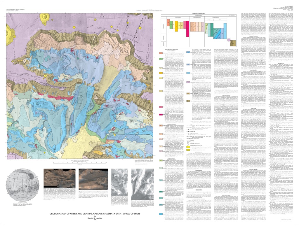
Mars Geologic Map of Ophir and Central Candor Chasmata (MTM -05072)
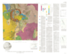
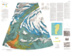
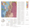
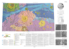
The geologic map of Ophir and central Candor Chasmata is one of a series of 1:500,000 scale maps prepared for areas on Mars that are of particular scientific interest and may serve as potential future landing sites. This map is also part of a set that includes east Candor Chasma, west Candor Chasma, and Melas Chasma. The geologic interpretations are based dominantly on medium- and high-resolution Viking images, many of them stereoscopic, and supplemented by lower resolution apoapsis and other color images. A strip of very high resolution stereoscopic images (~20 m/pixel) crosses the central part of the quadrangle from northwest to southeast and served to clarify detailed relations not obvious on other images. A topographic map with contour intervals of 200 m was also used, as were multidirectional oblique images derived from merged image mosaics and topography (see fig. 1) (Bertolini and McEwen, 1990). Geologic relations and interpretations are based on the entire central Valles Marineris map set. The map area is included in the Valles Marineris map of Witbeck and others (1991), but units were defined independently. Age assignments, however, were integrated with those by Witbeck and others and Scott and Tanaka (1986).
- Mimetype
- application/pdf
- Filename
- Mars-Geologic-Map-of-Ophir-and-Central-Candor-Chasmata-MTM--05072.pdf
- Publisher
- USGS Astrogeology Science Center
- Publication Date
- 7 January 2000
- Originator
- B. Lucchitta
- Group
- RPIF
- Added to Astropedia
- 3 May 2016
- Modified
- 12 September 2018
General
- Geospatial Data Presentation Form
- Geologic Map, Raster Data, Vector Data
- Series Id
- 2568
Keywords
- Target
- Mars
- Theme
- Cartography, Geology, Geomorphology, Photogeology, Stratigraphy, Planetary evolution
- Mission
Contact and Distribution
- Access Instructions
- 1 Map: 125 x 95 cm
Geospatial Information
- Minimum Latitude
- -7
- Maximum Latitude
- 0
- Minimum Longitude
- 285
- Maximum Longitude
- 290
- Quad Name
- Map Projection Name
- Transverse Mercator