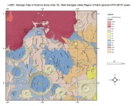
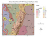
Mars Viking Geologic Map I-2402 of Mangala Valles
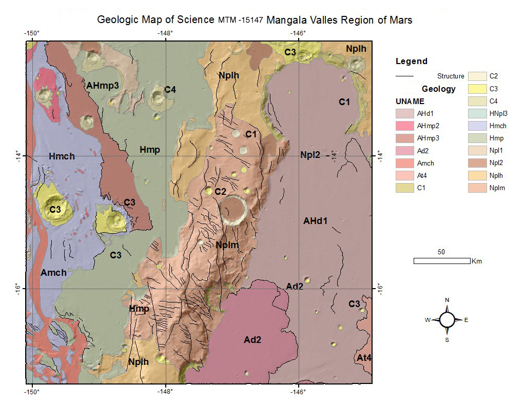
The map area is in the Mangala-Memnonia region which contains remarkably diverse geologic features and terrain types. Studies of the Mariner 9 images revealed the wide range of ages of the major rock units in this region; age assignments were based on the density of impact craters preserved on the various surfaces. The region includes ancient cratered highlands, more sparsely cratered smooth plains, young volcanic plains, and the Mangala Valles channel system. The sinuosity of the streamlined landforms within the Mangala Valles, combined with braided channels evident throughout the lower reaches of the valley system, were recognized as indicators that the Mangala area was subject to substantial erosion by a flowing fluid, most likely water. Recent global mapping based on the Viking Orbiter images (Scott and Tanaka, 1986) has refined the relative ages of many rock units on Mars, but it has modified only slightly the basic interpretations of features in the Mangala-Memnonia region.
- Mimetype
- application/zip
- Filename
- Mars-Viking-Geologic-Map-I-2402-of-Magala-Valles.zip
- Publisher
- USGS Astrogeology Science Center
- Publication Date
- 1 January 1994
- Author
- James R. Zimbleman
- Originator
- Robert A. Craddock, Ronald Greeley
- Group
- MRCTR
- Added to Astropedia
- 16 August 2013
- Modified
- 16 June 2021
General
- Purpose
Mars geologic mapping
- Geospatial Data Presentation Form
- Vector Data
- Series Id
- I-2402
- Edition
- 1
- Online Linkage
- http://astrogeology.usgs.gov/search
- Native Data Set Environment
- ESRI Arcinfo
Keywords
- System
- Mars
- Target
- Mars
- Theme
- Geographic Information System (GIS), Geology
- Mission
- Viking
- Mission Specific
- Instrument
- VISA, VISB
- Search Terms
- Mars, Geology, Mangala Valles
Contact and Distribution
- Access Constraints
- None
- Access Instructions
- You will need GIS software to view included files.
- Use Constraints
- None
Data Status and Quality
- Currentness Reference
- Publication date
- Progress
- Complete
- Update Frequency
- None planned
- Logical Consistency Report
- These data are believed to be logically consistent, though no tests were performed.
- Completeness Report
Maps were completed on Viking-era basemaps.
- Process Date
- 9 August 2000
- Process Description
The map was compiled on a Viking 1:500, 000-scale photomosaic base (U.S. Geologic Survey, 1985). Some map units are partly equivalent to units on smaller scale maps (Scott and Carr, 1978; Mutch and Morris, 1979; Scott and Tanaka, 1986), and the formal terminology proposed by Scott and Tanaka (1986) and Tanaka (1986) was followed were feasible. The mapped relations have implications for the processes of storage and release of volitles that led to the erosion and deposition evident within the Mangala Valles system. The map units are consistent with units on other 1:500, 000-scale.
- Horizontal Positional Accuracy Value
- 5000
- Horizontal Positional Accuracy Report
- Accurate to Control Net
- Entity and Attribute Overview
- Geologic units and structural layers
- Entity and Attribute Detailed Description
- Please see original map sheet for unit description
- Entity and Attribute Linkage
- http://astrogeology.usgs.gov/rpif
Lineage
- Source Originator
- United States Geological Survey
- Source Publication Date
- 1 January 1994
- Source Title
- Geologic Map of the MTM -15147 Quadrangle Mangala Valles Region of Mars
- Source Online Linkage
- http://astrogeology.usgs.gov/search
- Type of Source Media
- Stable-Base Material
- Attribute Accuracy Report
- Best Effort
Geospatial Information
- Feature Name
- Mangala Valles
- Feature Target
- East Mangala Valles
- Location Description
- Mangala Valles Region of Mars
- Minimum Latitude
- -12.5
- Maximum Latitude
- -17.5
- Minimum Longitude
- -150
- Maximum Longitude
- -145
- Direct Spatial Reference Method
- Vector
- Object Type
- Polygon
- Quad Name
- Control Net
- Viking MDIM1.0
- Map Projection Name
- Simple Cylindrical
- Latitude Type
- Planetocentric
- Longitude Direction
- Positive East
- Longitude Domain
- -180 to 180