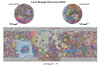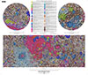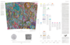
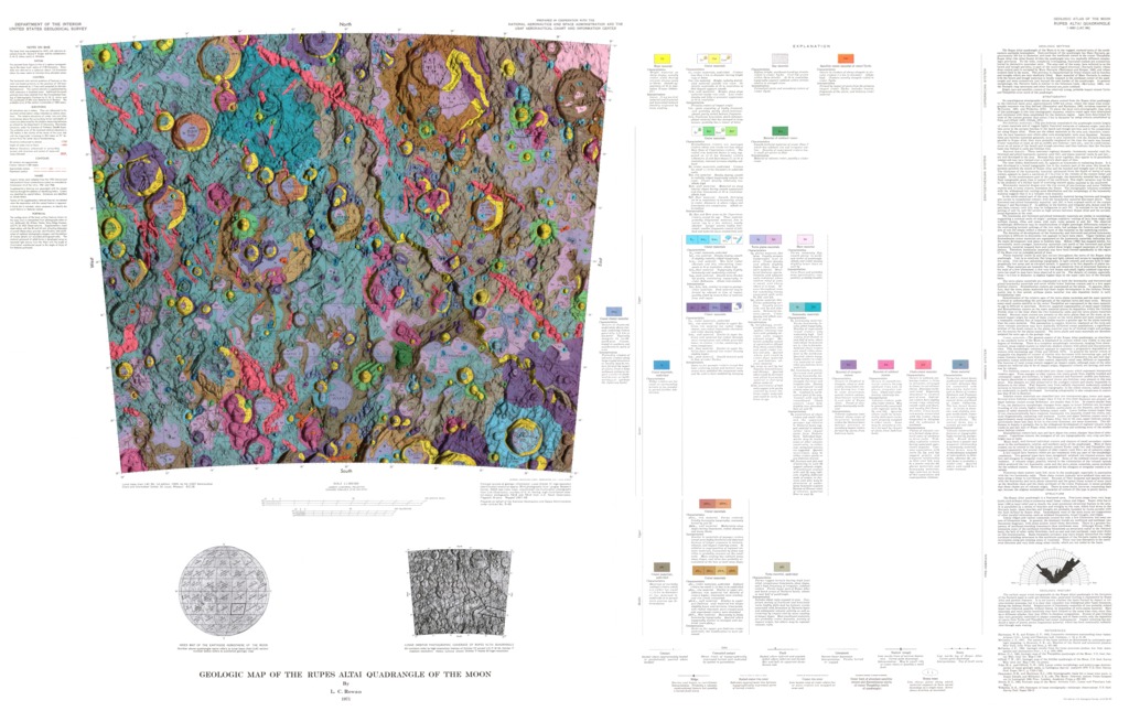
Moon Geologic Map of the Rupes Altai Quadrangle
- Publisher
- USGS Astrogeology Science Center
- Publication Date
- 1971-10-10
Contact and Distribution
- Format
- Geologic Map, Raster Data, Vector Data
- Access Scope
- Series Id
- 690
- Native Data Set Environment
- Astrogeology Theme
- Cartography, Geology, Geomorphology, Photogeology, Planetary evolution, Stratigraphy
- Online Package Link
- https://astrogeology.usgs.gov/search/map/moon_geologic_map_of_the_rupes_altai_quadrangle
- External File Size
- 9511983
- Online File Link
- http://astropedia.astrogeology.usgs.gov/download/Moon/Geology/year-1970/Moon-Geologic-Map-of-the-Rupes-Altai-Quadrangle.pdf
- Access Instructions
- 1 map :col. ;on sheet 81 x 127 cm. fold. in envelope 30 x 24 cm.
- Contact Address
- 2255 N. Gemini Drive
- Contact City
- Flagstaff
- Contact State
- AZ
- Contact Postal Code
- 86001
- Contact Email
- [email protected]
Geospatial Information
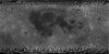
- Target
- Moon
- Well Known Text (WKT)
- POLYGON((10 -16, 30 -16, 30 -32, 10 -32, 10 -16))
- Minimum Latitude
- -32
- Maximum Latitude
- -16
- Minimum Longitude
- 10
- Maximum Longitude
- 30
- Object Type
- Grid Cell
- Quad Name
- LQ-20, LQ-27
- Map Scale (hard-copy)
- 1:1, 000, 000
- Horizontal Coordinate System Units
- Degrees