Moon Apollo Metric Mapping Camera Data
- Primary Authors
- Arizona State University
- Originators
- NASA, Johnson Space Center
- Publisher
- USGS Astrogeology Science Center
- Publication Date
- 2012-09-25
- Abstract
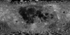
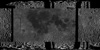
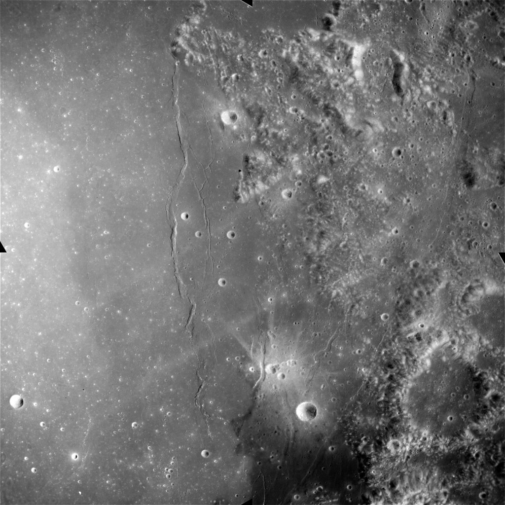
- The Apollo Metric Mapping Cameras were carried on the Apollo 15, 16, and 17 missions to map Earthâs Moon with a high degree of geometric fidelity. This archive collection consists of 7247 usable âMappingâ or Metric Camera frames. These data result from a NASA-funded Apollo Image digitization project managed by Dr. Mark S. Robinson of Arizona State University (ASU). This archive consists of original, raw or unprocessed digital scans (full resolution 16-bit TIFF files, 1.3 Gbytes each) of the original flight films carried to the Moon by the Apollo missions, now in storage in the Film Archive, Building 8 at the NASA Lyndon B. Johnson Space Center (see also http://apollo.sese.asu.edu/). The Metric photographs were acquired with a Leica DSW700 photogrammetric scanner allowing for very high geometric and radiometric fidelity, and were scanned at very high spatial resolutions (up to 200 pixels/mm, pixel size = 5 microns) and an extended bit depth (14-bit A/D, 16384 shades of gray) to ensure that as much of the information content of the film is preserved. This archive includes only the usable frames (as compared to âunusableâ frames, a designation used by NASA with the original Apollo mission data acquisition), although the ASU collection includes both usable and unusable frames. Unusable frames often contain only image artifacts, are very saturated, or include imaging of objects other than the lunar surface. Lower-resolution digital versions and a summary of these frame designations can be found at the Lunar and Planetary Institute (http://www.lpi.usra.edu/resources/apollo/catalog/metric/). In addition to mission, instrument and archive documentation and data, the archive collection includes these usable frame collections for the Apollo Metric âMappingâ Cameras (7247 usable, 2906 unusable, 10153 total): Apollo 15: 2616 usable (760 unusable, 3376 total) Apollo 16: 2491 usable (989 unusable, 3480 total) Apollo 17: 2140 usable (1157 unusable, 3297 total) Metric Camera Description: The Apollo spacecraft system included a vacant area in the Service Module, called the Scientific Instrumentation Module (SIM) Bay, reserved for new instrumentation designed to meet Apollo mission lunar surface mapping goals. Beginning with Apollo 15, CSM SIM Bays contained a variety of instruments designed to characterize the Moon and its environment, including cameras as well as x-ray, alpha-particle, gamma-ray, and mass spectrometers to investigate the properties of the lunar surface. One of the cameras was the Apollo Lunar Metric Mapping Camera, frequently referred to as the Metric camera. During Apollo 15, 16, and 17 missions, over 7000 frames were acquired by the Apollo Lunar Mapping Cameras, resulting in coverage of ~20% of the Moon's surface at resolutions of about 10-20 m/pixel. The Metric camera was produced by the Fairchild Corporation, and collected images of the Moon from lunar orbit through the Apollo 15, 16, and 17 missions. The Metric camera consisted of three systems: 1) The camera, which collected images of the lunar surface imprinted with reseau marks to compensate for film shrinking during processing 2) the stellar camera, which collected simultaneous exposures of the off-axis starfield in order to record the orientation of the spacecraft when each lunar image was obtained, and 3) the laser altimeter, which was used to determine and record the spacecraft's altitude over the lunar surface. Because the Service Module would be ejected prior to the Command Module's reentry into the Earth's atmosphere, the exposed film from the camera systems in the SIM Bay had to be retrieved during the return journey to Earth through an extravehicular activity (EVA). The Command Module Pilots of the last three Apollo missions--Al Worden (Apollo 15), Ken Mattingly (Apollo 16) and Ron Evans (Apollo 17)--performed EVAs in cislunar space to retrieve the exposed film canisters from the SIM Bay. References: Masursky, H., Colton, G. W., & El-Baz, F. (Eds.). (1978). Apollo Over the Moon: A View from Lunar Orbit NASA SP 362. Washington, DC: Scientific and Technical Information Office 1978, National Aeronautics and Space Administration. https://www.hq.nasa.gov/office/pao/History/SP-362/cover.htm Lawrence, S.J., et al. (2008). The Apollo digital image archive: New research and data products. Paper presented at National Lunar Science Conference, NASA Lunar Science Institute, Moffett Field, CA. http://www.lpi.usra.edu/meetings/nlsc2008/pdf/2066.pdf Speyerer, E., et al. (2006). Scanning Apollo Flight Films and Reconstructing CSM Trajectories. Eos Transactions, American Geophysical Union, 87(52), Fall Meeting Supplemental. http://abstractsearch.agu.org/meetings/2006/FM/U41C-0825.html Robinson, M. S., et al. (2008). The Apollo Digital Image Archive. Paper presented at 39th Lunar and Planetary Science Conference, Lunar and Planetary Institute, Houston, TX. http://www.lpi.usra.edu/meetings/lpsc2008/pdf/1515.pdf Edmundson, K. L., et al. (2016). Photogrammetric processing of Apollo 15 Metric Camera oblique images. International Archives of the Photogrammetry, Remote Sensing and Spatial Information Sciences, XLI-B4, 375-381. https://doi.org/10.5194/isprs-archives-XLI-B4-375-2016
- Purpose
- In 2006, Arizona State University and the NASA Johnson Space Center began an ambitious project to scan the original flight films carried to the Moon by the Apollo astronauts on their mission, including the Metric camera photographs, for posterity.
Contact and Distribution
- Format
- Grey Scale
- Access Constraints
- Please credit Dr. Mark Robinson and noted authors
- Access Scope
- PDS
- Use Constraints
- none
- Series Id
- AxxC-L-MC-2-SCANNED-IMAGES-V1.0
- Edition
- September 2012
- Edition Name
- Archive Date
- Supplemental Information
- http://apollo.sese.asu.edu/, http://apollo.sese.asu.edu/METRIC_PREVIEW/index.html
- Native Data Set Environment
- GDAL, ISIS v3
- Astrogeology Theme
- Astronaut Training, Exploration, Geomorphology, Image Processing, Remote Sensing, Selenology
- Mission Names
- Apollo
- Instrument Names
- MET
- Online Package Link
- https://astrogeology.usgs.gov/search/map/moon_apollo_metric_mapping_camera_data
- External File Size
- archive
- Online File Link
- https://pdsimage.wr.usgs.gov/Missions/Apollo/Metric_Camera/
- Contact Address
- 2255 N. Gemini Drive
- Contact City
- Flagstaff
- Contact State
- AZ
- Contact Postal Code
- 86001
- Contact Email
- [email protected]
- Currentness Reference
- Publication date
- Progress
- Complete
- Update Frequency
- None planned
- Logical Consistency
- see processing description
- Completeness Report
- This collection consists of 7247 usable Metric Camera frames.
- Process Description
- These raw digital scans of the Apollo flight films were processed using a standard set of procedures. First, unexposed portions of the film along the edges of a scanned frame were cropped, and the frame was straightened. Second, the background was removed from all scans by assuming that the average DN values of the unexposed regions at the edge of each raw scanned image represent the background (i.e., film base and fog). Third, a flatfield correction (derived from the actual image data) removed vignetting to the first order. Fourth, the reseau patterns (the small white crosses visible on published Apollo images) were removed from the images. Fifth, a logarithmic histogram transformation was applied to the image to produce a virtual print that simulated the natural contrast of a conventional paper print. Sixth, since the uncompressed images produced by the initial scanning process result in extremely large images, the scale is reduced by a factor corresponding to the square root of 2 (which serves to reduce the image size by 50% to 1.2 Gbytes for the 16-bit file).
Lineage
- Process Date
- 2006-09-01
- Source Title
- Apollo Metric Camera Data Set
- Source Online Linkage
- {http://wms.lroc.asu.edu/apollo/browse,https://www.nasa.gov/mission_pages/apollo/missions/index.html,http://pdsimage.wr.usgs.gov/archive/a15c-l-mc-2-scanned-images-v1.0/,http://pdsimage.wr.usgs.gov/archive/a16c-l-mc-2-scanned-images-v1.0/,http://pdsimage.wr.usgs.gov/archive/a17c-l-mc-2-scanned-images-v1.0/}
- Source PDS Archive
- Apollo
- PDS Status
- PDS 3 Archived
- Attribute Accuracy Report
- Best Effort
Geospatial Information
- Target
- Moon
- System
- Earth
- Minimum Latitude
- -90
- Maximum Latitude
- 180
- Minimum Longitude
- -180
- Maximum Longitude
- 90
- Direct Spatial Reference Method
- Raster
- Object Type
- Grid Cell
- Bit Type (8, 16, 32)
- 16
- Quad Name
- Radius A
- 1737400
- Radius C
- 1737400
- Bands
- 1
- Map Scale (hard-copy)
- 200 pixels/mm
- Horizontal Coordinate System Units
- Degrees
- Longitude Direction
- Positive East
- Longitude Domain
- -180 to 180