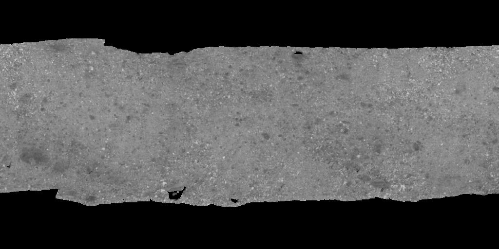
Bennu OSIRIS-REx OCAMS Global ALBEDO Mosaic 6.25cm
- Primary Authors
- Lunar and Planetary Laboratory, University of Arizona
- Originators
- Golish, D. R., Shultz, N. K., Becker, T. L., Becker, K. J., Edmundson, K. L., DellaGiustina, D. N., et al.
- Publisher
- USGS Astrogeology Science Center
- Publication Date
- 2021-06-26
- Abstract
-
In 2019, NASA's OSIRIS-REx (Origins, Spectral Interpretation, Resource Identification, and Security and Regolith Explorer) mission globally surveyed asteroid (101955) Bennu with a collection of instruments, including the OSIRIS-REx Camera Suite (OCAMS) PolyCam imager. Using PolyCam panchromatic images acquired at low phase angles (~8°), we constructed a near-global albedo map of Bennu with a ground sample distance of 6.25 cm/pixel (Golish et al. 2021a). The images were photometrically normalized using the published ROLO phase function and Lommel-Seeliger disk function for Bennu (Golish et al., 2021b) and orthorectified using the v20 global shape model (Barnouin, et al. (2020); Daly et al. (2020), produced by the OSIRIS-Rex Laser Altimeter (OLA; Daly et al. (2017)), with a ground sample distance of 88 cm. Mapping and global control methods were adapted from Bennett et al. (2021) and Edmundson et al. (2020).
Highlights:
- We produced a near-global albedo map of asteroid Bennu at a ground sample distance of 6.25 cm, covering ±55° latitude.
- Images were rectified to a 3D digital terrain model with a mean facet size of 88 cm.
- Images were photometrically normalized to 0° phase angle using a ROLO phase function.
- Bennu_global_ShapeV20_GndControl_ROLOphase_ALBEDO_v6 - Albedo mosaic in 32bit floating point.
- Purpose
- construction a near-global albedo map of Bennu with a ground sample distance of 6.25 cm/pixel (Golish et al. 2021a)
Contact and Distribution
- Format
- Global Mosaic
- Access Constraints
- please cite authors
- Access Scope
- PDS
- Use Constraints
- public domain
- Series Id
- 6
- Supplemental Information
- https://doi.org/10.1016/j.icarus.2020.114133, https://sbn.psi.edu/pds/resource/orex/ocams.html, https://www.asteroidmission.org/
- Native Data Set Environment
- GDAL, ISIS v3
- Astrogeology Theme
- Asteroids, Cartography, Image Processing, Photogrammetry, Remote Sensing, Sampling and analysis
- Mission Names
- OSIRIS-REx
- Instrument Names
- OCAMS
- Online Package Link
- https://astrogeology.usgs.gov/search/map/bennu_osiris_rex_ocams_global_albedo_mosaic_6_25cm
- External File Size
- 300 MB
- Online File Link
- https://planetarymaps.usgs.gov/mosaic/Bennu/Bennu_global_ShapeV20_GndControl_ROLOphase_ALBEDO_8bit_v6.tif
- Contact Address
- 2255 N. Gemini Drive
- Contact City
- Flagstaff
- Contact State
- AZ
- Contact Postal Code
- 86001
- Contact Email
- astroweb@usgs.gov
Data Status and Quality
- Time Period of Content (start)
- 2019-03-07
- Time Period of Content (stop)
- 2019-03-07
- Currentness Reference
- Ground condition
- Progress
- Complete
- Update Frequency
- As needed
- Completeness Report
- See: Golish, D. R., Shultz, N. K., Becker, T. L., Becker, K. J., Edmundson, K. L., DellaGiustina, D. N., et al. (2021). A high-resolution normal albedo map of asteroid (101955) Bennu. Icarus, 355, 114133. https://doi.org/10.1016/j.icarus.2020.114133
- Process Description
- The mapping used to convert to 8bit was a linear stretch from 0.002 - 0.007 to 1 - 254, maintaining 0 as NoDATA. See: Golish, D. R., Shultz, N. K., Becker, T. L., Becker, K. J., Edmundson, K. L., DellaGiustina, D. N., et al. (2021). A high-resolution normal albedo map of asteroid (101955) Bennu. Icarus, 355, 114133. https://doi.org/10.1016/j.icarus.2020.114133
- Source Title
- OSIRIS-REx PDS archive
- Source Online Linkage
- https://sbn.psi.edu/pds/resource/orex/
- PDS Status
- PDS 3 Compatible
- Attribute Accuracy Report
- Best Effort
- Horizontal Positional Accuracy Report
- Accurate to Control Net
Geospatial Information
- Target
- Bennu
- System
- Small Bodies
- Minimum Latitude
- -90
- Maximum Latitude
- 90
- Minimum Longitude
- 0
- Maximum Longitude
- 360
- Direct Spatial Reference Method
- Raster
- Object Type
- Grid Cell
- Raster Row Count (lines)
- 12568
- Raster Column Count (samples)
- 25134
- Bit Type (8, 16, 32)
- 8
- Quad Name
- Radius A
- 250
- Radius C
- 250
- Control Net
- OLA v20
- Bands
- 1
- Pixel Resolution (meters/pixel)
- 0.0625
- Scale (pixels/degree)
- 69.81388
- Map Projection Name
- Equirectangular
- Latitude Type
- Planetocentric
- Longitude Direction
- Positive East
- Longitude Domain
- 0 to 360


