Bennu OSIRIS-REx OCAMS Photometric Mosaics 25cm
- Primary Authors
- D.N. DellaGiustina, D.R. Golish, K.J. Becker, T.L. Becker, K.L. Edmundson, C.A. Bennett, K.N. Burke, J.I. Brodbeck, N.A. Porter, N.K. Shultz, B. Rizk, C.Y. Drouet d'Aubigny
- Originators
- Lunar and Planetary Laboratory, University of Arizona
- Publisher
- USGS Astrogeology Science Center
- Publication Date
- 2025-08-04
- Abstract
-
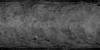
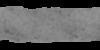
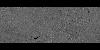
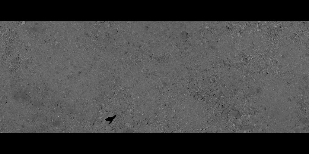
In 2019, NASA's OSIRIS-REx (Origins, Spectral Interpretation, Resource Identification, and Security Regolith Explorer) mission surveyed asteroid (101955) Bennu with a collection of instruments, including the OSIRIS-REx Camera Suite (OCAMS) MapCam imager. Using MapCam images taken with four narrowband color filters, we constructed four globally controlled basemaps of Bennu at an approximate ground sample distance of 25cm (25cm/pixel). The center wavelengths of the four filters are 473nm (b), 550nm (v), 698nm (w), and 847nm (x). The basemap was photometrically normalized to represent normal albedo, using the ROLO model described in Golish et al. (2021). We removed shadows using a mask created that omitted all pixels with values less than 0.027 in the v band normal reflectance map. For more see DellaGiustina et al. (2020).
Highlights:
- We produced a four global basemaps of asteroid Bennu at a ground sample distance of 25 cm with center wavelengths of 473, 550, 698, and 847 nm.
- New methods were developed to deal with Bennu's rough surface and irregular shape.
- Images were rectified to a 3D digital terrain model with a mean facet size of 80 cm.
- Images were photometrically normalized to 0° phase angle using a ROLO model.
- This archive also includes a false Red-Green-Blue color model (RGB) composite overlaid on a 0.55-μm (v band) normal reflectance map of Bennu. Color channels are: red, x/v (0.85/0.55 μm, mid-VIS to NIR spectral slope); green, w-band strength (depth at 0.70 μm, composition, fig. S5); and blue, b′/v (0.47/0.55 μm, near-UV slope).
- Bennu_OSIRIS-REx_OCAMS_Photometric_Mosaics_25cm.zip - 4 mosaics in 32bit floating point I/F (reflectance). In GeoTIFF format with ISIS3 labels.
- Bennu_OSIRIS-REx_OCAMS_Photometric_Mosaics_25cm_pngs.zip - 4 mosaics in 8bit browse PNG.
- Purpose
- Reflectance (I/F) basemaps were created to clearly show separated wavelengths to support visualizing geologic features including craters, ridges, and boulders.
Contact and Distribution
- Format
- Global Mosaic, Grey Scale, Image, Raster Data, Remote-sensing Data
- Access Constraints
- None
- Access Scope
- Astrogeology, Astropedia
- Use Constraints
- Please cite authors
- Edition
- 1
- Edition Name
- version
- Supplemental Information
- https://figshare.com/articles/journal_contribution/Maps_DellaGiustina_et_al_Science_2020_abc3660/12996494, https://astrogeology.usgs.gov/search/map/bennu_osiris_rex_ocams_global_pan_mosaic_5cm
- Native Data Set Environment
- GDAL, ISIS v3
- Astrogeology Theme
- Asteroids, Cartography, Exploration, Geology, Geomorphology, Image Processing, Remote Sensing
- Mission Names
- OSIRIS-REx
- Instrument Names
- OCAMS
- Digital Product?
- yes
- Online Package Link
- https://astrogeology.usgs.gov/search/map/bennu-osiris-rex-ocams-photometric-mosaics-25cm
- External File Size
- 7 MB
Data Status and Quality
- Time Period of Content (start)
- 2019-03-21
- Time Period of Content (stop)
- 2019-04-11
- Currentness Reference
- Ground condition
- Progress
- Complete
- Update Frequency
- None planned
- Completeness Report
- Most images that contribute to the global panchromatic basemap were acquired during Flybys 3, 4A, and 4B.
- Process Description
- please see: https://doi.org/10.1016/j.icarus.2020.113724
Lineage
- Process Date
- 2025-08-04
- Source Name or Organization
- Planetary Data System
- Source Title
- OSIRIS-REx PDS archive
- Source Online Linkage
- https://sbn.psi.edu/pds/resource/orex/
- PDS Status
- PDS 3 Archived
- Type of Source Media
- Online
- Horizontal Positional Accuracy Report
- Accurate to Control Net
- Vertical Positional Accuracy Report
- Best Effort
Geospatial Information
- Target
- Bennu
- System
- Small Bodies
- Minimum Latitude
- -90
- Maximum Latitude
- 90
- Minimum Longitude
- 0
- Maximum Longitude
- 360
- Direct Spatial Reference Method
- Raster
- Object Type
- Pixel
- Raster Row Count (lines)
- 3142
- Raster Column Count (samples)
- 6284
- Bit Type (8, 16, 32)
- 32
- Radius A
- 250
- Radius C
- 250
- Control Net
- ShapeV28
- Bands
- 1
- Pixel Resolution (meters/pixel)
- 0.25
- Scale (pixels/degree)
- 17.45
- Horizontal Coordinate System Units
- Meters
- Map Projection Name
- Equirectangular
- Latitude Type
- Planetocentric
- Longitude Direction
- Positive East
- Longitude Domain
- 0 to 360