Moon Color-Coded Topography and Shaded Relief Maps of the Lunar Hemispheres
- Publisher
- USGS Astrogeology Science Center
- Publication Date
- 2002-01-02
- Abstract
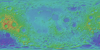
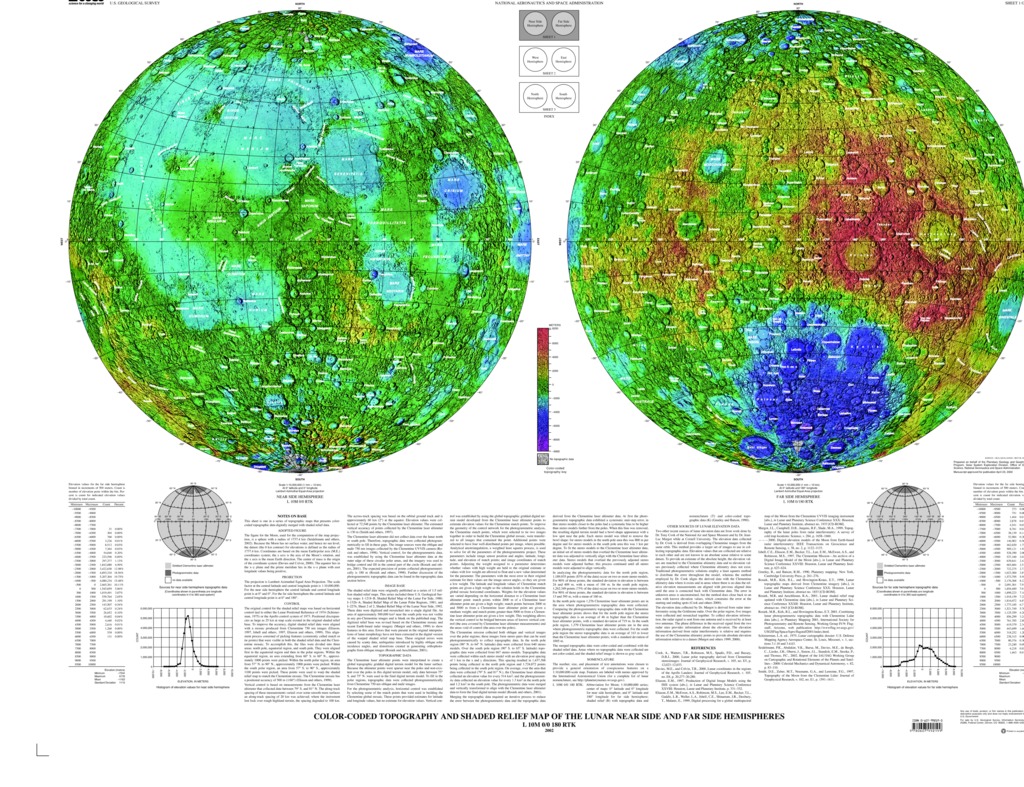
- This publication is a set of three sheets of topographic maps that presents color-coded topographic data digitally merged with shaded relief data. Adopted figure: The figure for the Moon, used for the computation of the map projection, is a sphere with a radius of 1737.4 km. Because the Moon has no surface water, and hence no sea level, the datum (the 0 km contour) for elevations is defined as the radius of 1737.4 km. Coordinates are based on the mean Earth/polar axis (M.E.) coordinates system, the z axis is the axis of the Moon's rotation, and the x axis is the mean Earth direction. The center of mass is the origin of the coordinate system. The equator lies in the x-y plane and the prime meridian lies in the x-z plane with east longitude values being positive. Projection: The projection is Lambert Azimuthal Equal Area Projection. The scale factor at the central latitude and central longitude point is 1:10,000,000. For the near side hemisphere the central latitude and central longitude point is at 0ð and 0ð. For the far side hemisphere the central latitude and central longitude point is at 0ð and 180ð.
Contact and Distribution
- Format
- Shaded-Relief Map
- Access Scope
- Series Id
- 2769
- Native Data Set Environment
- Astrogeology Theme
- Cartography, Remote Sensing, Topography
- Online Package Link
- https://astrogeology.usgs.gov/search/map/moon_color_coded_topography_and_shaded_relief_maps_of_the_lunar_hemispheres
- External File Size
- 45830748
- Online File Link
- http://astropedia.astrogeology.usgs.gov/download/Moon/Topography/Moon-Color-Coded-Topography-and-Shaded-Relief-Maps-of-the-Lunar-Hemispheres.pdf
- Access Instructions
- 3 Maps: 109 x 84 cm
- Contact Address
- 2255 N. Gemini Drive
- Contact City
- Flagstaff
- Contact State
- AZ
- Contact Postal Code
- 86001
- Contact Email
- [email protected]
Geospatial Information
- Target
- Moon
- Object Type
- Grid Cell
- Quad Name
- Map Scale (hard-copy)
- 1:10000000
- Horizontal Coordinate System Units
- Degrees