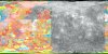
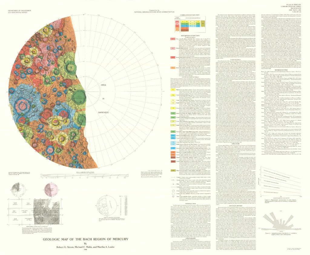
Mercury Geologic Map of the Bach Region
- Originators
- R. Strom, M. Malin, M. Leake
- Publisher
- USGS Astrogeology Science Center
- Publication Date
- 1990-12-29
Contact and Distribution
- Format
- Geologic Map, Raster Data, Vector Data
- Access Scope
- RPIF
- Series Id
- 2015
- Native Data Set Environment
- Astrogeology Theme
- Cartography, Geology, Geomorphology, Photogeology, Planetary evolution, Stratigraphy
- Online Package Link
- https://astrogeology.usgs.gov/search/map/mercury_geologic_map_of_the_bach_region
- External File Size
- 7486964
- Online File Link
- http://astropedia.astrogeology.usgs.gov/download/Mercury/Geology/Mercury-Geologic-Map-of-the-Bach-Region.pdf
- Access Instructions
- 1 remote sensing image :col. ;46 cm. diam., on sheet 76 x 92 cm., folded in envelope 30 x 24 cm.
- Contact Address
- 2255 N. Gemini Drive
- Contact City
- Flagstaff
- Contact State
- AZ
- Contact Postal Code
- 86001
- Contact Email
- [email protected]
Geospatial Information
- Target
- Mercury
- Well Known Text (WKT)
- POLYGON((0 -65, 360 -65, 360 -90, 0 -90, 0 -65))
- Minimum Latitude
- -90
- Maximum Latitude
- -65
- Minimum Longitude
- 0
- Maximum Longitude
- 360
- Object Type
- Grid Cell
- Quad Name
- H-15
- Map Scale (hard-copy)
- 1:5000000
- Horizontal Coordinate System Units
- Degrees