Mars Year 24-28 MOC WA Red and Blue 2023
- Primary Authors
- Stuart Robbins
- Originators
- Southwest Research Institute (SwRI)
- Publisher
- USGS Astrogeology Science Center
- Abstract
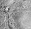
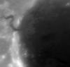
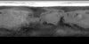
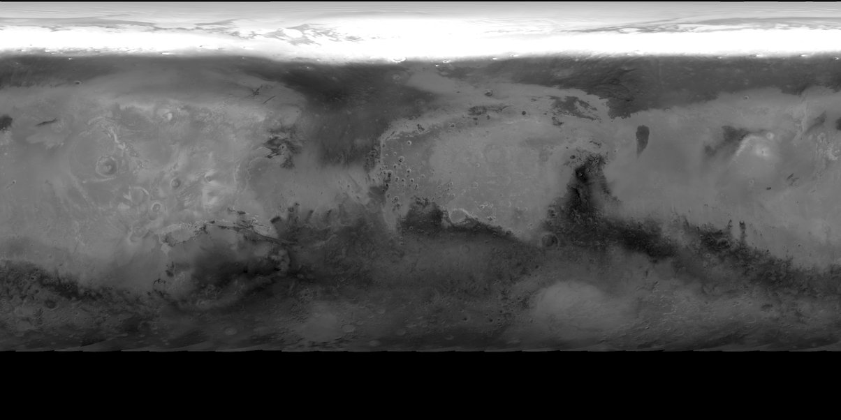
- NASA's Mars Global Surveyor spacecraft contained the Mars Orbiter Camera, which had a wide-angle (MOC-WA) system sensitive to narrow, 50 nm-wide ranges of purple ('blue') and orange ('red') light. In various combinations of operating modes, the MOC-WA could return limb-to-limb images of Mars, and these were used to produce the first modern mosaics from orbit and to monitor weather. This product is a reprocessing using more recent software and techniques of MOC-WA red and blue limb-to-limb images with a best-effort attempt to photometrically control the images using a Hapke-Henyey-Greenstein photometric model. The processed dataset consists of 53,346 images which were processed using the United States Geological Survey's Integrated Software for Imagers and Spectrometers (ISIS), driven by local Python scripts. Every MOC-WA image was manually screened for artifacts and those images with uncorrectable artifacts were removed. DOI: 10.17189/kxff-cs44 PDS logical_identifier: urn:nasa:pds:mars_mgs_moc-wa_photometric-controls_robbins_2023 Image shown: MY28_RED_Ls02_034_eq_75.tif Access instructions: currently this archive is available from an Amazon S3 bucket. Please the next examples for listing or downloading this archive using Amazon aws command-line routines (or as listed individually from this long index.html listing). Listing the archive: aws s3 ls --no-sign-request --recursive s3://asc-pds-individual-investigations/mars_mgs_moc-wa_photometric-controls_robbins_2023/ to copy the whole archive (to test, add --dryrun to command-line): aws s3 sync --no-sign-request s3://asc-pds-individual-investigations/mars_mgs_moc-wa_photometric-controls_robbins_2023/ /my/local/path/. References: Robbins, S., 2023, Red and Blue Color Changes of Mars from Mars Orbiter Camera Images (1999â2006), Earth & Space Science, accepted. Robbins, S, 2022, Mars Global Surveyor's Mars Orbiter Camera (MOC) Wide-Angle Images (1999â2006): 2. Data Investigation into North Polar Hood Formation, Broad Brightness Changes in Acidalia, and Seasonal Frost in Hellas, JGR Planets, DOI: 10.1029/2022JE007621, URL: https://doi.org/10.1029/2022JE007621. Robbins, S., 2020, Mars's Red (575-625 nm) Seasonal Approximate Reflectivity Averaged Over Mars Years 24-28 From Mars Orbiter Camera, Journal of Geophysical Research: Planets, Volume 125, Issue 7, DOI: 10.1029/2019JE006231, URL: https://doi.org/10.1029/2019JE006231.
Contact and Distribution
- Format
- Image, Raster Data, Remote-sensing Data
- Access Constraints
- please cite authors
- Access Scope
- PDS
- Use Constraints
- public domain
- Native Data Set Environment
- ESRI Arcinfo
- Astrogeology Theme
- Image Processing, Remote Sensing
- Mission Names
- Mars Global Surveyor
- Instrument Names
- MOC
- Online Package Link
- https://astrogeology.usgs.gov/search/map/mars_year_24_28_moc_wa_red_and_blue_2023
- External File Size
- (Archive 367 GB)
- Online File Link
- https://asc-pds-individual-investigations.s3.us-west-2.amazonaws.com/mars_mgs_moc-wa_photometric-controls_robbins_2023/index.html
- Access Instructions
- See abstract for AWS instructions.
- Contact Address
- 2255 N. Gemini Drive
- Contact City
- Flagstaff
- Contact State
- AZ
- Contact Postal Code
- 86001
- Contact Email
- [email protected]
- Currentness Reference
- Ground condition
- Progress
- Complete
- Update Frequency
- As needed
- Process Description
- The processing used standard ISIS processing steps: MOC2ISIS (import PDS data into ISIS), SPICEINIT (attach SPICE data), MOCCAL (calibration recommended by the MOC team), and PHOTOMET (photometric modeling). After that step, empirical flats were created on a per-color, per-Earth-month basis to attempt to remove residual photometric effects that were not taken care of with the photometric modeling of PHOTOMET. Data were then projected into an equirectangular projection (CAM2MAP). From that projection, they were also projected into north and south polar stereographic systems, cropped at the equator. After processing, data were clipped for incidence angles <75 degrees and <90 degrees. The <75 degrees clip provides approximate even illumination over the entire extent of the mosaic due to the photometric corrections applied. The <90 degrees clip does not provide even illumination, but it can be used to see into the twilight for investigations of polar processes during their winters. After the above processing, data for daily intervals and intervals of 2 degrees Ls (solar longitude), 5 degrees, and 10 degrees were averaged together to produce the multiple sets of mosaics in this archive. This was done for both red and blue cameras. The method of averaging was a weighted arithmetic average of map-projected images that belonged to each mosaic. Weights were based on phase, incidence, and emission angles. The weights for each angle were multiplied into the total weight that began as 1.0 across an image. The emission angle weight was a sigmoid function, (1.0111-1.023/(1+exp(-(emission-45)/10))). The effect is to minimize pixels with emission angles larger than 45 degrees. Incidence angle weight was a piece-wise sigmoid meant to decrease emphasis on near-noon pixels, gradually increase emphasis to pixels with an incidence of 60 degrees, and then rapidly decrease emphasis on pixels with more twilight sun angles. For pixels with incidence angles <60 degrees, the function was (0.5+(0.5/(1+exp(-(incidence-25)/6)))); for pixels with incidence angles >60 degrees, the function was (1.0+(-1.0/(1.0+exp(-(incidence-75)/2)))). Phase angle weights were also a piece-wise sigmoid meant to de-emphasize the opposition surge in case it was poorly modeled, and similarly decrease high-phase pixels that might be poorly corrected from the photometry: For phase <35 degrees, (0+1.0/(1.0+exp(-(phase-10)/2))); for phase >35 degrees, (1.0-1.0/(1.0+exp(-(phase-80)/6))). The final data were scaled by 2^17 from their actual reflectivity values, so they can be scaled by that inverse to retrieve the original values. (Images within the ISIS system are kept at 32-bit floating-point values, and reflectivity values range 0 to 1. The final archive is 16-bit integer values. Almost values >0.5 were found on the data, so with an actual range of ~0.0-0.5, the images were scaled by 2^17 and then rounded to the nearest integer in order to preserve as much dynamic range as possible.) Further, the red and blue colors were combined to create a synthetic green channel, and all of the above-noted mosaics were combined to produce three-color RGB composites.
- Source Title
- MGS MOC Image Collection
- Source Online Linkage
- https://pds-imaging.jpl.nasa.gov/portal/mgs_mission.html
- Source PDS Archive
- Mars Global Surveyor
Geospatial Information
- Target
- Mars
- System
- Mars
- Direct Spatial Reference Method
- Raster
- Object Type
- Grid Cell
- Bit Type (8, 16, 32)
- 16
- Quad Name
- Radius A
- 3396190
- Radius C
- 3396190
- Control Net
- MOLA
- Horizontal Coordinate System Units
- Degrees
- Latitude Type
- Planetocentric
- Longitude Direction
- Positive East
- Longitude Domain
- -180 to 180