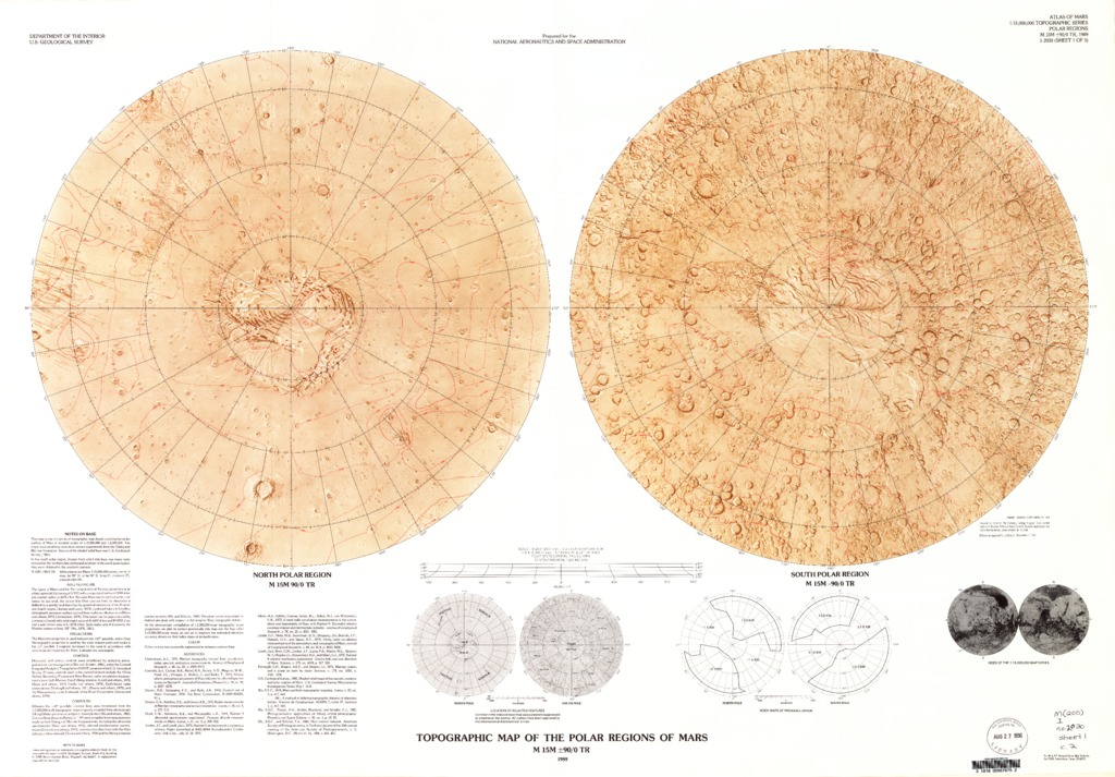
Mars Topographic Maps of the Western, Eastern Equatorial and Polar Regions
- Publisher
- USGS Astrogeology Science Center
- Publication Date
- 1989-11-28
Contact and Distribution
- Format
- Regional Mosaic
- Access Scope
- RPIF
- Series Id
- 2030
- Native Data Set Environment
- Astrogeology Theme
- Cartography, Remote Sensing, Topography
- Online Package Link
- https://astrogeology.usgs.gov/search/map/mars_topographic_maps_of_the_western_eastern_equatorial_and_polar_regions
- External File Size
- 13544365
- Online File Link
- http://astropedia.astrogeology.usgs.gov/download/Mars/Topography/year-1980/Mars-Topographic-Maps-of-the-Western-Eastern-Equatorial-and-Polar-Regions.pdf
- Access Instructions
- 4 remote sensing images on 3 sheets :col. ;47 cm. diam. and 55 x 71 cm., sheets 71 x 102 and 87 x 79 cm., folded in envelope 30 x 24 cm.
- Contact Address
- 2255 N. Gemini Drive
- Contact City
- Flagstaff
- Contact State
- AZ
- Contact Postal Code
- 86001
- Contact Email
- [email protected]
Geospatial Information
- Target
- Mars
- Object Type
- Grid Cell
- Quad Name
- Map Scale (hard-copy)
- 1:15000000
- Horizontal Coordinate System Units
- Degrees