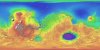
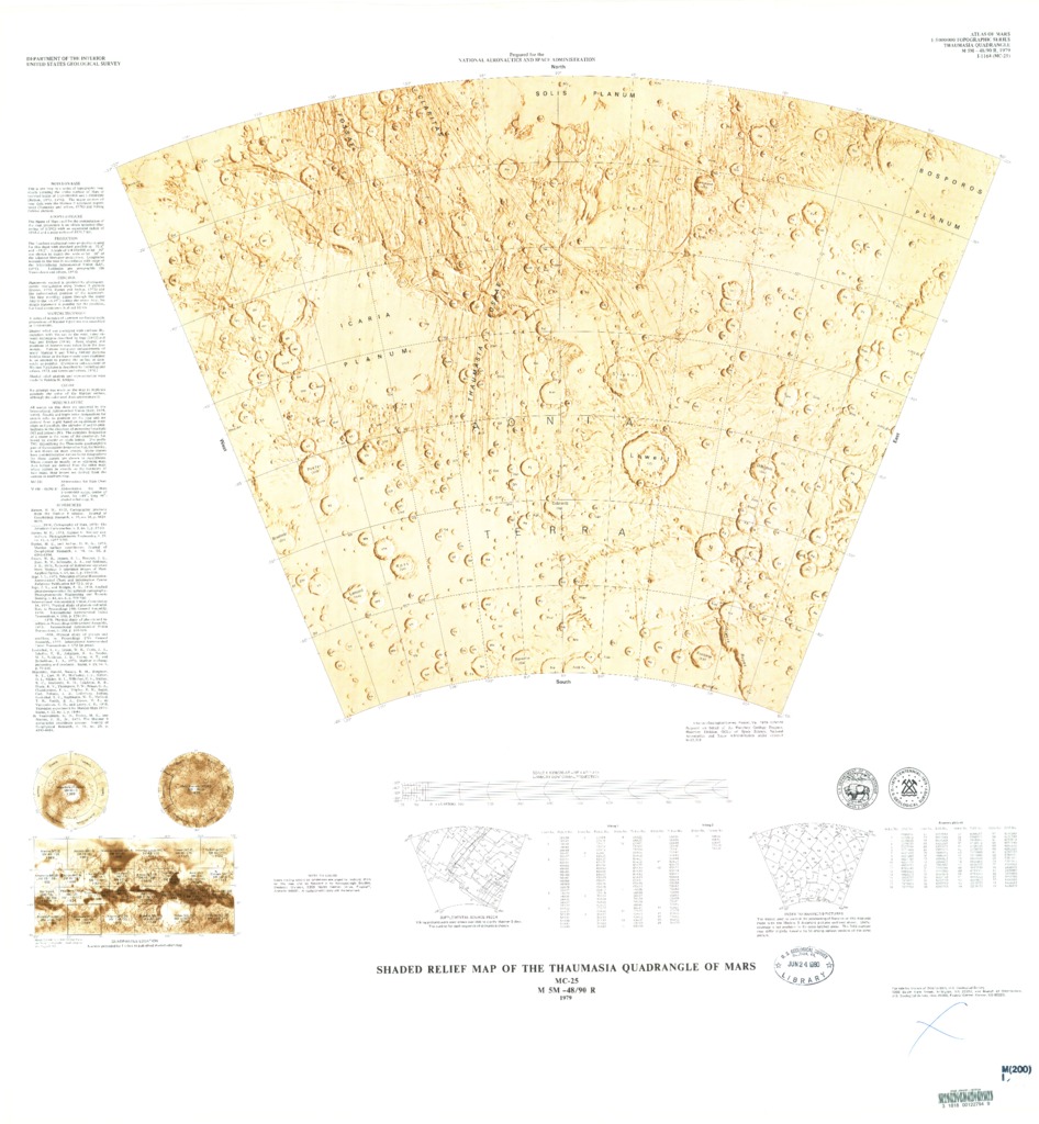
Mars Shaded Relief Map of the Thaumasia Quadrangle
- Publisher
- USGS Astrogeology Science Center
- Publication Date
- 1979-10-18
Contact and Distribution
- Format
- Shaded-Relief Map
- Access Scope
- RPIF
- Series Id
- 1164
- Native Data Set Environment
- Astrogeology Theme
- Cartography, Remote Sensing, Topography
- Online Package Link
- https://astrogeology.usgs.gov/search/map/mars_shaded_relief_map_of_the_thaumasia_quadrangle
- External File Size
- 10258423
- Online File Link
- http://astropedia.astrogeology.usgs.gov/download/Mars/Topography/year-1970/Mars-Shaded-Relief-Map-of-the-Thaumasia-Quadrangle.pdf
- Access Instructions
- 1 map :col. ;47 x 70 cm. on sheet 86 x 82 cm. fold. in envelope 30 x 24 cm.
- Contact Address
- 2255 N. Gemini Drive
- Contact City
- Flagstaff
- Contact State
- AZ
- Contact Postal Code
- 86001
- Contact Email
- [email protected]
Geospatial Information
- Target
- Mars
- Well Known Text (WKT)
- POLYGON((240 -30, 300 -30, 300 -65, 240 -65, 240 -30))
- Minimum Latitude
- -65
- Maximum Latitude
- -30
- Minimum Longitude
- 240
- Maximum Longitude
- 300
- Object Type
- Grid Cell
- Quad Name
- MC-25
- Map Scale (hard-copy)
- 1:5000000
- Horizontal Coordinate System Units
- Degrees