Products

6 Results Collapse
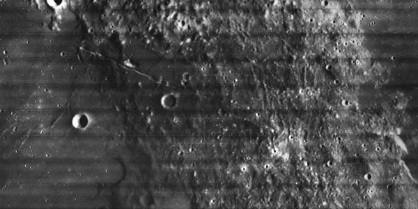
Lunar LRO NAC Haworth Photoclinometry DEM 1m v3 thumbnail

Lunar LRO NAC Haworth Photoclinometry DEM 1m v3

image/tiff 1 kBJan 15 2021

This is a shape-from-shading (SfS or photoclinometry) digital elevation model (DEM) for the Haworth area. The Haworth area is beyond the north rim of Haworth crater and centered at 338.0 (-21.0) E,…

Regional Topography and Photometric Cube Data for Lunar Locations thumbnail

Regional Topography and Photometric Cube Data for Lunar Locations

application/isis 779 kBMay 15 2023

This archive contains topography and photometric data generated by the Gaskell Stereophotoclinometry (SPC) software suite. It focuses on six regions on the Moon. These include wrinkle ridges at Dorsa…

ISPRS 2001 Topographic Mapping of the Galilean and Other Icy Satellites: Prospects and Problems for Stereo and Photoclinometry thumbnail

ISPRS 2001 Topographic Mapping of the Galilean and Other Icy Satellites: Prospects and Problems for Stereo and Photoclinometry

application/pdf 107 kB

The utility (read: need) of topographic data in formulating and testing hypotheses for the formation of geologic features is undisputed. In the absence of laser altimeters, however, image-based…

ISPRS 2003 Photoclinometry Made Simple...? thumbnail

ISPRS 2003 Photoclinometry Made Simple...?

application/pdf 964 kB

We describe a series of programs and scripts under development for the USGS digital cartography and image processing software system ISIS that will make it possible for users to create digital…

ISPRS 2003 Topographic Mapping of Icy Satellites: New Methods and New Maps thumbnail

ISPRS 2003 Topographic Mapping of Icy Satellites: New Methods and New Maps

application/pdf 111 kB

Topographic mapping of icy satellites is a critical tool for evaluation of geologic problems ranging from the origin of ionian mountains to the thickness of floating ice shells. With the lack of…

ISPRS 2002 High-Resolution Topomapping of Mars Orbiter Camera Narrow-Angle Images thumbnail

ISPRS 2002 High-Resolution Topomapping of Mars Orbiter Camera Narrow-Angle Images

application/pdf 800 kB

We describe our initial experiences producing controlled digital elevation models (DEMs) of Mars with horizontal resolutions of ≤10 m and vertical precisions of ≤2 m. Such models are of intense…

Project Pages

2 Results Collapse
Mars Global Digital Image Mosaic MDIM 2.1 thumbnail

Mars Global Digital Image Mosaic MDIM 2.1

http://astrogeology.usgs.gov/maps/mdim-2-1

This global image map of Mars has a resolution of 256 pixels/degree (scale approximately 231 m/pixel at the equator). The black-and-white mosaic is processed to emphasize local topographic…

Moon Pyroclastic Volcanism Project thumbnail

Moon Pyroclastic Volcanism Project

http://astrogeology.usgs.gov/geology/moon-pyroclastic-volcanism-project

Project Overview The goal of this research project is to advance our understanding of pyroclastic volcanism on the Moon using remote sensing data, primarily the high-spatial-resolution (~100 m/pixel)…

Documents

4 Results Collapse
ISPRS 2001 Topographic Mapping of the Galilean and Other Icy Satellites: Prospects and Problems for Stereo and Photoclinometry thumbnail

ISPRS 2001 Topographic Mapping of the Galilean and Other Icy Satellites: Prospects and Problems for Stereo and Photoclinometry

application/pdf 107 kB

The utility (read: need) of topographic data in formulating and testing hypotheses for the formation of geologic features is undisputed. In the absence of laser altimeters, however, image-based…

ISPRS 2002 High-Resolution Topomapping of Mars Orbiter Camera Narrow-Angle Images thumbnail

ISPRS 2002 High-Resolution Topomapping of Mars Orbiter Camera Narrow-Angle Images

application/pdf 800 kB

We describe our initial experiences producing controlled digital elevation models (DEMs) of Mars with horizontal resolutions of ≤10 m and vertical precisions of ≤2 m. Such models are of intense…

ISPRS 2003 Topographic Mapping of Icy Satellites: New Methods and New Maps thumbnail

ISPRS 2003 Topographic Mapping of Icy Satellites: New Methods and New Maps

application/pdf 111 kB

Topographic mapping of icy satellites is a critical tool for evaluation of geologic problems ranging from the origin of ionian mountains to the thickness of floating ice shells. With the lack of…

ISPRS 2003 Photoclinometry Made Simple...? thumbnail

ISPRS 2003 Photoclinometry Made Simple...?

application/pdf 964 kB

We describe a series of programs and scripts under development for the USGS digital cartography and image processing software system ISIS that will make it possible for users to create digital…