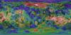
Venus Magellan Global C3-MDIR Synthetic Color Mosaic 4641m
- Primary Authors
- USGS Astrogeology Science Center
- Originators
- PDS Geosciences Node
- Publisher
- USGS Astrogeology Science Center
- Abstract
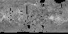
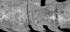
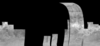
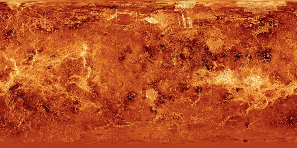
- Product Information: This synthetic colorized version of the C3-MIDR mosaic was developed to simulate the surface of Venus. This mosaic was created from the Magellan Full resolution Basic Image Data Records (F-BIDRs), the highest resolution radar images of the Venus surface (~75 meters per pixel [m]). To make this product, the F-BIDR is assembled into Full-Resolution Mosaicked Image Data Records (F-MIDRs) which are then averaged in successive operations resulting in each pixel being the average of nine pixels resulting in compressed BIDR or C-BIDR. The resulting C-BIDR are then mosaicked into 8192 x 8192 arrays called C1-MIDR (Compressed Once - Mosaicked Image Data Record) which are then further compressed into C2- and C3-MIDR. The original Magellan Compressed Mosaicked Image Data Record (C3-MIDR) archive contains three times compressed mosaics of image swaths (C-BIDRs) at a resolution of 2025 m/pixel. C3-MIDRs consist of mosaics generated by computing 3x3 pixel arithmetic moving averages from the C2-MIDRs. C3-MIDRs, with their 2.025 km pixel widths, are designed to cover the planet at reasonably high resolution and high signal to noise ratio. (Ford et al., 1993). Mission and Instrument Information: The Magellan Mission to Venus launched on May 4, 1989 on board the Space Shuttle Atlantis. The spacecraft arrived at Venus on August 10th, 1990 and was inserted into a near-polar elliptical orbit. The primary mission requirements were to map at least 70% of the surface at a resolution better than 300 meters/pixel and to determine the global relief at such a resolution as to facilitate detailed analysis of tectonic, volcanic, eolian, and impact features. Magellan successfully completed four mapping cycles at Venus. The first mapping cycle lasted from mid-September 1990 to mid-May 1991 focused on fulfilling the primary mission requirements. The second mapping cycle was from mid-May 1991 to mid-January 1992 and was dedicated to filing in gaps in the cycle 1 coverage and obtaining coverage of the south polar region; this cycle resulted in 54% of surfaced coverage and increased the cumulative coverage of the mission to 96%. Cycle 3 was from mid-January to mid-September 1992 and focused on acquiring stereo image coverage; this cycle resulted in about 21% surface coverage and increased total surface coverage to 98%. Cycle 4 was dedicated to gravity observations and as such did not add to the cumulative coverage of imagery taken by the spacecraft (Ford et al., 1993). References: Ford, J. P., Plaut, J. J., Weitz, C. M., Farr, T. G., Senske, D. A., Stofan, E. R., Michaels, G., & Parker, T. J. (1993). Guide to Magellan Image Interpretation. JPL Publication 93-24 pp. 1-18. https://ntrs.nasa.gov/archive/nasa/casi.ntrs.nasa.gov/19940013181.pdf Ford, J. P., Blom, R. G., Crisp, J. A., Elachi, C., Farr, T. G., Saunders, R. S., Theilig, E. E., et al. (1989). Spaceborne Radar Observations, a guide for Magellan radar-image analysis. JPL Publication 89-41. https://ntrs.nasa.gov/archive/nasa/casi.ntrs.nasa.gov/19900013510.pdf
- Purpose
- A mosaic which simulates the surface color of Venus.
Contact and Distribution
- Format
- Global Mosaic
- Access Constraints
- public domain
- Access Scope
- PDS
- Use Constraints
- None
- Edition
- 1
- Supplemental Information
- http://geo.pds.nasa.gov/missions/magellan/c123midr, https://pds-imaging.jpl.nasa.gov/software/MGN_SAR_UserGuide.pdf
- Native Data Set Environment
- ISIS v3
- Astrogeology Theme
- Image Processing, Remote Sensing, Volcanism
- Mission Names
- Magellan
- Instrument Names
- SAR
- Online Package Link
- https://astrogeology.usgs.gov/search/map/venus_magellan_global_c3_mdir_synthetic_color_mosaic_4641m
- External File Size
- 96 MB
- Online File Link
- https://planetarymaps.usgs.gov/mosaic/Venus_Magellan_C3-MDIR_Colorized_Global_Mosaic_4641m.tif
- Contact Address
- 2255 N. Gemini Drive
- Contact City
- Flagstaff
- Contact State
- AZ
- Contact Postal Code
- 86001
- Contact Email
- [email protected]
- Currentness Reference
- Publication date
- Progress
- Complete
- Update Frequency
- None planned
- Process Description
- Fully simulated colorized mosaic for the C3-MDIR mosaic
- Source Title
- Magellan Compressed Mosaicked Image Data Record (C1-, C2-, C3-MIDR)
- Source Online Linkage
- {https://pds-imaging.jpl.nasa.gov/volumes/magellan.html#mgnMIDR,http://pds-imaging.jpl.nasa.gov/portal/magellan_mission.html}
- PDS Status
- PDS 3 Archived
Geospatial Information
- Target
- Venus
- Minimum Latitude
- -90
- Maximum Latitude
- 90
- Minimum Longitude
- -180
- Maximum Longitude
- 180
- Direct Spatial Reference Method
- Raster
- Object Type
- Grid Cell
- Raster Row Count (lines)
- 4096
- Raster Column Count (samples)
- 8192
- Bit Type (8, 16, 32)
- 8
- Quad Name
- Radius A
- 6051000
- Radius C
- 6051000
- Bands
- 3
- Pixel Resolution (meters/pixel)
- 4641
- Scale (pixels/degree)
- 22.7558
- Map Projection Name
- Equirectangular
- Latitude Type
- Planetocentric
- Longitude Direction
- Positive East
- Longitude Domain
- -180 to 180