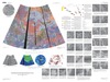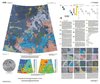
Venus Geologic Map of the Snegurochka Planitia Quadrangle
- Originators
- D. Hurwitz, J. Head
- Publisher
- USGS Astrogeology Science Center
- Publication Date
- 2012-02-12
- Abstract
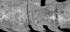
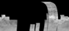
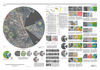
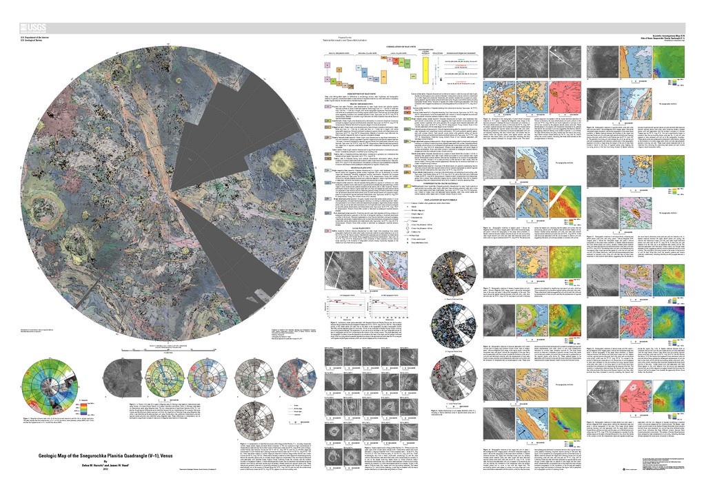
- The Snegurochka Planitia region is a predominantly low-lying terrain that covers the north polar region of Venus, extending from lat 75° N. to 90° N. and from long 0° E. to 360° E. The plains associated with Snegurochka Planitia abut the highlands of Metis Mons to the south from approximately long 240° E. to 300° E. (V6) and the highlands of Ishtar Terra to the south from approximately long 300° E. to 60° E. (Lakshmi Planum, V7; Fortuna Tessera, V2). The plains of Louhi Planitia also lie within the V1 region and form the northern border with the highlands of Tethus Regio from approximately long 60° E. to 120° E. (V3 Meskhent Tessera) and with the lowlands of both Atalanta Planitia (V4) and the nearby deformed region containing a series of ridged belts (V5, Pandrosos Dorsa) from approximately long 120° E. to 240° E. The plains generally lie between +500 m and -500 m of the mean planetary radius (MPR) of 6051.8 km, with the highest terrain in the region, the northernmost extent of Ishtar Terra (Itzpapalotl Tessera, lat 75° N., long ~315° E.), rising more than 6.4 km above MPR.
Contact and Distribution
- Format
- Geologic Map, Raster Data, Vector Data
- Access Scope
- RPIF
- Series Id
- 3178
- Native Data Set Environment
- Astrogeology Theme
- Cartography, Geology, Geomorphology, Photogeology, Planetary evolution, Stratigraphy
- Online Package Link
- https://astrogeology.usgs.gov/search/map/venus_geologic_map_of_the_snegurochka_planitia_quadrangle
- External File Size
- 110613966
- Online File Link
- http://astropedia.astrogeology.usgs.gov/download/Venus/Geology/year-2010/Venus-Geologic-Map-of-the-Snegurochka-Planitia-Quadrangle-V-1.zip
- Access Instructions
- ii, 28 p.; ill.; maps; Map: 1 Sheet: 60 x 42 inches; TXT Download of Readme; Metadata Folder; ZIP Download of GIS Database
- Contact Address
- 2255 N. Gemini Drive
- Contact City
- Flagstaff
- Contact State
- AZ
- Contact Postal Code
- 86001
- Contact Email
- [email protected]
Geospatial Information
- Target
- Venus
- Well Known Text (WKT)
- POLYGON((0 90, 360 90, 360 75, 0 75, 0 90))
- Minimum Latitude
- 75
- Maximum Latitude
- 90
- Minimum Longitude
- 0
- Maximum Longitude
- 360
- Object Type
- Grid Cell
- Quad Name
- V-1
- Map Scale (hard-copy)
- 1:5000000
- Horizontal Coordinate System Units
- Degrees