Venus Geologic Map of the Ovda Regio Quadrangle
- Primary Authors
- Leslie F. Bleamaster
- Publisher
- USGS Astrogeology Science Center
- Publication Date
- 2005-01-05
- Abstract
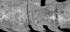
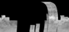
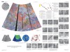
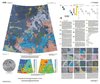
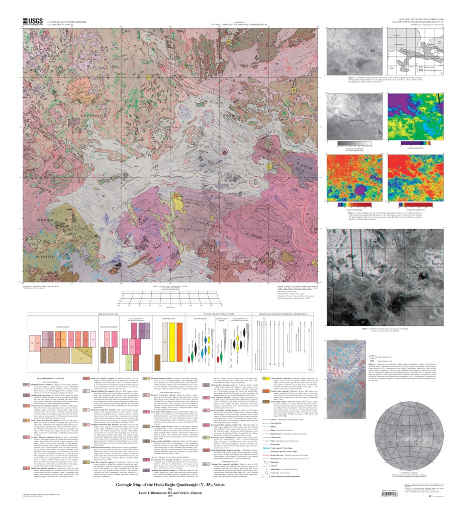
- The Ovda Regio quadrangle (V-35), at lat 0º N. to 25º S. and long 90º to 120º E., encompasses approximately 8.4 M km2 of complex geology with intricate volcano-tectonic relationships. The quadrangle was mapped at 1:5,000,000 scale under the Venus Geologic Mapping program. The northern part of V-35 includes south-central Aphrodite Terra, a high-standing, equatorial, plateau region that contains eastern Ovda Regio and western Thetis Regio; the southern region, which is lower in topography, hosts Tahmina Planitia, Gauri Mons, Boszorkany Dorsa, the extensive flows of Inari Corona, and numerous other unnamed deformation centers and corona flows. The Kuanja, Ralk-umgu, and Vir-ava Chasmata system, a highly deformed east-trending zone, defines a geomorphic boundary between the high-standing crustal plateaus of the north and the southern low-lying plains (fig. 1, map sheet). Cross-cutting and embayment relations constrain the relative spatial and temporal relations of map units and tectonic structures within three geographic regions. Within each region, individual tessera units, large corona flows, local volcano-tectonic complexes, chasmata deformation, and impact craters describe a coherent, or logically consistent, geologic history.For questions about the content of this report, contact Ken Tanaka
Contact and Distribution
- Format
- Geologic Map, Raster Data, Vector Data
- Access Scope
- Series Id
- 2808
- Native Data Set Environment
- Astrogeology Theme
- Cartography, Geology, Geomorphology, Photogeology, Planetary evolution, Stratigraphy
- Online Package Link
- https://astrogeology.usgs.gov/search/map/venus_geologic_map_of_the_ovda_regio_quadrangle
- External File Size
- 25174236
- Online File Link
- http://astropedia.astrogeology.usgs.gov/download/Venus/Geology/year-2000/Venus-Geologic-Map-of-the-Ovda-Regio-Quadrangle-V-35.pdf
- Access Instructions
- 15 p. and 1 sheet
- Contact Address
- 2255 N. Gemini Drive
- Contact City
- Flagstaff
- Contact State
- AZ
- Contact Postal Code
- 86001
- Contact Email
- astroweb@usgs.gov
Geospatial Information
- Target
- Venus
- Well Known Text (WKT)
- POLYGON((90 0, 120 0, 120 -25, 90 -25, 90 0))
- Minimum Latitude
- -25
- Maximum Latitude
- 0
- Minimum Longitude
- 90
- Maximum Longitude
- 120
- Object Type
- Grid Cell
- Quad Name
- V-35
- Map Scale (hard-copy)
- 1:5000000
- Horizontal Coordinate System Units
- Degrees