Titan Fluvial GIS Mapping Project
- Primary Authors
- Devon M. Burr
- Originators
- Devon M. Burr, S.A. Drummond, R. Cartwright, B.A. Black, J.T. Perron
- Publisher
- USGS Astrogeology Science Center
- Publication Date
- 2013-07-15
- Abstract
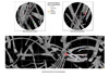
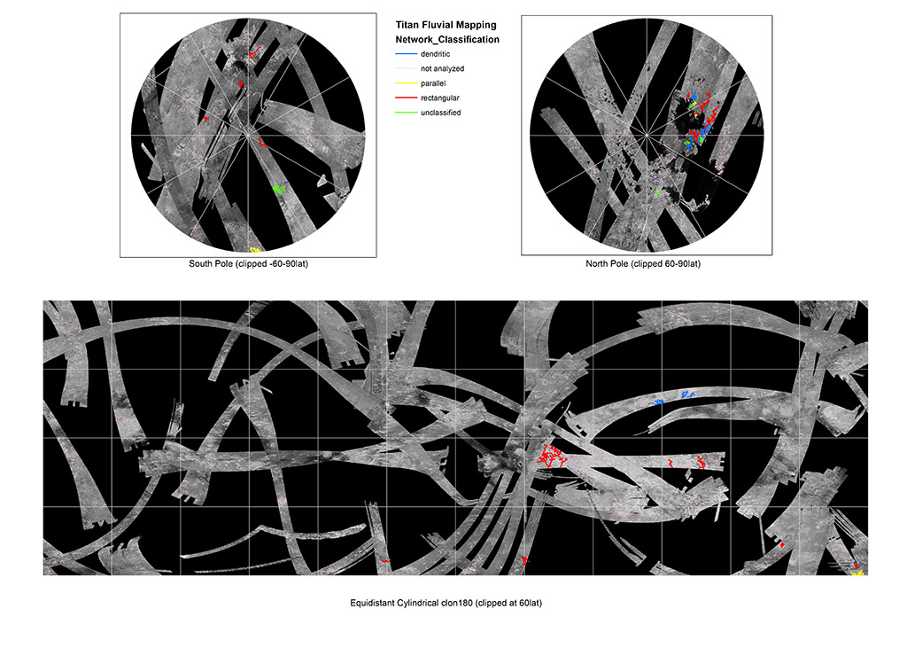
- Project Information: The Titan Fluvial GIS Mapping Project follows previous work by Barnes et al., 2007, Lorenz et al., 2008 & Burr et al., 2009, to map fluvial features on Titan. The Cassini Radio Detection and Ranging (RADAR) instrument data was developed to characterize surface morphology. Fluvial features are delineated as vector-based GIS poly lines. Three criteria were used in the delineations: (a) distinguishability in tone (bright or dark) from the surrounding terrain, (b) a bright/dark pairing consistent with illumination direction that is indicative of a trough, and (c) fluviatile morphology, i.e., having sinuous links and/or a branching pattern. Features of all levels of certainty (Burr et al., 2009; Figure 1, top) were included in the subsequent drainage pattern analysis (Burr et al., 2009; Figure 1, bottom). During this analysis, those features (reaches) of different certainty levels that formed individual links were aggregated into links in our ArcGIS files. For networks having fewer than 10 links, which were not analyzed, the features (reaches) were not aggregated. Mission and Instrument Information: The Cassini-Huygens mission was a joint endeavor between the Italian Space Agency, the European Space Agency (ESA) and National Aeronautics and Space Administration (NASA). The Cassini-Huygens mission launched from Cape Canaveral Air Force Base in Florida on October 15, 1997 and ended on September 15, 2017 when Cassini began its Final Entry into Saturnâs Atmosphere. The primary mission ran from July 2004 â June 2008, the first mission extension, Equinox, was from July 2008- October 2010 and was followed by a final extended mission, Solstice, from October 2010 â September 2017. References: Barnes, J. W., Radebaugh, J., Brown, R. H., Wall, S., Soderblom, L., Lunine, J., Burr, D., et al. (2007). Near-infrared spectral mapping of Titanâs mountains and channels. Journal of Geophysical Research, 112(11). https://doi.org/10.1029/2007JE002932 Burr, D. M., Jacobsen, R. E., Roth, D. L., Phillips, C. B., Mitchell, K. L., Viola, D. (2009). Fluvial network analysis on Titan: Evidence for subsurface structure and west-to-east wind flow, southwestern Xanadu. Geophysical Research Letters, 36(22). https://doi.org/10.1029/2009GL040909 Elachi, C., Wall, S., Allison, M., Anderson, Y., Boehmer, A. R., Callahan, P., Encrenaz, P., et al. (2005). Cassini Radar views the surface of Titan. Science, 308(5724), 970-974. https://doi.org/10.1126/science.1109919 Lorenz, R. D., Lopes, R. M., Paganelli, F., Lunine, J. I., Kirk, R. L., Mitchell, K. L., Soderblom, L. A., Cassini RADAR Team, et al. (2008). Fluvial channels on Titan: Initial Cassini RADAR observations. Planetary and Space Science, 56(8), 1132-1144. https://doi.org/10.1016/j.pss.2008.02.009
- Purpose
- Fluvial features for Titan delineated as vector-based GIS polylines
Contact and Distribution
- Format
- Remote-sensing Data, Vector Data
- Access Constraints
- None
- Access Scope
- MRCTR
- Use Constraints
- Please cite authors: Burr, D.M., S.A. Drummond, R. Cartwright, B.A. Black, and J.T. Perron, 2013, Morphology of fluvial networks on Titan, Icarus, doi. 10.1016/j.icarus.2013.06.016.
- Edition
- 1
- Supplemental Information
- http://authors.elsevier.com/sd/article/S0019103513002728
- Native Data Set Environment
- ESRI Arcinfo, ISIS v2
- Astrogeology Theme
- Geographic Information System (GIS), Hydrology, Remote Sensing
- Mission Names
- Cassini-Huygens
- Instrument Names
- SAR
- Online Package Link
- https://astrogeology.usgs.gov/search/map/titan_fluvial_gis_mapping_project
- External File Size
- 343579320
- Online File Link
- http://astropedia.astrogeology.usgs.gov/download/Titan/Cassini/TitanFluvialMapping/TitanFluvialMapping_July2013.zip
- Access Instructions
- Requires GIS-compatible software to view vector files
- Contact Address
- 2255 N. Gemini Drive
- Contact City
- Flagstaff
- Contact State
- AZ
- Contact Postal Code
- 86001
- Contact Email
- [email protected]
- Currentness Reference
- Publication date
- Progress
- In Work
- Update Frequency
- As needed
- Logical Consistency
- Fluvial features were tagged on a best effort basis.
- Completeness Report
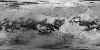
- Mapping was limited to image coverage. See included Cassini SAR mosaic for coverage.
- Process Description
- The fluvial features were delineated as vector-based polylines within ArcGIS 10.1 software using Cassini Titan Radar Mapper synthetic aperture radar (SAR) swaths (Elachi et al., 2005) from T0 through T71. Following previous work (Barnes et al. 2007, Lorenz et al. 2008, Burr et al. 2009), three criteria were used in the delineations: (a) distinguishability in tone (bright or dark) from the surrounding terrain, (b) a bright/dark pairing consistent with illumination direction that is indicative of a trough, and (c) fluviatile morphology, i.e., having sinuous links and/or a branching pattern.
- Source Title
- Cassini Titan Radar Mapper synthetic aperture radar (SAR) swaths (Elachi et al., 2005)
- Source Online Linkage
- {https://pds-imaging.jpl.nasa.gov/volumes/radar.html,http://pds-imaging.jpl.nasa.gov/portal/cassini_mission.html}
- PDS Status
- PDS 4 In Progress
- Attribute Accuracy Report
- Best Effort
- Horizontal Positional Accuracy Report
- Best Effort
Geospatial Information
- Target
- Titan
- System
- Saturn
- Minimum Latitude
- -90
- Maximum Latitude
- 90
- Minimum Longitude
- -180
- Maximum Longitude
- 180
- Direct Spatial Reference Method
- Vector
- Object Type
- Grid Cell
- Point and Vector Object Count
- 4797
- Quad Name
- Radius A
- 2575000
- Radius C
- 2575000
- Control Net
- preliminary
- Map Projection Name
- Simple Cylindrical
- Latitude Type
- Planetocentric
- Longitude Direction
- Positive East
- Longitude Domain
- -180 to 180